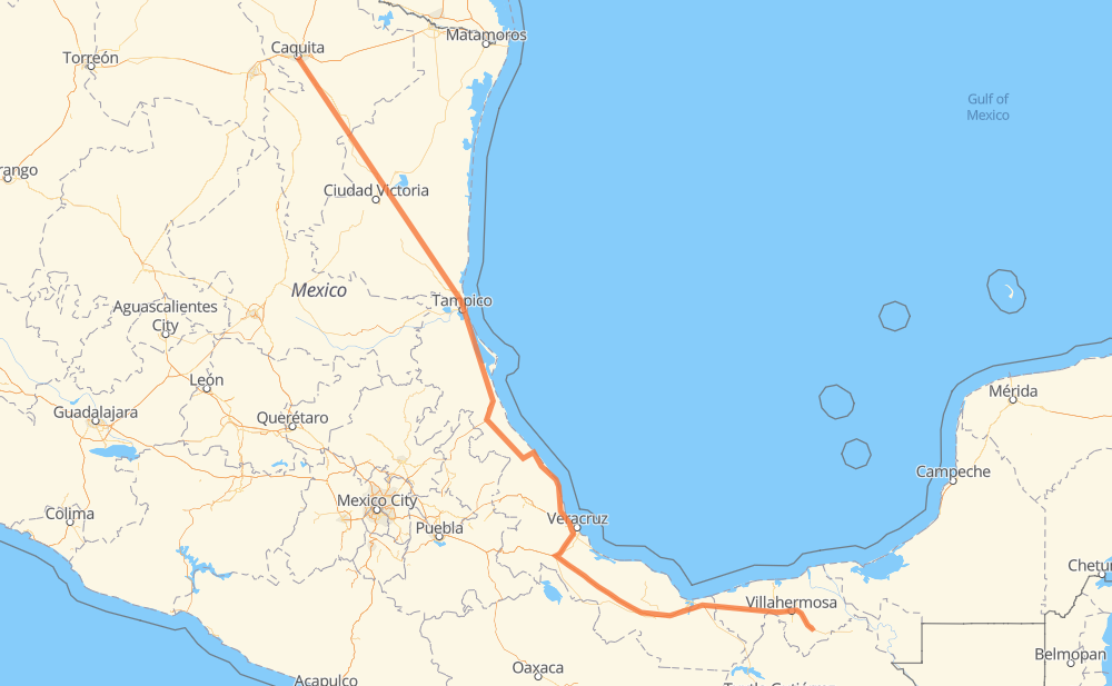
Distance between Monterrey and Macuspana
The distance from Monterrey to Macuspana is 921 miles by road including 346 miles on motorways. Road takes approximately 16 hours and 54 minutes and goes through Ciudad Madero, Villahermosa, El Yerbaniz, Santiago, Allende, Hualahuises and Linares.
| Shortest distance by air | 738 mi ✈️ |
| Car route length | 921.5 mi 🚗 |
| Driving time | 16 h 54 min |
| Fuel amount | 31.3 gal |
| Fuel cost | 123.2 USD |
| Toll roads cost | 1,048 + ? MXN |
| Point | Distance | Time | Fuel | |
| Monterrey | 0 mi | 00 min | 0.0 gal | |
|
MEX 85 15 mi, 18 min
|
||||
| El Yerbaniz | 15 mi | 18 min | 0.5 gal | |
|
MEX 85 5 mi, 05 min
|
||||
| Santiago | 20 mi | 24 min | 0.6 gal | |
|
MEX 85 12 mi, 14 min
|
||||
| Allende | 32 mi | 38 min | 0.9 gal | |
|
MEX 85 42 mi, 48 min
|
||||
| Hualahuises | 74 mi | 1 h 26 min | 2.4 gal | |
|
MEX 85 6 mi, 06 min
|
||||
| Linares | 80 mi | 1 h 33 min | 2.7 gal | |
|
MEX 85 171 mi, 3 h 16 min
|
||||
| González | 252 mi | 4 h 49 min | 8.4 gal | |
|
MEX 81 MEX 180 70 mi, 1 h 18 min
|
||||
| Ciudad Madero | 321 mi | 6 h 07 min | 10.8 gal | |
|
MEX 180 576 mi, 10 h 16 min
|
||||
| Villahermosa | 897 mi | 16 h 23 min | 30.4 gal | |
|
MEX 186 31 mi, 29 min
|
||||
| Macuspana | 928 mi | 16 h 53 min | 31.5 gal | |
Frequently Asked Questions
How many toll booths are there from Monterrey to Macuspana?
There are 13 toll booths between Monterrey and Macuspana: Tampico, Naranjos, Tuxpan, Cardel - Posa Rica, Nautla, La Antigua, San Julián, Paso del Toro, Cosamaloapan, Acayucan, Antonio Dovali, Sánchez Magallanes and Grijalva.
How much does the toll booths cost from Monterrey to Macuspana?
Toll roads cost: Tampico (35 MXN) + Naranjos (297 MXN) + Tuxpan (45 MXN) + Cardel - Posa Rica (205 MXN) + Nautla (24 MXN) + La Antigua (?) + San Julián (?) + Paso del Toro (87 MXN) + Cosamaloapan (229 MXN) + Acayucan (?) + Antonio Dovali (20 MXN) + Sánchez Magallanes (82 MXN) + Grijalva (24 MXN) = 1,048 + ? MXN
How much does it cost to drive from Monterrey to Macuspana?
Fuel cost: 123.2 USD
This fuel cost is calculated as: (Route length 921.5 mi) / (Fuel consumption 29.4 mpg) * (Fuel price 3.93 USD / gal)
You can adjust fuel consumption and fuel price here.
Toll roads cost: 1,048 + ? MXN
How long is a car ride from Monterrey to Macuspana?
Driving time: 16 h 54 min
This time is calculated for driving at the maximum permitted speed, taking into account traffic rules restrictions.
- 35 mi with a maximum speed 68 mph = 31 min
- 242 mi with a maximum speed 62 mph = 3 h 53 min
- 219 mi with a maximum speed 56 mph = 3 h 55 min
- 83 mi with a maximum speed 56 mph = 1 h 29 min
- 339 mi with a maximum speed 50 mph = 6 h 48 min
- 1 mi with a maximum speed 43 mph = 1 min
- 6 mi with a maximum speed 37 mph = 9 min
- 1 mi with a maximum speed 31 mph = 2 min
- 1 mi with a maximum speed 25 mph = 2 min
The calculated driving time does not take into account intermediate stops and traffic jams.
How far is Monterrey to Macuspana by land?
The distance between Monterrey and Macuspana is 921.5 mi by road including 346.1 mi on motorways.
Precise satellite coordinates of highways were used for this calculation. The start and finish points are the centers of Monterrey and Macuspana respectively.
How far is Monterrey to Macuspana by plane?
The shortest distance (air line, as the crow flies) between Monterrey and Macuspana is 737.6 mi.
This distance is calculated using the Haversine formula as a great-circle distance between two points on the surface of a sphere. The start and finish points are the centers of Monterrey and Macuspana respectively. Actual distance between airports may be different.
How many hours is Monterrey from Macuspana by plane?
Boeing 737 airliner needs 1 h 29 min to cover the distance of 738 mi at a cruising speed of 497 mph.
Small plane "Cessna 172" needs 5 h 23 min to flight this distance at average speed of 136 mph.
This time is approximate and do not take into account takeoff and landing times, airport location and other real world factors.
How long is a helicopter ride from Monterrey to Macuspana?
Fast helicopter "Eurocopter AS350" or "Hughes OH-6 Cayuse" need 4 h 56 min to cover the distance of 738 mi at a cruising speed of 149 mph.
Popular "Robinson R44" needs 5 h 39 min to flight this distance at average speed of 130 mph.
This time is approximate and do not take into account takeoff and landing times, aerodrome location and other real world factors.
What city is halfway between Monterrey and Macuspana?
The halfway point between Monterrey and Macuspana is Vicente Herrera. It is located about 4 mi from the exact midpoint by road.
The distance from Vicente Herrera to Monterrey is 457 mi and driving will take about 8 h 36 min. The road between Vicente Herrera and Macuspana has length 465 mi and will take approximately 8 h 17 min.
The other cities located close to halfway point:
Where is Monterrey in relation to Macuspana?
Monterrey is located 738 mi north-west of Macuspana.
Monterrey has geographic coordinates: latitude 25.66966, longitude -100.31782.
Macuspana has geographic coordinates: latitude 17.76091, longitude -92.59611.
Which highway goes from Monterrey to Macuspana?
The route from Monterrey to Macuspana follows MEX 180, MEX 85, MEX 145D, MEX 180D.
Other minor sections pass along the road:
- MEX 83: 58 mi
- MEX 81: 51 mi
- MEX 80: 45 mi
- MEX 186: 29 mi
- MEX 135D: 28 mi
- MEX 150D: 27 mi
- MEX: 19 mi
- MEX 129: 14 mi
- MEX 132D: 8 mi
- 25: 7 mi
- MEX 132: 6 mi
- 24: 1 mi