Distance between Moosehorn MB and Lund BC
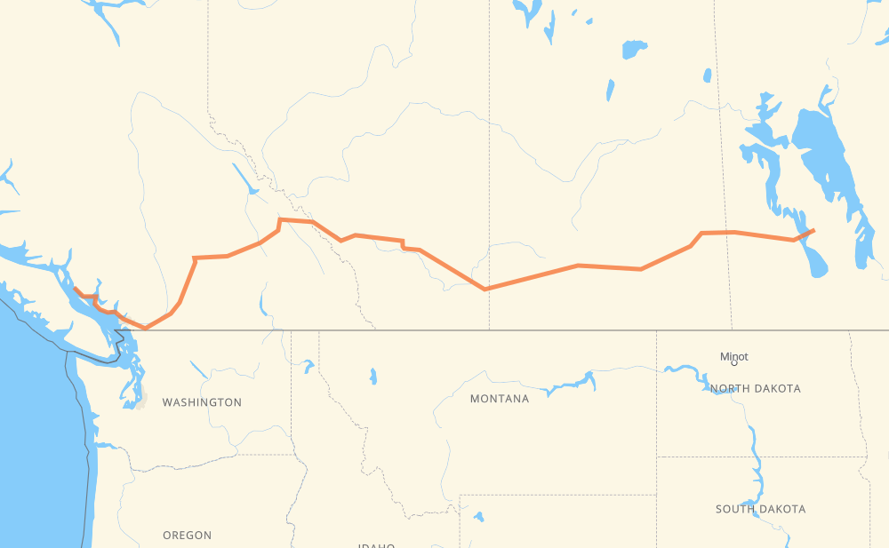
The distance from Moosehorn to Lund is 1,520 miles by road including 423 miles on motorways. Road takes approximately 28 hours and 37 minutes and goes through Yorkton, Melville, Regina, Moose Jaw, Swift Current, Medicine Hat and Brooks.
| Shortest distance by air | 1,152 mi ✈️ |
| Car route length | 1,520.5 mi 🚗 |
| Driving time | 28 h 37 min |
| Fuel amount | 51.7 gal |
| Fuel cost | 199.7 USD |
| Point | Distance | Time | Fuel | |
| Moosehorn | 0 mi | 00 min | 0.0 gal | |
|
PTH 6 PTH 5 211 mi, 4 h 00 min
|
||||
| Yorkton | 211 mi | 4 h 00 min | 7.0 gal | |
|
10 18 mi, 21 min
|
||||
| Melville | 229 mi | 4 h 22 min | 7.4 gal | |
|
10 98 mi, 1 h 48 min
|
||||
| Regina | 327 mi | 6 h 11 min | 11.0 gal | |
|
6 1 65 mi, 1 h 07 min
|
||||
| Moose Jaw | 391 mi | 7 h 18 min | 12.6 gal | |
|
1 86 mi, 1 h 32 min
|
||||
| Swift Current | 478 mi | 8 h 51 min | 16.1 gal | |
|
1 137 mi, 2 h 27 min
|
||||
| Medicine Hat | 616 mi | 11 h 18 min | 20.8 gal | |
|
1 66 mi, 1 h 10 min
|
||||
| Brooks | 682 mi | 12 h 29 min | 23.1 gal | |
|
1 101 mi, 1 h 49 min
|
||||
| Chestermere | 783 mi | 14 h 18 min | 26.4 gal | |
|
1 264 mi, 4 h 42 min
|
||||
| Revelstoke | 1,047 mi | 19 h 00 min | 35.5 gal | |
|
1 63 mi, 1 h 10 min
|
||||
| Salmon Arm | 1,110 mi | 20 h 11 min | 37.5 gal | |
|
1 126 mi, 2 h 05 min
|
||||
| Merritt | 1,237 mi | 22 h 16 min | 41.8 gal | |
|
5 98 mi, 1 h 28 min
|
||||
| Chilliwack | 1,334 mi | 23 h 44 min | 45.1 gal | |
|
1 19 mi, 18 min
|
||||
| Abbotsford | 1,353 mi | 24 h 03 min | 45.7 gal | |
|
1 30 mi, 29 min
|
||||
| Coquitlam | 1,384 mi | 24 h 33 min | 47.0 gal | |
|
1 6 mi, 06 min
|
||||
| Burnaby | 1,390 mi | 24 h 39 min | 47.2 gal | |
|
1 4 mi, 05 min
|
||||
| Vancouver | 1,395 mi | 24 h 44 min | 47.4 gal | |
|
1 4 mi, 05 min
|
||||
| District of North Vancouver | 1,399 mi | 24 h 50 min | 47.5 gal | |
|
1 14 mi, 38 min
|
||||
| West Vancouver | 1,412 mi | 25 h 28 min | 47.7 gal | |
|
3 101 93 mi, 2 h 51 min
|
||||
| Powell River | 1,506 mi | 28 h 20 min | 51.1 gal | |
|
101 15 mi, 17 min
|
||||
| Lund | 1,520 mi | 28 h 37 min | 51.6 gal | |
Hotels of Lund
Frequently Asked Questions
How much does it cost to drive from Moosehorn to Lund?
Fuel cost: 199.7 USD
This fuel cost is calculated as: (Route length 1,520.5 mi) / (Fuel consumption 29.4 mpg) * (Fuel price 3.86 USD / gal)
You can adjust fuel consumption and fuel price here.
How long is a car ride from Moosehorn to Lund?
Driving time: 28 h 37 min
This time is calculated for driving at the maximum permitted speed, taking into account traffic rules restrictions.
- 194 mi with a maximum speed 68 mph = 2 h 51 min
- 126 mi with a maximum speed 62 mph = 2 h 1 min
- 768 mi with a maximum speed 56 mph = 13 h 42 min
- 147 mi with a maximum speed 56 mph = 2 h 37 min
- 225 mi with a maximum speed 50 mph = 4 h 31 min
- 17 mi with a maximum speed 43 mph = 23 min
- 12 mi with a maximum speed 37 mph = 20 min
- 6 mi with a maximum speed 31 mph = 11 min
- 1 mi with a maximum speed 19 mph = 1 min
- 24 mi with a maximum speed 12 mph = 1 h 55 min
The calculated driving time does not take into account intermediate stops and traffic jams.
How far is Moosehorn to Lund by land?
The distance between Moosehorn and Lund is 1,520.5 mi by road including 423.2 mi on motorways.
Precise satellite coordinates of highways were used for this calculation. The start and finish points are the centers of Moosehorn and Lund respectively.
How far is Moosehorn to Lund by plane?
The shortest distance (air line, as the crow flies) between Moosehorn and Lund is 1,152 mi.
This distance is calculated using the Haversine formula as a great-circle distance between two points on the surface of a sphere. The start and finish points are the centers of Moosehorn and Lund respectively. Actual distance between airports may be different.
How many hours is Moosehorn from Lund by plane?
Boeing 737 airliner needs 2 h 19 min to cover the distance of 1,152 mi at a cruising speed of 497 mph.
Small plane "Cessna 172" needs 8 h 25 min to flight this distance at average speed of 136 mph.
This time is approximate and do not take into account takeoff and landing times, airport location and other real world factors.
How long is a helicopter ride from Moosehorn to Lund?
Fast helicopter "Eurocopter AS350" or "Hughes OH-6 Cayuse" need 7 h 43 min to cover the distance of 1,152 mi at a cruising speed of 149 mph.
Popular "Robinson R44" needs 8 h 49 min to flight this distance at average speed of 130 mph.
This time is approximate and do not take into account takeoff and landing times, aerodrome location and other real world factors.
What city is halfway between Moosehorn and Lund?
The halfway point between Moosehorn and Lund is Strathmore. It is located about 4 mi from the exact midpoint by road.
The distance from Strathmore to Moosehorn is 765 mi and driving will take about 13 h 58 min. The road between Strathmore and Lund has length 756 mi and will take approximately 14 h 39 min.
The other cities located close to halfway point:
Where is Moosehorn in relation to Lund?
Moosehorn is located 1,152 mi east of Lund.
Moosehorn has geographic coordinates: latitude 51.28333, longitude -98.41667.
Lund has geographic coordinates: latitude 49.98217, longitude -124.76085.
Which highway goes from Moosehorn to Lund?
The route from Moosehorn to Lund follows 1, 10, 5, PTH 5, 101.
Other minor sections pass along the road:
- PTH 68: 49 mi
- 97: 23 mi
- PR 325: 19 mi
- 93: 17 mi
- 19: 16 mi
- 22: 16 mi
- 3: 15 mi
- PTH 10: 15 mi
- 8: 12 mi
- 7: 12 mi
- 41: 10 mi
- PTH 6: 9 mi
- 35: 6 mi
- 99: 6 mi
- 6: 4 mi
- 637: 3 mi
- 47: 2 mi
- 23: 1 mi
- 9: 1 mi
- 16: 1 mi