Distance between Mossoró and Ceará
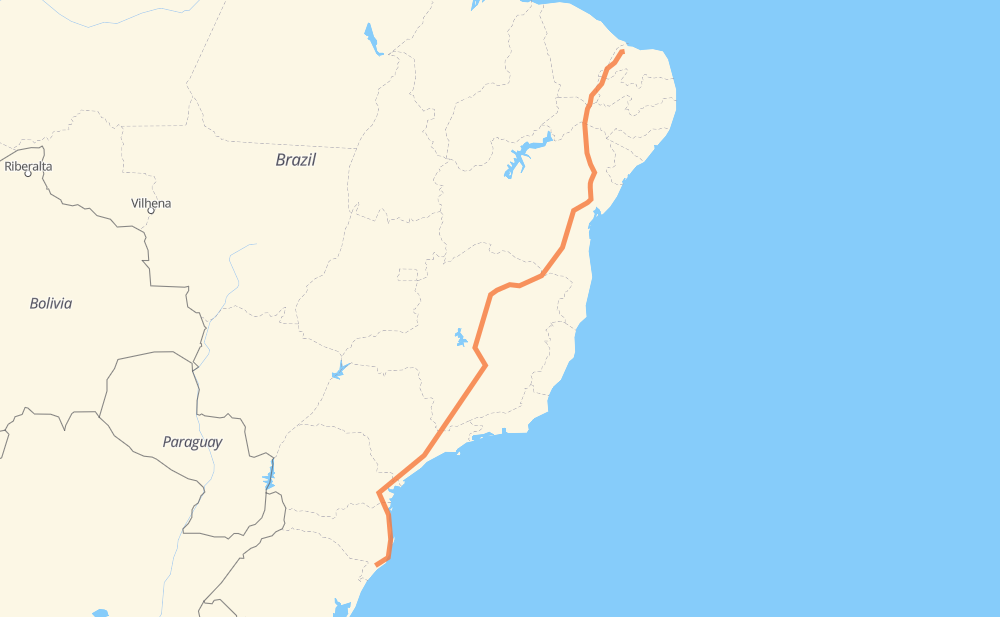
The distance from Mossoró to Ceará is 2,264 miles by road including 971 miles on motorways. Road takes approximately 41 hours and 21 minutes and goes through Ribeirão das Neves, Contagem, Betim, Atibaia, Barueri and Piraquara.
| Shortest distance by air | 1,804 mi ✈️ |
| Car route length | 2,263.7 mi 🚗 |
| Driving time | 41 h 21 min |
| Fuel amount | 77 gal |
| Fuel cost | 302.6 USD |
| Point | Distance | Time | Fuel | |
| -5.19043, -37.34439 | 0 mi | 00 min | 0.0 gal | |
|
BR-405 154 mi, 2 h 58 min
|
||||
| Cajazeiras | 154 mi | 2 h 58 min | 9.8 gal | |
|
PB-393 BR-116 363 mi, 6 h 47 min
|
||||
| Teofilândia | 517 mi | 9 h 45 min | 22.3 gal | |
|
BR-116 152 mi, 2 h 41 min
|
||||
| Entrocamento do Cem | 669 mi | 12 h 26 min | 27.5 gal | |
|
BR-116 151 mi, 3 h 01 min
|
||||
| Distrito Industrial dos Imborés | 819 mi | 15 h 27 min | 32.7 gal | |
|
BR-116 BR-135 540 mi, 10 h 12 min
|
||||
| Ribeirão das Neves | 1,359 mi | 25 h 40 min | 51.0 gal | |
|
BR-040 14 mi, 16 min
|
||||
| Contagem | 1,373 mi | 25 h 56 min | 51.5 gal | |
|
BR-381 10 mi, 11 min
|
||||
| Betim | 1,383 mi | 26 h 07 min | 51.8 gal | |
|
BR-381 305 mi, 4 h 52 min
|
||||
| Atibaia | 1,688 mi | 31 h 00 min | 62.0 gal | |
|
SP-065 SP-354 46 mi, 51 min
|
||||
| Barueri | 1,734 mi | 31 h 52 min | 63.8 gal | |
|
SP-021 BR-116 245 mi, 4 h 29 min
|
||||
| Piraquara | 1,979 mi | 36 h 22 min | 72.1 gal | |
|
BR-116 BR-101 298 mi, 4 h 58 min
|
||||
| -28.68762, -49.35324 | 2,277 mi | 41 h 21 min | 82.3 gal | |
Frequently Asked Questions
How much does it cost to drive from Mossoró to Ceará?
Fuel cost: 302.6 USD
This fuel cost is calculated as: (Route length 2,263.7 mi) / (Fuel consumption 29.4 mpg) * (Fuel price 3.93 USD / gal)
You can adjust fuel consumption and fuel price here.
How long is a car ride from Mossoró to Ceará?
Driving time: 41 h 21 min
This time is calculated for driving at the maximum permitted speed, taking into account traffic rules restrictions.
- 500 mi with a maximum speed 68 mph = 7 h 21 min
- 265 mi with a maximum speed 62 mph = 4 h 16 min
- 795 mi with a maximum speed 56 mph = 14 h 11 min
- 35 mi with a maximum speed 56 mph = 38 min
- 532 mi with a maximum speed 50 mph = 10 h 42 min
- 9 mi with a maximum speed 43 mph = 13 min
- 120 mi with a maximum speed 37 mph = 3 h 12 min
- 2 mi with a maximum speed 31 mph = 3 min
- 17 mi with a maximum speed 25 mph = 42 min
The calculated driving time does not take into account intermediate stops and traffic jams.
How far is Mossoró to Ceará by land?
The distance between Mossoró and Ceará is 2,263.7 mi by road including 971.2 mi on motorways.
Precise satellite coordinates of highways were used for this calculation. The start and finish points are the centers of Mossoró and Ceará respectively.
How far is Mossoró to Ceará by plane?
The shortest distance (air line, as the crow flies) between Mossoró and Ceará is 1,804.5 mi.
This distance is calculated using the Haversine formula as a great-circle distance between two points on the surface of a sphere. The start and finish points are the centers of Mossoró and Ceará respectively. Actual distance between airports may be different.
How many hours is Mossoró from Ceará by plane?
Boeing 737 airliner needs 3 h 37 min to cover the distance of 1,804 mi at a cruising speed of 497 mph.
Small plane "Cessna 172" needs 13 h 12 min to flight this distance at average speed of 136 mph.
This time is approximate and do not take into account takeoff and landing times, airport location and other real world factors.
How long is a helicopter ride from Mossoró to Ceará?
Fast helicopter "Eurocopter AS350" or "Hughes OH-6 Cayuse" need 12 h 6 min to cover the distance of 1,804 mi at a cruising speed of 149 mph.
Popular "Robinson R44" needs 13 h 49 min to flight this distance at average speed of 130 mph.
This time is approximate and do not take into account takeoff and landing times, aerodrome location and other real world factors.
What city is halfway between Mossoró and Ceará?
The halfway point between Mossoró and Ceará is Santo Amaro. It is located about 14 mi from the exact midpoint by road.
The distance from Santo Amaro to Mossoró is 1,118 mi and driving will take about 21 h 15 min. The road between Santo Amaro and Ceará has length 1,146 mi and will take approximately 20 h 5 min.
The other cities located close to halfway point:
Where is Mossoró in relation to Ceará?
Mossoró is located 1,804 mi north-east of Ceará.
Mossoró has geographic coordinates: latitude -5.19043, longitude -37.34439.
Ceará has geographic coordinates: latitude -28.68762, longitude -49.35324.
Which highway goes from Mossoró to Ceará?
The route from Mossoró to Ceará follows BR-116, BR-381, BR-135, BR-101, BR-251, SP-230, BR-405, BR-040.
Other minor sections pass along the road:
- BR-376: 46 mi
- BR-478: 30 mi
- CMG-135: 29 mi
- SP-354: 25 mi
- SP-010: 22 mi
- BA-262: 22 mi
- SP-021: 14 mi
- PB-393: 14 mi
- BR-122: 11 mi
- BR-050: 9 mi
- SP-330: 9 mi
- SP-065: 7 mi
- PB-420: 7 mi
- SC-445: 7 mi
- LMG-653: 7 mi
- BR-277: 6 mi
- CMG-251: 6 mi
- CMG-122: 6 mi
- MGC-122: 6 mi
- MGC-251: 6 mi
- JAR-354: 6 mi
- BR-230: 5 mi
- BR-262: 4 mi
- BR-030: 2 mi
- BR-494: 2 mi