Distance between Musgrave Harbour NL and Ingleside ON
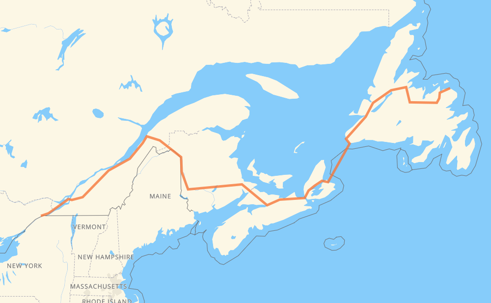
The distance from Musgrave Harbour to Ingleside is 1,509 miles by road including 885 miles on motorways. Road takes approximately 31 hours and 59 minutes and goes through Corner Brook, Moncton, Fredericton, Lévis, Drummondville, Longueuil and Montreal.
You can adjust fuel consumption and fuel price here.
How long is a car ride from Musgrave Harbour to Ingleside?
Driving time:
31 h 59 min
This time is calculated for driving at the maximum permitted speed, taking into account traffic rules restrictions.
421 mi with a maximum speed 68 mph = 6 h 11 min
444 mi with a maximum speed 62 mph = 7 h 8 min
434 mi with a maximum speed 56 mph = 7 h 45 min
26 mi with a maximum speed 56 mph = 27 min
52 mi with a maximum speed 50 mph = 1 h 3 min
17 mi with a maximum speed 43 mph = 23 min
2 mi with a maximum speed 40 mph = 2 min
2 mi with a maximum speed 31 mph = 4 min
110 mi with a maximum speed 12 mph = 8 h 52 min
The calculated driving time does not take into account intermediate stops and traffic jams.
How far is Musgrave Harbour to Ingleside by land?
The distance between Musgrave Harbour and Ingleside is 1,508.7 mi by road including 885.5 mi on motorways.
Precise satellite coordinates of highways were used for this calculation. The start and finish points are the centers of Musgrave Harbour and Ingleside respectively.
How far is Musgrave Harbour to Ingleside by plane?
The shortest distance (air line, as the crow flies) between Musgrave Harbour and Ingleside is 1,030.2 mi.
This distance is calculated using the Haversine formula as a great-circle distance between two points on the surface of a sphere. The start and finish points are the centers of Musgrave Harbour and Ingleside respectively. Actual distance between airports may be different.
How many hours is Musgrave Harbour from Ingleside by plane?
Boeing 737 airliner needs 2 h 4 min to cover the distance of 1,030 mi at a cruising speed of 497 mph.
Small plane "Cessna 172" needs 7 h 32 min to flight this distance at average speed of 136 mph.
This time is approximate and do not take into account takeoff and landing times, airport location and other real world factors.
How long is a helicopter ride from Musgrave Harbour to Ingleside?
Fast helicopter "Eurocopter AS350" or "Hughes OH-6 Cayuse" need 6 h 54 min to cover the distance of 1,030 mi at a cruising speed of 149 mph.
Popular "Robinson R44" needs 7 h 53 min to flight this distance at average speed of 130 mph.
This time is approximate and do not take into account takeoff and landing times, aerodrome location and other real world factors.
What city is halfway between Musgrave Harbour and Ingleside?
The halfway point between Musgrave Harbour and Ingleside is Oxford.
The distance from Oxford to Musgrave Harbour is 754 mi and driving will take about 20 h 7 min. The road between Oxford and Ingleside has length 754 mi and will take approximately 11 h 51 min.
The other cities located close to halfway point:
Amherst is in 777 mi from Musgrave Harbour and 731 mi from Ingleside
Aulac is in 780 mi from Musgrave Harbour and 728 mi from Ingleside
Sackville is in 785 mi from Musgrave Harbour and 724 mi from Ingleside
Where is Musgrave Harbour in relation to Ingleside?
Musgrave Harbour is located 1,030 mi east of Ingleside.
Musgrave Harbour has geographic coordinates: latitude 49.45116, longitude -53.95111.
Ingleside has geographic coordinates: latitude 44.99549, longitude -74.98674.
Which highway goes from Musgrave Harbour to Ingleside?
The route from Musgrave Harbour to Ingleside follows TCH, 1, 2, 20, NS 104, NS 105.