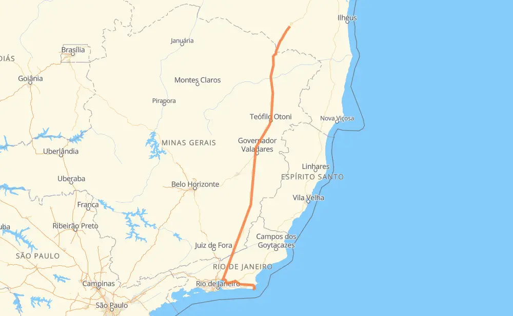
Distance between Pé de Galinha and Arraial do Cabo
The distance from Pé de Galinha to Arraial do Cabo is 740 miles by road including 64 miles on motorways. Road takes approximately 14 hours and 22 minutes and goes through Muriaé, Magé, Medina, Itaobim, Ponto dos Volantes, Padre Paraíso and Itambacuri.
| Shortest distance by air | 560 mi ✈️ |
| Car route length | 740.1 mi 🚗 |
| Driving time | 14 h 22 min |
| Fuel amount | 25.2 gal |
| Fuel cost | 98.9 USD |
| Point | Distance | Time | Fuel | |
| Pé de Galinha | 0 mi | 00 min | 0.0 gal | |
|
BR-116 111 mi, 2 h 03 min
|
||||
| Medina | 111 mi | 2 h 03 min | 3.0 gal | |
|
BR-116 30 mi, 32 min
|
||||
| Itaobim | 140 mi | 2 h 36 min | 4.5 gal | |
|
BR-116 15 mi, 17 min
|
||||
| Ponto dos Volantes | 155 mi | 2 h 54 min | 5.0 gal | |
|
BR-116 17 mi, 19 min
|
||||
| Padre Paraíso | 173 mi | 3 h 14 min | 5.6 gal | |
|
BR-116 82 mi, 1 h 40 min
|
||||
| Itambacuri | 255 mi | 4 h 54 min | 8.5 gal | |
|
BR-116 63 mi, 1 h 14 min
|
||||
| Santa Paula | 318 mi | 6 h 09 min | 10.8 gal | |
|
BR-116 7 mi, 08 min
|
||||
| Azteca | 324 mi | 6 h 17 min | 11.0 gal | |
|
BR-116 176 mi, 3 h 27 min
|
||||
| Muriaé | 501 mi | 9 h 44 min | 16.8 gal | |
|
BR-116 151 mi, 3 h 03 min
|
||||
| Magé | 652 mi | 12 h 48 min | 22.0 gal | |
|
BR-493 RJ-124 89 mi, 1 h 33 min
|
||||
| -22.96628, -42.02443 | 741 mi | 14 h 21 min | 25.2 gal | |
Hotels of Arraial do Cabo
Frequently Asked Questions
How much does it cost to drive from Pé de Galinha to Arraial do Cabo?
Fuel cost: 98.9 USD
This fuel cost is calculated as: (Route length 740.1 mi) / (Fuel consumption 29.4 mpg) * (Fuel price 3.93 USD / gal)
You can adjust fuel consumption and fuel price here.
How long is a car ride from Pé de Galinha to Arraial do Cabo?
Driving time: 14 h 22 min
This time is calculated for driving at the maximum permitted speed, taking into account traffic rules restrictions.
- 35 mi with a maximum speed 68 mph = 30 min
- 18 mi with a maximum speed 62 mph = 17 min
- 360 mi with a maximum speed 56 mph = 6 h 25 min
- 283 mi with a maximum speed 50 mph = 5 h 41 min
- 27 mi with a maximum speed 37 mph = 42 min
- 4 mi with a maximum speed 31 mph = 7 min
- 16 mi with a maximum speed 25 mph = 36 min
The calculated driving time does not take into account intermediate stops and traffic jams.
How far is Pé de Galinha to Arraial do Cabo by land?
The distance between Pé de Galinha and Arraial do Cabo is 740.1 mi by road including 64 mi on motorways.
Precise satellite coordinates of highways were used for this calculation. The start and finish points are the centers of Pé de Galinha and Arraial do Cabo respectively.
How far is Pé de Galinha to Arraial do Cabo by plane?
The shortest distance (air line, as the crow flies) between Pé de Galinha and Arraial do Cabo is 559.9 mi.
This distance is calculated using the Haversine formula as a great-circle distance between two points on the surface of a sphere. The start and finish points are the centers of Pé de Galinha and Arraial do Cabo respectively. Actual distance between airports may be different.
How many hours is Pé de Galinha from Arraial do Cabo by plane?
Boeing 737 airliner needs 1 h 7 min to cover the distance of 560 mi at a cruising speed of 497 mph.
Small plane "Cessna 172" needs 4 h 5 min to flight this distance at average speed of 136 mph.
This time is approximate and do not take into account takeoff and landing times, airport location and other real world factors.
How long is a helicopter ride from Pé de Galinha to Arraial do Cabo?
Fast helicopter "Eurocopter AS350" or "Hughes OH-6 Cayuse" need 3 h 45 min to cover the distance of 560 mi at a cruising speed of 149 mph.
Popular "Robinson R44" needs 4 h 17 min to flight this distance at average speed of 130 mph.
This time is approximate and do not take into account takeoff and landing times, aerodrome location and other real world factors.
What city is halfway between Pé de Galinha and Arraial do Cabo?
The halfway point between Pé de Galinha and Arraial do Cabo is Inhapim. It is located about 2 mi from the exact midpoint by road.
The distance from Inhapim to Pé de Galinha is 372 mi and driving will take about 7 h 11 min. The road between Inhapim and Arraial do Cabo has length 368 mi and will take approximately 7 h 10 min.
The other cities located close to halfway point:
Where is Pé de Galinha in relation to Arraial do Cabo?
Pé de Galinha is located 560 mi north of Arraial do Cabo.
Pé de Galinha has geographic coordinates: latitude -14.93421, longitude -40.89069.
Arraial do Cabo has geographic coordinates: latitude -22.96628, longitude -42.02443.
Which highway goes from Pé de Galinha to Arraial do Cabo?
The route from Pé de Galinha to Arraial do Cabo follows BR-116.
Other minor sections pass along the road:
- BR-342: 44 mi
- RJ-124: 35 mi
- BR-101: 22 mi
- BR-493: 12 mi
- RJ-140: 11 mi
- BR-251: 9 mi
- RJ-102: 4 mi
- BR-393: 2 mi
- RJ-106: 2 mi