Distance between Paracho de Verduzco and Cuatrociénegas de Carranza
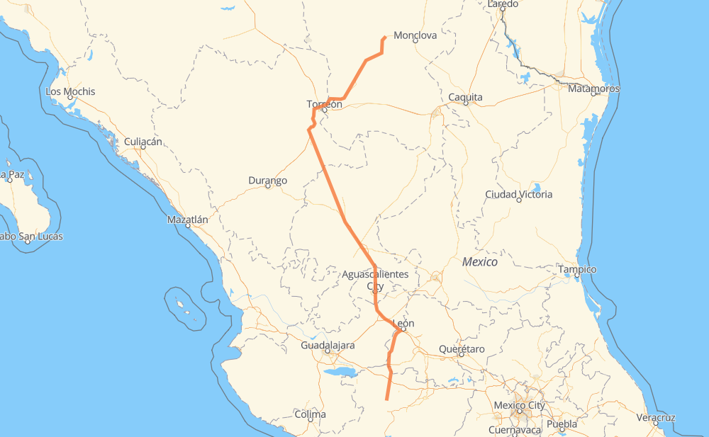
The distance from Paracho de Verduzco to Cuatrociénegas de Carranza is 660 miles by road including 137 miles on motorways. Road takes approximately 12 hours and 20 minutes and goes through Aguascalientes, Fresnillo, Cherán, Purépero de Echáiz, Tlazazalca, Ciudad Manuel Doblado and Encarnación de Díaz.
| Shortest distance by air | 508 mi ✈️ |
| Car route length | 659.9 mi 🚗 |
| Driving time | 12 h 20 min |
| Fuel amount | 22.4 gal |
| Fuel cost | 87.6 USD |
| Toll roads cost | 455 + ? MXN |
| Point | Distance | Time | Fuel | |
| Paracho de Verduzco | 0 mi | 00 min | 0.0 gal | |
|
MEX 37 12 mi, 14 min
|
||||
| Cherán | 12 mi | 14 min | 0.2 gal | |
|
MEX 37 12 mi, 14 min
|
||||
| Purépero de Echáiz | 24 mi | 29 min | 0.7 gal | |
|
MEX 37 11 mi, 13 min
|
||||
| Tlazazalca | 34 mi | 43 min | 0.9 gal | |
|
MEX 37 62 mi, 1 h 14 min
|
||||
| Ciudad Manuel Doblado | 96 mi | 1 h 57 min | 3.2 gal | |
|
MEX 37 MEX 45D 76 mi, 1 h 16 min
|
||||
| Encarnación de Díaz | 172 mi | 3 h 14 min | 5.8 gal | |
|
MEX 45D MEX 70 29 mi, 33 min
|
||||
| Aguascalientes | 201 mi | 3 h 47 min | 6.7 gal | |
|
MEX 45 13 mi, 15 min
|
||||
| San Francisco de Los Romo | 214 mi | 4 h 02 min | 7.2 gal | |
|
MEX 45 MEX 45D 94 mi, 1 h 41 min
|
||||
| Fresnillo | 308 mi | 5 h 44 min | 10.2 gal | |
|
MEX 45D MEX 49 355 mi, 6 h 35 min
|
||||
| Cuatrociénegas de Carranza | 662 mi | 12 h 20 min | 21.0 gal | |
Hotels of Cuatrociénegas de Carranza
Frequently Asked Questions
How many toll booths are there from Paracho de Verduzco to Cuatrociénegas de Carranza?
There are 8 toll booths between Paracho de Verduzco and Cuatrociénegas de Carranza: León Guzmán, Cuencame, Morfín Chávez, Calera, Veta Grande, Zacatecas, Encarnacion De Diaz and León - Aguascalientes.
How much does the toll booths cost from Paracho de Verduzco to Cuatrociénegas de Carranza?
Toll roads cost: León - Aguascalientes (153 MXN) + Encarnacion De Diaz (150 MXN) + Zacatecas (41 MXN) + Veta Grande (48 MXN) + Calera (23 MXN) + Morfín Chávez (40 MXN) + Cuencame (?) + León Guzmán (?) = 455 + ? MXN
How much does it cost to drive from Paracho de Verduzco to Cuatrociénegas de Carranza?
Fuel cost: 87.6 USD
This fuel cost is calculated as: (Route length 659.9 mi) / (Fuel consumption 29.4 mpg) * (Fuel price 3.9 USD / gal)
You can adjust fuel consumption and fuel price here.
Toll roads cost: 455 + ? MXN
How long is a car ride from Paracho de Verduzco to Cuatrociénegas de Carranza?
Driving time: 12 h 20 min
This time is calculated for driving at the maximum permitted speed, taking into account traffic rules restrictions.
- 127 mi with a maximum speed 68 mph = 1 h 52 min
- 6 mi with a maximum speed 62 mph = 5 min
- 217 mi with a maximum speed 56 mph = 3 h 52 min
- 47 mi with a maximum speed 56 mph = 50 min
- 213 mi with a maximum speed 50 mph = 4 h 17 min
- 33 mi with a maximum speed 43 mph = 45 min
- 14 mi with a maximum speed 37 mph = 21 min
- 2 mi with a maximum speed 31 mph = 4 min
- 1 mi with a maximum speed 25 mph = 3 min
- 1 mi with a maximum speed 19 mph = 4 min
- 1 mi with a maximum speed 12 mph = 2 min
The calculated driving time does not take into account intermediate stops and traffic jams.
How far is Paracho de Verduzco to Cuatrociénegas de Carranza by land?
The distance between Paracho de Verduzco and Cuatrociénegas de Carranza is 659.9 mi by road including 137.3 mi on motorways.
Precise satellite coordinates of highways were used for this calculation. The start and finish points are the centers of Paracho de Verduzco and Cuatrociénegas de Carranza respectively.
How far is Paracho de Verduzco to Cuatrociénegas de Carranza by plane?
The shortest distance (air line, as the crow flies) between Paracho de Verduzco and Cuatrociénegas de Carranza is 507.7 mi.
This distance is calculated using the Haversine formula as a great-circle distance between two points on the surface of a sphere. The start and finish points are the centers of Paracho de Verduzco and Cuatrociénegas de Carranza respectively. Actual distance between airports may be different.
How many hours is Paracho de Verduzco from Cuatrociénegas de Carranza by plane?
Boeing 737 airliner needs 1 h 1 min to cover the distance of 508 mi at a cruising speed of 497 mph.
Small plane "Cessna 172" needs 3 h 42 min to flight this distance at average speed of 136 mph.
This time is approximate and do not take into account takeoff and landing times, airport location and other real world factors.
How long is a helicopter ride from Paracho de Verduzco to Cuatrociénegas de Carranza?
Fast helicopter "Eurocopter AS350" or "Hughes OH-6 Cayuse" need 3 h 24 min to cover the distance of 508 mi at a cruising speed of 149 mph.
Popular "Robinson R44" needs 3 h 53 min to flight this distance at average speed of 130 mph.
This time is approximate and do not take into account takeoff and landing times, aerodrome location and other real world factors.
What city is halfway between Paracho de Verduzco and Cuatrociénegas de Carranza?
The halfway point between Paracho de Verduzco and Cuatrociénegas de Carranza is Fresnillo. It is located about 23 mi from the exact midpoint by road.
The distance from Fresnillo to Paracho de Verduzco is 308 mi and driving will take about 5 h 43 min. The road between Fresnillo and Cuatrociénegas de Carranza has length 353 mi and will take approximately 6 h 36 min.
The other cities located close to halfway point:
- Río Grande is in 357 mi from Paracho de Verduzco and 303 mi from Cuatrociénegas de Carranza
- General Félix U. Gómez is in 297 mi from Paracho de Verduzco and 363 mi from Cuatrociénegas de Carranza
- General Enrique Estrada is in 292 mi from Paracho de Verduzco and 368 mi from Cuatrociénegas de Carranza
Where is Paracho de Verduzco in relation to Cuatrociénegas de Carranza?
Paracho de Verduzco is located 508 mi south of Cuatrociénegas de Carranza.
Paracho de Verduzco has geographic coordinates: latitude 19.64659, longitude -102.04809.
Cuatrociénegas de Carranza has geographic coordinates: latitude 26.98808, longitude -102.06305.
Which highway goes from Paracho de Verduzco to Cuatrociénegas de Carranza?
The route from Paracho de Verduzco to Cuatrociénegas de Carranza follows MEX 30, MEX 49, MEX 45D, MEX 37, MEX 45, MEX 40D.
Other minor sections pass along the road:
- MEX 49D: 55 mi
- MEX 70: 31 mi
- GTO 87-0: 19 mi
- GTO 86: 6 mi
- MEX 90: 6 mi
- MEX 40: 6 mi
- GTO 87-7: 3 mi
- MEX 15: 2 mi
- GTO 87: 1 mi