Distance between Patrocínio and Congonhal
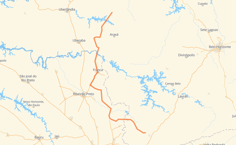
The distance from Patrocínio to Congonhal is 361 miles by road including 64 miles on motorways. Road takes approximately 6 hours and 31 minutes and goes through Poços de Caldas, Perdizes, Sacramento, Jardim Vera Cruz III, Residencial Boca da Mata, Caldas and Ipuiúna.
| Shortest distance by air | 231 mi ✈️ |
| Car route length | 361 mi 🚗 |
| Driving time | 6 h 31 min |
| Fuel amount | 12.3 gal |
| Fuel cost | 48.3 USD |
| Point | Distance | Time | Fuel | |
| -18.94083, -46.99266 | 0 mi | 00 min | 0.0 gal | |
|
BR-462 35 mi, 39 min
|
||||
| Perdizes | 35 mi | 39 min | 1.9 gal | |
|
BR-462 47 mi, 53 min
|
||||
| Sacramento | 83 mi | 1 h 32 min | 3.4 gal | |
|
MG-190 SP-334 64 mi, 1 h 09 min
|
||||
| Jardim Vera Cruz III | 147 mi | 2 h 42 min | 5.8 gal | |
|
SP-334 75 mi, 1 h 15 min
|
||||
| Residencial Boca da Mata | 222 mi | 3 h 58 min | 8.5 gal | |
|
SP-338 71 mi, 1 h 13 min
|
||||
| Porto da Cascata | 293 mi | 5 h 11 min | 10.8 gal | |
|
BR-267 MG-877 16 mi, 18 min
|
||||
| Poços de Caldas | 309 mi | 5 h 30 min | 11.3 gal | |
|
MG-877 BR-459 18 mi, 20 min
|
||||
| Caldas | 327 mi | 5 h 50 min | 11.9 gal | |
|
BR-459 15 mi, 17 min
|
||||
| Ipuiúna | 342 mi | 6 h 08 min | 12.4 gal | |
|
BR-459 19 mi, 22 min
|
||||
| Congonhal | 361 mi | 6 h 30 min | 13.1 gal | |
Frequently Asked Questions
How much does it cost to drive from Patrocínio to Congonhal?
Fuel cost: 48.3 USD
This fuel cost is calculated as: (Route length 361 mi) / (Fuel consumption 29.4 mpg) * (Fuel price 3.93 USD / gal)
You can adjust fuel consumption and fuel price here.
How long is a car ride from Patrocínio to Congonhal?
Driving time: 6 h 31 min
This time is calculated for driving at the maximum permitted speed, taking into account traffic rules restrictions.
- 43 mi with a maximum speed 68 mph = 37 min
- 19 mi with a maximum speed 62 mph = 17 min
- 210 mi with a maximum speed 56 mph = 3 h 45 min
- 87 mi with a maximum speed 50 mph = 1 h 45 min
- 1 mi with a maximum speed 37 mph = 1 min
- 1 mi with a maximum speed 31 mph = 1 min
- 1 mi with a maximum speed 25 mph = 2 min
The calculated driving time does not take into account intermediate stops and traffic jams.
How far is Patrocínio to Congonhal by land?
The distance between Patrocínio and Congonhal is 361 mi by road including 64 mi on motorways.
Precise satellite coordinates of highways were used for this calculation. The start and finish points are the centers of Patrocínio and Congonhal respectively.
How far is Patrocínio to Congonhal by plane?
The shortest distance (air line, as the crow flies) between Patrocínio and Congonhal is 230.5 mi.
This distance is calculated using the Haversine formula as a great-circle distance between two points on the surface of a sphere. The start and finish points are the centers of Patrocínio and Congonhal respectively. Actual distance between airports may be different.
How many hours is Patrocínio from Congonhal by plane?
Boeing 737 airliner needs 27 min to cover the distance of 231 mi at a cruising speed of 497 mph.
Small plane "Cessna 172" needs 1 h 41 min to flight this distance at average speed of 136 mph.
This time is approximate and do not take into account takeoff and landing times, airport location and other real world factors.
How long is a helicopter ride from Patrocínio to Congonhal?
Fast helicopter "Eurocopter AS350" or "Hughes OH-6 Cayuse" need 1 h 32 min to cover the distance of 231 mi at a cruising speed of 149 mph.
Popular "Robinson R44" needs 1 h 46 min to flight this distance at average speed of 130 mph.
This time is approximate and do not take into account takeoff and landing times, aerodrome location and other real world factors.
What city is halfway between Patrocínio and Congonhal?
The halfway point between Patrocínio and Congonhal is Jardim Vera Cruz III. It is located about 34 mi from the exact midpoint by road.
The distance from Jardim Vera Cruz III to Patrocínio is 147 mi and driving will take about 2 h 42 min. The road between Jardim Vera Cruz III and Congonhal has length 214 mi and will take approximately 3 h 48 min.
The other cities located close to halfway point:
Where is Patrocínio in relation to Congonhal?
Patrocínio is located 231 mi north-west of Congonhal.
Patrocínio has geographic coordinates: latitude -18.94083, longitude -46.99266.
Congonhal has geographic coordinates: latitude -22.15325, longitude -46.04047.
Which highway goes from Patrocínio to Congonhal?
The route from Patrocínio to Congonhal follows SP-334.
Other minor sections pass along the road:
- BR-462: 56 mi
- SP-338: 42 mi
- BR-459: 31 mi
- BR-267: 30 mi
- SP-215: 29 mi
- SP-351: 22 mi
- BR-265: 22 mi
- SP-340: 19 mi
- MG-190: 17 mi
- MG-877: 16 mi
- MG-428: 14 mi
- BR-262: 12 mi
- BR-464: 3 mi
- BR-452: 2 mi
- SP-344: 1 mi