Distance between Pelequén and Santa Rosa
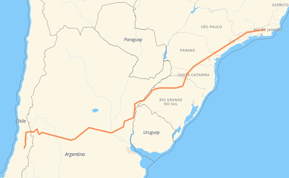
The distance from Pelequén to Santa Rosa is 2,464 miles by road including 792 miles on motorways. Road takes approximately 45 hours and 25 minutes and goes through Rancagua, San Bernardo, Santiago, Colina, Los Andes, San Luis and Río Cuarto.
| Shortest distance by air | 1,898 mi ✈️ |
| Car route length | 2,464.4 mi 🚗 |
| Driving time | 45 h 25 min |
| Fuel amount | 83.8 gal |
| Fuel cost | 326.9 USD |
| Point | Distance | Time | Fuel | |
| Pelequén | 0 mi | 00 min | 0.0 gal | |
|
H-611 5 23 mi, 20 min
|
||||
| Rancagua | 23 mi | 20 min | 0.7 gal | |
|
5 40 mi, 36 min
|
||||
| San Bernardo | 63 mi | 57 min | 2.0 gal | |
|
5 74 38 mi, 40 min
|
||||
| Colina | 101 mi | 1 h 37 min | 3.0 gal | |
|
57 52 mi, 1 h 04 min
|
||||
| Los Andes | 153 mi | 2 h 42 min | 4.2 gal | |
|
60-CH RN7 316 mi, 6 h 01 min
|
||||
| San Luis | 469 mi | 8 h 43 min | 15.8 gal | |
|
RN7 RN8 132 mi, 2 h 25 min
|
||||
| Río Cuarto | 601 mi | 11 h 09 min | 20.3 gal | |
|
RN8 RN158 87 mi, 1 h 51 min
|
||||
| Villa María | 687 mi | 13 h 00 min | 23.3 gal | |
|
RP2 RN9 156 mi, 2 h 19 min
|
||||
| Rosario | 843 mi | 15 h 20 min | 28.5 gal | |
|
RNA008 BR-285 1,070 mi, 20 h 05 min
|
||||
| Piraquara | 1,913 mi | 35 h 26 min | 64.9 gal | |
|
BR-116 237 mi, 4 h 05 min
|
||||
| Taboão da Serra | 2,150 mi | 39 h 31 min | 73.1 gal | |
|
SP-230 SP-070 71 mi, 1 h 10 min
|
||||
| Jacareí | 2,221 mi | 40 h 42 min | 75.5 gal | |
|
SP-070 SP-060 64 mi, 1 h 00 min
|
||||
| Guaratinguetá | 2,285 mi | 41 h 43 min | 77.7 gal | |
|
SP-060 BR-116 207 mi, 4 h 04 min
|
||||
| Santa Rosa | 2,492 mi | 45 h 47 min | 84.7 gal | |
Frequently Asked Questions
How much does it cost to drive from Pelequén to Santa Rosa?
Fuel cost: 326.9 USD
This fuel cost is calculated as: (Route length 2,464.4 mi) / (Fuel consumption 29.4 mpg) * (Fuel price 3.9 USD / gal)
You can adjust fuel consumption and fuel price here.
How long is a car ride from Pelequén to Santa Rosa?
Driving time: 45 h 25 min
This time is calculated for driving at the maximum permitted speed, taking into account traffic rules restrictions.
- 519 mi with a maximum speed 68 mph = 7 h 38 min
- 136 mi with a maximum speed 62 mph = 2 h 11 min
- 1,158 mi with a maximum speed 56 mph = 20 h 41 min
- 15 mi with a maximum speed 56 mph = 16 min
- 460 mi with a maximum speed 50 mph = 9 h 15 min
- 34 mi with a maximum speed 43 mph = 47 min
- 99 mi with a maximum speed 37 mph = 2 h 38 min
- 27 mi with a maximum speed 31 mph = 53 min
- 1 mi with a maximum speed 28 mph = 2 min
- 24 mi with a maximum speed 25 mph = 56 min
- 1 mi with a maximum speed 19 mph = 3 min
The calculated driving time does not take into account intermediate stops and traffic jams.
How far is Pelequén to Santa Rosa by land?
The distance between Pelequén and Santa Rosa is 2,464.4 mi by road including 792.2 mi on motorways.
Precise satellite coordinates of highways were used for this calculation. The start and finish points are the centers of Pelequén and Santa Rosa respectively.
How far is Pelequén to Santa Rosa by plane?
The shortest distance (air line, as the crow flies) between Pelequén and Santa Rosa is 1,898.3 mi.
This distance is calculated using the Haversine formula as a great-circle distance between two points on the surface of a sphere. The start and finish points are the centers of Pelequén and Santa Rosa respectively. Actual distance between airports may be different.
How many hours is Pelequén from Santa Rosa by plane?
Boeing 737 airliner needs 3 h 49 min to cover the distance of 1,898 mi at a cruising speed of 497 mph.
Small plane "Cessna 172" needs 13 h 53 min to flight this distance at average speed of 136 mph.
This time is approximate and do not take into account takeoff and landing times, airport location and other real world factors.
How long is a helicopter ride from Pelequén to Santa Rosa?
Fast helicopter "Eurocopter AS350" or "Hughes OH-6 Cayuse" need 12 h 43 min to cover the distance of 1,898 mi at a cruising speed of 149 mph.
Popular "Robinson R44" needs 14 h 32 min to flight this distance at average speed of 130 mph.
This time is approximate and do not take into account takeoff and landing times, aerodrome location and other real world factors.
What city is halfway between Pelequén and Santa Rosa?
The halfway point between Pelequén and Santa Rosa is San Salvador. It is located about 208 mi from the exact midpoint by road.
The distance from San Salvador to Pelequén is 1,025 mi and driving will take about 18 h 39 min. The road between San Salvador and Santa Rosa has length 1,440 mi and will take approximately 26 h 46 min.
The other cities located close to halfway point:
Where is Pelequén in relation to Santa Rosa?
Pelequén is located 1,898 mi south-west of Santa Rosa.
Pelequén has geographic coordinates: latitude -34.46633, longitude -70.89554.
Santa Rosa has geographic coordinates: latitude -22.24232, longitude -42.77498.
Which highway goes from Pelequén to Santa Rosa?
The route from Pelequén to Santa Rosa follows BR-116, RN7, BR-285, SP-230, BR-153, RN14, RN9, BR-476, BR-472, BR-393, RN158, SP-060, RN8, SP-070, 5, RN18.
Other minor sections pass along the road:
- 60-CH: 48 mi
- ERS-135: 45 mi
- RP6: 39 mi
- RN174: 38 mi
- 57: 37 mi
- BR-478: 30 mi
- RN12: 29 mi
- RP26: 25 mi
- 74: 15 mi
- SP-015: 14 mi
- BR-277: 14 mi
- RN40: 13 mi
- BR-040: 11 mi
- BR-459: 9 mi
- RP2: 8 mi
- SP-021: 8 mi
- BR-383: 7 mi
- RN117: 7 mi
- RNA008: 6 mi
- E-57: 5 mi
- ERS-536: 4 mi
- BR-492: 4 mi
- RJ-134: 4 mi
- BR-050: 4 mi
- E-61: 4 mi
- RJ-130: 3 mi
- BR-293: 3 mi
- BR-290: 3 mi
- ERS-342: 2 mi
- RP11: 2 mi
- SP-280: 2 mi
- BR-374: 2 mi
- SPI 117/070: 2 mi
- SPM-280 E: 1 mi
- RJ-151: 1 mi
- RN40 RN7: 1 mi
- SPI-016/021: 1 mi
- RJ-157: 1 mi