Distance between Pembroke ON and Mayland Heights AB
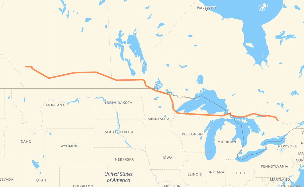
The distance from Pembroke to Mayland Heights is 2,032 miles by road including 103 miles on motorways. Road takes approximately 37 hours and 18 minutes and goes through North Bay, Sault Ste. Marie, Marquette, Duluth, International Falls, Steinbach and Winnipeg.
You can adjust fuel consumption and fuel price here.
How long is a car ride from Pembroke to Mayland Heights?
Driving time:
37 h 18 min
This time is calculated for driving at the maximum permitted speed, taking into account traffic rules restrictions.
17 mi with a maximum speed 68 mph = 15 min
7 mi with a maximum speed 65 mph = 6 min
48 mi with a maximum speed 62 mph = 46 min
1,133 mi with a maximum speed 56 mph = 20 h 13 min
350 mi with a maximum speed 56 mph = 6 h 15 min
139 mi with a maximum speed 55 mph = 2 h 31 min
3 mi with a maximum speed 50 mph = 4 min
270 mi with a maximum speed 50 mph = 5 h 26 min
11 mi with a maximum speed 45 mph = 15 min
20 mi with a maximum speed 43 mph = 27 min
3 mi with a maximum speed 40 mph = 4 min
13 mi with a maximum speed 37 mph = 20 min
6 mi with a maximum speed 35 mph = 9 min
7 mi with a maximum speed 31 mph = 13 min
4 mi with a maximum speed 30 mph = 7 min
The calculated driving time does not take into account intermediate stops and traffic jams.
How far is Pembroke to Mayland Heights by land?
The distance between Pembroke and Mayland Heights is 2,031.9 mi by road including 103.1 mi on motorways.
Precise satellite coordinates of highways were used for this calculation. The start and finish points are the centers of Pembroke and Mayland Heights respectively.
How far is Pembroke to Mayland Heights by plane?
The shortest distance (air line, as the crow flies) between Pembroke and Mayland Heights is 1,711.3 mi.
This distance is calculated using the Haversine formula as a great-circle distance between two points on the surface of a sphere. The start and finish points are the centers of Pembroke and Mayland Heights respectively. Actual distance between airports may be different.
How many hours is Pembroke from Mayland Heights by plane?
Boeing 737 airliner needs 3 h 26 min to cover the distance of 1,711 mi at a cruising speed of 497 mph.
Small plane "Cessna 172" needs 12 h 31 min to flight this distance at average speed of 136 mph.
This time is approximate and do not take into account takeoff and landing times, airport location and other real world factors.
How long is a helicopter ride from Pembroke to Mayland Heights?
Fast helicopter "Eurocopter AS350" or "Hughes OH-6 Cayuse" need 11 h 28 min to cover the distance of 1,711 mi at a cruising speed of 149 mph.
Popular "Robinson R44" needs 13 h 6 min to flight this distance at average speed of 130 mph.
This time is approximate and do not take into account takeoff and landing times, aerodrome location and other real world factors.
What city is halfway between Pembroke and Mayland Heights?
The halfway point between Pembroke and Mayland Heights is Emo. It is located about 6 mi from the exact midpoint by road.
The distance from Emo to Pembroke is 1,009 mi and driving will take about 18 h 52 min. The road between Emo and Mayland Heights has length 1,022 mi and will take approximately 18 h 26 min.
The other cities located close to halfway point:
Devlin is in 1,004 mi from Pembroke and 1,028 mi from Mayland Heights
Fort Frances is in 991 mi from Pembroke and 1,041 mi from Mayland Heights
Rainy River is in 1,046 mi from Pembroke and 986 mi from Mayland Heights
Where is Pembroke in relation to Mayland Heights?
Pembroke is located 1,711 mi east of Mayland Heights.
Pembroke has geographic coordinates: latitude 45.81827, longitude -77.11442.
Mayland Heights has geographic coordinates: latitude 51.06057, longitude -114.01191.
Which highway goes from Pembroke to Mayland Heights?
The route from Pembroke to Mayland Heights follows 1, 17, M 28, PTH 1, US 53, US 2, PTH 12.