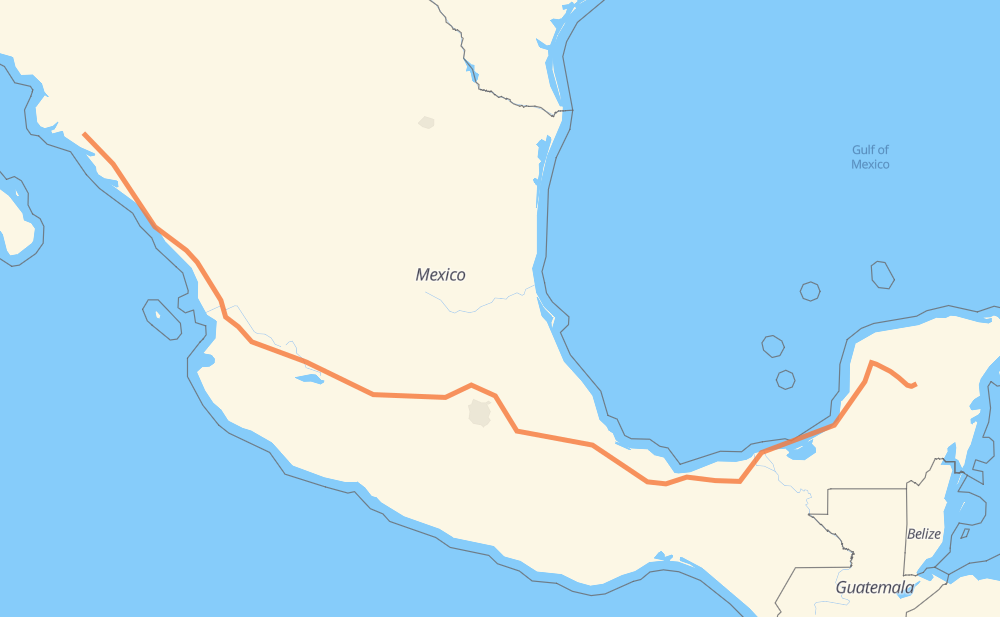
The distance from Peto to Las Cuchillas is 1,687 miles by road including 1,275 miles on motorways. Road takes approximately 29 hours and 42 minutes and goes through Orizaba, Tonalá, Tepic and Dimas (Estación Dimas).
You can adjust fuel consumption and fuel price here.
Toll roads cost:
2,957 + ? MXN
How long is a car ride from Peto to Las Cuchillas?
Driving time:
29 h 42 min
This time is calculated for driving at the maximum permitted speed, taking into account traffic rules restrictions.
227 mi with a maximum speed 68 mph = 3 h 20 min
686 mi with a maximum speed 62 mph = 11 h 2 min
112 mi with a maximum speed 56 mph = 1 h 59 min
52 mi with a maximum speed 56 mph = 56 min
590 mi with a maximum speed 50 mph = 11 h 52 min
10 mi with a maximum speed 43 mph = 13 min
5 mi with a maximum speed 37 mph = 8 min
2 mi with a maximum speed 31 mph = 4 min
2 mi with a maximum speed 25 mph = 4 min
The calculated driving time does not take into account intermediate stops and traffic jams.
How far is Peto to Las Cuchillas by land?
The distance between Peto and Las Cuchillas is 1,687 mi by road including 1,275.1 mi on motorways.
Precise satellite coordinates of highways were used for this calculation. The start and finish points are the centers of Peto and Las Cuchillas respectively.
How far is Peto to Las Cuchillas by plane?
The shortest distance (air line, as the crow flies) between Peto and Las Cuchillas is 1,287.5 mi.
This distance is calculated using the Haversine formula as a great-circle distance between two points on the surface of a sphere. The start and finish points are the centers of Peto and Las Cuchillas respectively. Actual distance between airports may be different.
How many hours is Peto from Las Cuchillas by plane?
Boeing 737 airliner needs 2 h 35 min to cover the distance of 1,287 mi at a cruising speed of 497 mph.
Small plane "Cessna 172" needs 9 h 25 min to flight this distance at average speed of 136 mph.
This time is approximate and do not take into account takeoff and landing times, airport location and other real world factors.
How long is a helicopter ride from Peto to Las Cuchillas?
Fast helicopter "Eurocopter AS350" or "Hughes OH-6 Cayuse" need 8 h 38 min to cover the distance of 1,287 mi at a cruising speed of 149 mph.
Popular "Robinson R44" needs 9 h 52 min to flight this distance at average speed of 130 mph.
This time is approximate and do not take into account takeoff and landing times, aerodrome location and other real world factors.
What city is halfway between Peto and Las Cuchillas?
The halfway point between Peto and Las Cuchillas is José María Morelos (San José). It is located about 7 mi from the exact midpoint by road.
The distance from José María Morelos (San José) to Peto is 836 mi and driving will take about 15 h 8 min. The road between José María Morelos (San José) and Las Cuchillas has length 851 mi and will take approximately 14 h 34 min.
The other cities located close to halfway point:
Unidad Petrolera (Unidad Habitacional PEMEX) is in 803 mi from Peto and 883 mi from Las Cuchillas
Santa María Moyotzingo is in 802 mi from Peto and 885 mi from Las Cuchillas
Tezoquipa is in 888 mi from Peto and 799 mi from Las Cuchillas
Where is Peto in relation to Las Cuchillas?
Peto is located 1,287 mi south-east of Las Cuchillas.
Peto has geographic coordinates: latitude 20.1265, longitude -88.92246.
Las Cuchillas has geographic coordinates: latitude 25.49732, longitude -108.30317.
Which highway goes from Peto to Las Cuchillas?
The route from Peto to Las Cuchillas follows MEX 15D, MEX 180, MEX 150D, MEX 145D, MEX M40D, MEX 180D.