Distance between Piedra Herrada and Allende
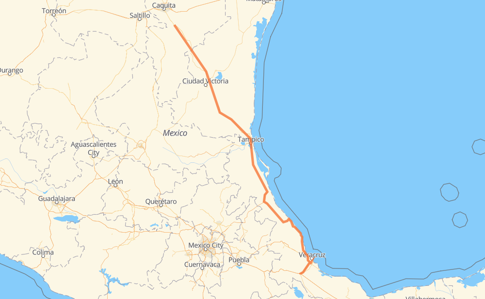
The distance from Piedra Herrada to Allende is 603 miles by road including 115 miles on motorways. Road takes approximately 11 hours and 26 minutes and goes through Ciudad Madero, José Cardel, Túxpam de Rodríguez Cano, Alto Lucero, Anáhuac, Altamira and Villa Manuel.
| Shortest distance by air | 505 mi ✈️ |
| Car route length | 603.4 mi 🚗 |
| Driving time | 11 h 26 min |
| Fuel amount | 20.5 gal |
| Fuel cost | 80.7 USD |
| Toll roads cost | 309 + ? MXN |
| Point | Distance | Time | Fuel | |
| Piedra Herrada | 0 mi | 00 min | 0.0 gal | |
|
MEX 145D MEX 150D 59 mi, 1 h 00 min
|
||||
| José Cardel | 59 mi | 1 h 00 min | 2.0 gal | |
|
MEX 180 163 mi, 3 h 06 min
|
||||
| Túxpam de Rodríguez Cano | 222 mi | 4 h 07 min | 7.5 gal | |
|
MEX 132 3 mi, 04 min
|
||||
| Alto Lucero | 226 mi | 4 h 11 min | 7.6 gal | |
|
MEX 132 MEX 180 99 mi, 1 h 47 min
|
||||
| Ciudad Madero | 324 mi | 5 h 58 min | 11.0 gal | |
|
MEX 180 16 mi, 19 min
|
||||
| Altamira | 340 mi | 6 h 17 min | 11.2 gal | |
|
MEX 80 39 mi, 46 min
|
||||
| Villa Manuel | 380 mi | 7 h 04 min | 12.8 gal | |
|
MEX 81 14 mi, 15 min
|
||||
| González | 394 mi | 7 h 20 min | 13.2 gal | |
|
MEX 81 MEX 85 171 mi, 3 h 16 min
|
||||
| Linares | 565 mi | 10 h 36 min | 19.2 gal | |
|
MEX 85 45 mi, 49 min
|
||||
| Allende | 610 mi | 11 h 26 min | 20.7 gal | |
Hotels of Allende
Frequently Asked Questions
How many toll booths are there from Piedra Herrada to Allende?
There are 6 toll booths between Piedra Herrada and Allende: Tampico, Tuxpan, Cardel - Posa Rica, Nautla, La Antigua and San Julián.
How much does the toll booths cost from Piedra Herrada to Allende?
Toll roads cost: San Julián (?) + La Antigua (?) + Nautla (24 MXN) + Cardel - Posa Rica (205 MXN) + Tuxpan (45 MXN) + Tampico (35 MXN) = 309 + ? MXN
How much does it cost to drive from Piedra Herrada to Allende?
Fuel cost: 80.7 USD
This fuel cost is calculated as: (Route length 603.4 mi) / (Fuel consumption 29.4 mpg) * (Fuel price 3.93 USD / gal)
You can adjust fuel consumption and fuel price here.
Toll roads cost: 309 + ? MXN
How long is a car ride from Piedra Herrada to Allende?
Driving time: 11 h 26 min
This time is calculated for driving at the maximum permitted speed, taking into account traffic rules restrictions.
- 15 mi with a maximum speed 68 mph = 13 min
- 66 mi with a maximum speed 62 mph = 1 h 3 min
- 186 mi with a maximum speed 56 mph = 3 h 19 min
- 68 mi with a maximum speed 56 mph = 1 h 12 min
- 265 mi with a maximum speed 50 mph = 5 h 20 min
- 7 mi with a maximum speed 37 mph = 12 min
- 1 mi with a maximum speed 31 mph = 1 min
- 1 mi with a maximum speed 25 mph = 2 min
The calculated driving time does not take into account intermediate stops and traffic jams.
How far is Piedra Herrada to Allende by land?
The distance between Piedra Herrada and Allende is 603.4 mi by road including 115 mi on motorways.
Precise satellite coordinates of highways were used for this calculation. The start and finish points are the centers of Piedra Herrada and Allende respectively.
How far is Piedra Herrada to Allende by plane?
The shortest distance (air line, as the crow flies) between Piedra Herrada and Allende is 504.6 mi.
This distance is calculated using the Haversine formula as a great-circle distance between two points on the surface of a sphere. The start and finish points are the centers of Piedra Herrada and Allende respectively. Actual distance between airports may be different.
How many hours is Piedra Herrada from Allende by plane?
Boeing 737 airliner needs 1 h to cover the distance of 505 mi at a cruising speed of 497 mph.
Small plane "Cessna 172" needs 3 h 41 min to flight this distance at average speed of 136 mph.
This time is approximate and do not take into account takeoff and landing times, airport location and other real world factors.
How long is a helicopter ride from Piedra Herrada to Allende?
Fast helicopter "Eurocopter AS350" or "Hughes OH-6 Cayuse" need 3 h 23 min to cover the distance of 505 mi at a cruising speed of 149 mph.
Popular "Robinson R44" needs 3 h 52 min to flight this distance at average speed of 130 mph.
This time is approximate and do not take into account takeoff and landing times, aerodrome location and other real world factors.
What city is halfway between Piedra Herrada and Allende?
The halfway point between Piedra Herrada and Allende is Horconcitos. It is located about 7 mi from the exact midpoint by road.
The distance from Horconcitos to Piedra Herrada is 295 mi and driving will take about 5 h 22 min. The road between Horconcitos and Allende has length 309 mi and will take approximately 6 h 3 min.
The other cities located close to halfway point:
Where is Piedra Herrada in relation to Allende?
Piedra Herrada is located 505 mi south-east of Allende.
Piedra Herrada has geographic coordinates: latitude 18.76777, longitude -96.44833.
Allende has geographic coordinates: latitude 25.28026, longitude -100.01981.
Which highway goes from Piedra Herrada to Allende?
The route from Piedra Herrada to Allende follows MEX 180, MEX 85, MEX 180D.
Other minor sections pass along the road:
- MEX 83: 57 mi
- MEX 81: 52 mi
- MEX 80: 47 mi
- MEX 135D: 28 mi
- MEX 150D: 27 mi
- MEX: 19 mi
- MEX 129: 14 mi
- MEX 132D: 8 mi
- MEX 132: 6 mi
- MEX 145D: 1 mi