Distance between Ploufragan and Douai

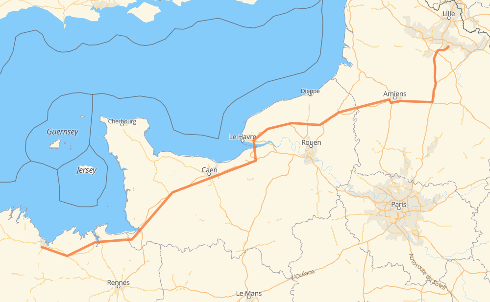
The distance from Ploufragan to Douai is 368 miles by road including 264 miles on motorways. Road takes approximately 5 hours and 54 minutes and goes through Amiens, Lamballe, Avranches, Mondeville and Vallée Barrey.

There are tolls on the route.
Shortest distance by air 294 mi ✈️
Car route length 367.9 mi 🚗
Driving time 5 h 54 min
Fuel amount 12.5 gal
Fuel cost 48.8 USD
Click here to load the interactive map
Compare this route in other services:
City
Town
Village
Hamlet
Motorway
Primary
Secondary
Unclassified
Point Distance Time Fuel
Ploufragan 0 mi 0:00 00 min 0.0 gal
D 222 4 mi, 05 min
La Croix Gibat 4 mi 0:05 05 min 0.1 gal
D 222 N 12 2 mi, 02 min
Yffiniac 6 mi 0:07 07 min 0.2 gal
N 12 2 mi, 02 min
Saint-René 9 mi 0:10 10 min 0.3 gal
N 12 5 mi, 05 min
Lamballe 14 mi 0:15 15 min 0.4 gal
N 12 4 mi, 04 min
Plestan 18 mi 0:20 20 min 0.6 gal
N 12 N 176 63 mi, 1 h 09 min
Avranches 81 mi 1:29 1 h 29 min 2.7 gal
N 175 A 84 65 mi, 59 min
Mondeville 147 mi 2:29 2 h 29 min 5.0 gal
A 13 A 29 154 mi, 2 h 18 min
Amiens 301 mi 4:48 4 h 48 min 10.2 gal
A 29 A 1 66 mi, 1 h 05 min
Douai 368 mi 5:53 5 h 53 min 12.5 gal
City
Town
Village
Hamlet
Motorway
Primary
Secondary
Unclassified
Point Distance Time Fuel
Ploufragan 0 mi 0:00 00 min 0.0 gal
D 222 4 mi, 05 min
La Croix Gibat 4 mi 0:05 05 min 0.1 gal
D 222 N 12 2 mi, 02 min
Yffiniac 6 mi 0:07 07 min 0.2 gal
N 12 1 mi, 01 min
Les Fraîches 7 mi 0:09 09 min 0.3 gal
N 12 1 mi, 00 min
Saint-René 9 mi 0:10 10 min 0.3 gal
N 12 2 mi, 01 min
Jamet 11 mi 0:12 12 min 0.3 gal
N 12 3 mi, 03 min
Lamballe 14 mi 0:15 15 min 0.4 gal
N 12 4 mi, 04 min
Plestan 18 mi 0:20 20 min 0.6 gal
N 12 4 mi, 03 min
Tramain 22 mi 0:24 24 min 0.7 gal
N 176 6 mi, 05 min
Lescouët-Jugon 27 mi 0:30 30 min 0.9 gal
N 176 7 mi, 07 min
Quévert 34 mi 0:37 37 min 1.0 gal
N 176 6 mi, 06 min
Saint-Samson-sur-Rance 40 mi 0:43 43 min 1.3 gal
N 176 3 mi, 03 min
Saint-Goudas 43 mi 0:47 47 min 1.4 gal
N 176 2 mi, 03 min
Port Saint-Hubert 46 mi 0:50 50 min 1.5 gal
N 176 1 mi, 01 min
Veaux-Boeufs 47 mi 0:51 51 min 1.6 gal
N 176 6 mi, 06 min
Le Mesnil des Aulnays 52 mi 0:57 57 min 1.7 gal
N 176 4 mi, 04 min
Dol-de-Bretagne 57 mi 1:01 1 h 01 min 1.9 gal
N 176 4 mi, 03 min
Seve Davy 60 mi 1:05 1 h 05 min 1.9 gal
N 176 4 mi, 04 min
La Lande de Montomblay 65 mi 1:10 1 h 10 min 2.1 gal
N 176 3 mi, 03 min
Pontorson 67 mi 1:13 1 h 13 min 2.3 gal
N 176 2 mi, 02 min
Curey 69 mi 1:15 1 h 15 min 2.3 gal
N 175 3 mi, 03 min
Servon 73 mi 1:19 1 h 19 min 2.4 gal
N 175 2 mi, 01 min
Précey 74 mi 1:21 1 h 21 min 2.5 gal
N 175 5 mi, 05 min
Le Val-Saint-Père 79 mi 1:27 1 h 27 min 2.7 gal
N 175 2 mi, 02 min
Avranches 81 mi 1:29 1 h 29 min 2.7 gal
N 175 3 mi, 03 min
Plomb 85 mi 1:32 1 h 32 min 2.8 gal
A 84 4 mi, 03 min
Les Chaignonnières 88 mi 1:35 1 h 35 min 2.9 gal
A 84 4 mi, 03 min
Rouffigny 92 mi 1:39 1 h 39 min 3.1 gal
A 84 3 mi, 02 min
La Pinçonnière 95 mi 1:41 1 h 41 min 3.2 gal
A 84 5 mi, 04 min
Le Champ Huet 99 mi 1:45 1 h 45 min 3.3 gal
A84 4 mi, 03 min
La Petite Mintrie 104 mi 1:49 1 h 49 min 3.5 gal
A 84 2 mi, 02 min
Calambieu 106 mi 1:51 1 h 51 min 3.6 gal
A 84 1 mi, 00 min
La Sagère 107 mi 1:52 1 h 52 min 3.6 gal
A 84 7 mi, 06 min
Guilberville 114 mi 1:58 1 h 58 min 3.8 gal
A 84 5 mi, 04 min
Les Loges 119 mi 2:02 2 h 02 min 4.0 gal
A 84 3 mi, 02 min
La Fongaie 122 mi 2:05 2 h 05 min 4.1 gal
A 84 2 mi, 02 min
Maisoncelles-Pelvey 125 mi 2:07 2 h 07 min 4.2 gal
A 84 2 mi, 02 min
Villers-Bocage 127 mi 2:09 2 h 09 min 4.3 gal
A 84 4 mi, 03 min
Monts-en-Bessin 130 mi 2:12 2 h 12 min 4.4 gal
A 84 17 mi, 16 min
Mondeville 147 mi 2:29 2 h 29 min 5.0 gal
A 13 6 mi, 05 min
Troarn 153 mi 2:34 2 h 34 min 5.2 gal
A 13 3 mi, 02 min
L'Église 157 mi 2:37 2 h 37 min 5.3 gal
A 13 8 mi, 07 min
La Forge Moisy 165 mi 2:44 2 h 44 min 5.5 gal
A 13 5 mi, 04 min
Reux 170 mi 2:49 2 h 49 min 5.7 gal
A 13 2 mi, 02 min
Pont-l'Évêque 172 mi 2:51 2 h 51 min 5.8 gal
A 13 2 mi, 01 min
Surville 174 mi 2:52 2 h 52 min 5.9 gal
A 13 9 mi, 09 min
Le Theil-en-Auge 183 mi 3:02 3 h 02 min 6.1 gal
A 29 19 mi, 17 min
Gommerville 203 mi 3:19 3 h 19 min 6.8 gal
A 29 9 mi, 08 min
Nointot 212 mi 3:28 3 h 28 min 7.0 gal
A 29 12 mi, 11 min
Ectot-lès-Baons 224 mi 3:39 3 h 39 min 7.6 gal
A 29 6 mi, 05 min
Ectot-l'Auber 231 mi 3:44 3 h 44 min 7.7 gal
A 29 7 mi, 05 min
La Houssaye-Béranger 237 mi 3:50 3 h 50 min 8.0 gal
A 29 11 mi, 10 min
Maucomble 249 mi 4:00 4 h 00 min 8.4 gal
A 28 3 mi, 02 min
Esclavelles 252 mi 4:03 4 h 03 min 8.5 gal
A 28 13 mi, 11 min
Plaine de la Clouterie 265 mi 4:15 4 h 15 min 8.9 gal
A 29 12 mi, 11 min
Gauville 277 mi 4:26 4 h 26 min 9.3 gal
A 29 11 mi, 09 min
Fricamps 288 mi 4:36 4 h 36 min 9.6 gal
A 29 13 mi, 11 min
Amiens 301 mi 4:47 4 h 47 min 10.2 gal
A 29 7 mi, 06 min
Cachy 308 mi 4:54 4 h 54 min 10.4 gal
A 29 10 mi, 08 min
Vermandovillers 318 mi 5:03 5 h 03 min 10.6 gal
A 29 A 1 11 mi, 11 min
Assevillers 329 mi 5:14 5 h 14 min 11.1 gal
A 1 7 mi, 06 min
Combles 336 mi 5:20 5 h 20 min 11.4 gal
A 1 3 mi, 02 min
Morval 339 mi 5:22 5 h 22 min 11.5 gal
A 1 3 mi, 02 min
Bancourt 342 mi 5:25 5 h 25 min 11.6 gal
A 1 3 mi, 02 min
Beugnâtre 345 mi 5:28 5 h 28 min 11.7 gal
A 1 4 mi, 03 min
Croisilles 350 mi 5:31 5 h 31 min 11.9 gal
A 1 3 mi, 02 min
Héninel 353 mi 5:34 5 h 34 min 12.0 gal
A 1 4 mi, 03 min
Rœux 357 mi 5:37 5 h 37 min 12.1 gal
A 1 4 mi, 03 min
Fresnes-lès-Montauban 360 mi 5:41 5 h 41 min 12.2 gal
D 950 2 mi, 03 min
Vitry-en-Artois 362 mi 5:44 5 h 44 min 12.3 gal
D 950 2 mi, 02 min
Brebières 365 mi 5:47 5 h 47 min 12.4 gal
D 950 D 650 2 mi, 02 min
Lambres-lez-Douai 367 mi 5:49 5 h 49 min 12.5 gal
D 650 1 mi, 02 min
Douai 368 mi 5:52 5 h 52 min 12.5 gal

Frequently Asked Questions

How much does it cost to drive from Ploufragan to Douai?

Fuel cost: 48.8 USD

This fuel cost is calculated as: (Route length 367.9 mi) / (Fuel consumption 29.4 mpg) * (Fuel price 3.9 USD / gal)

You can adjust fuel consumption and fuel price here.

How long is a car ride from Ploufragan to Douai?

Driving time: 5 h 54 min

This time is calculated for driving at the maximum permitted speed, taking into account traffic rules restrictions.

  • 255 mi with a maximum speed 68 mph = 3 h 44 min
  • 2 mi with a maximum speed 62 mph = 1 min
  • 75 mi with a maximum speed 56 mph = 1 h 19 min
  • 17 mi with a maximum speed 56 mph = 18 min
  • 10 mi with a maximum speed 50 mph = 11 min
  • 5 mi with a maximum speed 43 mph = 6 min
  • 4 mi with a maximum speed 31 mph = 8 min
  • 1 mi with a maximum speed 19 mph = 1 min

The calculated driving time does not take into account intermediate stops and traffic jams.

How far is Ploufragan to Douai by land?

The distance between Ploufragan and Douai is 367.9 mi by road including 264.1 mi on motorways.

Precise satellite coordinates of highways were used for this calculation. The start and finish points are the centers of Ploufragan and Douai respectively.

How far is Ploufragan to Douai by plane?

The shortest distance (air line, as the crow flies) between Ploufragan and Douai is 293.9 mi.

This distance is calculated using the Haversine formula as a great-circle distance between two points on the surface of a sphere. The start and finish points are the centers of Ploufragan and Douai respectively. Actual distance between airports may be different.

How many hours is Ploufragan from Douai by plane?

Boeing 737 airliner needs 35 min to cover the distance of 294 mi at a cruising speed of 497 mph.

Small plane "Cessna 172" needs 2 h 9 min to flight this distance at average speed of 136 mph.

This time is approximate and do not take into account takeoff and landing times, airport location and other real world factors.

How long is a helicopter ride from Ploufragan to Douai?

Fast helicopter "Eurocopter AS350" or "Hughes OH-6 Cayuse" need 1 h 58 min to cover the distance of 294 mi at a cruising speed of 149 mph.

Popular "Robinson R44" needs 2 h 15 min to flight this distance at average speed of 130 mph.

This time is approximate and do not take into account takeoff and landing times, aerodrome location and other real world factors.

What city is halfway between Ploufragan and Douai?

The halfway point between Ploufragan and Douai is Le Theil-en-Auge. It is located about 1 mi from the exact midpoint by road.

The distance from Le Theil-en-Auge to Ploufragan is 183 mi and driving will take about 3 h 2 min. The road between Le Theil-en-Auge and Douai has length 185 mi and will take approximately 2 h 51 min.

The other cities located close to halfway point:

  • Surville is in 174 mi from Ploufragan and 194 mi from Douai
  • Pont-l'Évêque is in 172 mi from Ploufragan and 196 mi from Douai
  • Reux is in 170 mi from Ploufragan and 198 mi from Douai

Where is Ploufragan in relation to Douai?

Ploufragan is located 294 mi south-west of Douai.

Ploufragan has geographic coordinates: latitude 48.49139, longitude -2.79344.

Douai has geographic coordinates: latitude 50.37037, longitude 3.07614.

Which highway goes from Ploufragan to Douai?

The route from Ploufragan to Douai follows A 29.

Other minor sections pass along the road:

  • A 84: 50 mi
  • N 176: 48 mi
  • A 1: 34 mi
  • A 13: 31 mi
  • N 175: 15 mi
  • N 12: 14 mi
  • A 28: 12 mi
  • N 814: 7 mi
  • A84: 5 mi
  • D 950: 5 mi
  • N 1029: 4 mi
  • D 222: 4 mi
  • A 16: 2 mi
  • D 650: 2 mi
Have any questions? Contact us!