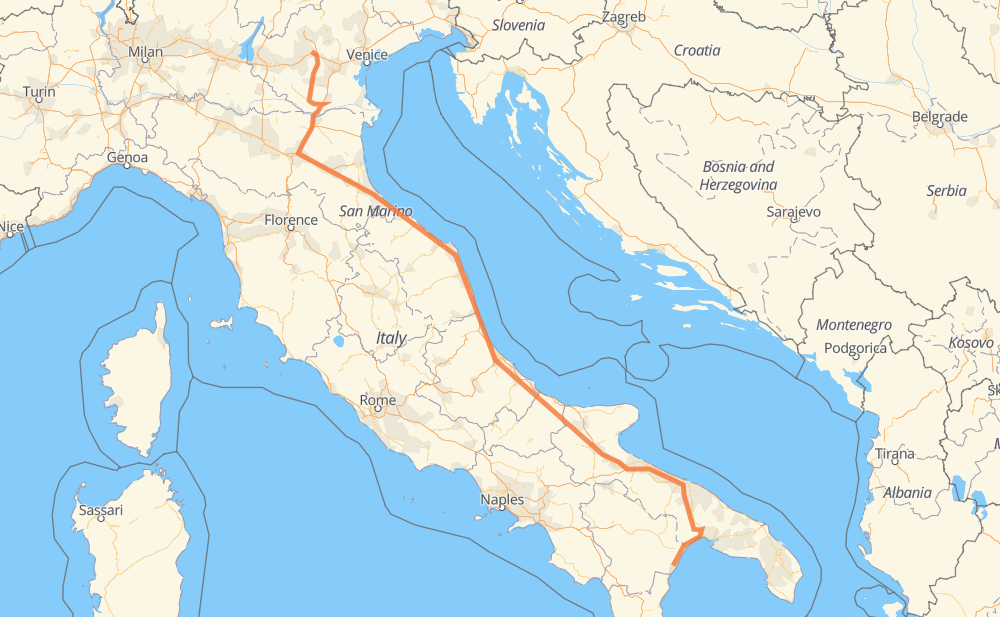
The distance from Policoro to Vicence is 580 miles by road including 528 miles on motorways. Road takes approximately 8 hours and 51 minutes and goes through Bari, Andria, Trani, Barletta, Foggia, Chieti and Ancône.
You can adjust fuel consumption and fuel price here.
How long is a car ride from Policoro to Vicence?
Driving time:
8 h 51 min
This time is calculated for driving at the maximum permitted speed, taking into account traffic rules restrictions.
518 mi with a maximum speed 68 mph = 7 h 36 min
12 mi with a maximum speed 56 mph = 13 min
29 mi with a maximum speed 56 mph = 31 min
16 mi with a maximum speed 50 mph = 18 min
2 mi with a maximum speed 31 mph = 3 min
3 mi with a maximum speed 25 mph = 6 min
The calculated driving time does not take into account intermediate stops and traffic jams.
How far is Policoro to Vicence by land?
The distance between Policoro and Vicence is 580.4 mi by road including 527.5 mi on motorways.
Precise satellite coordinates of highways were used for this calculation. The start and finish points are the centers of Policoro and Vicence respectively.
How far is Policoro to Vicence by plane?
The shortest distance (air line, as the crow flies) between Policoro and Vicence is 451.1 mi.
This distance is calculated using the Haversine formula as a great-circle distance between two points on the surface of a sphere. The start and finish points are the centers of Policoro and Vicence respectively. Actual distance between airports may be different.
How many hours is Policoro from Vicence by plane?
Boeing 737 airliner needs 54 min to cover the distance of 451 mi at a cruising speed of 497 mph.
Small plane "Cessna 172" needs 3 h 18 min to flight this distance at average speed of 136 mph.
This time is approximate and do not take into account takeoff and landing times, airport location and other real world factors.
How long is a helicopter ride from Policoro to Vicence?
Fast helicopter "Eurocopter AS350" or "Hughes OH-6 Cayuse" need 3 h 1 min to cover the distance of 451 mi at a cruising speed of 149 mph.
Popular "Robinson R44" needs 3 h 27 min to flight this distance at average speed of 130 mph.
This time is approximate and do not take into account takeoff and landing times, aerodrome location and other real world factors.
What city is halfway between Policoro and Vicence?
The halfway point between Policoro and Vicence is Roseto degli Abruzzi. It is located about 2 mi from the exact midpoint by road.
The distance from Roseto degli Abruzzi to Policoro is 289 mi and driving will take about 4 h 23 min. The road between Roseto degli Abruzzi and Vicence has length 292 mi and will take approximately 4 h 27 min.
The other cities located close to halfway point:
Giulianova is in 295 mi from Policoro and 286 mi from Vicence
Colle Imperatore is in 296 mi from Policoro and 284 mi from Vicence
Pineto is in 282 mi from Policoro and 298 mi from Vicence
Where is Policoro in relation to Vicence?
Policoro is located 451 mi south-east of Vicence.
Policoro has geographic coordinates: latitude 40.21045, longitude 16.67638.
Vicence has geographic coordinates: latitude 45.54883, longitude 11.54788.