Distance between Port Moody BC and Mississauga ON
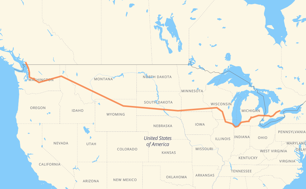
The distance from Port Moody to Mississauga is 2,729 miles by road including 2,707 miles on motorways. Road takes approximately 41 hours and 35 minutes and goes through Coquitlam, Bellingham, Everett, Bellevue, Moses Lake, Spokane and Coeur d'Alene.
| Shortest distance by air | 2,065 mi ✈️ |
| Car route length | 2,729.1 mi 🚗 |
| Driving time | 41 h 35 min |
| Fuel amount | 92.8 gal |
| Fuel cost | 362 USD |
| Point | Distance | Time | Fuel | |
| Port Moody | 0 mi | 00 min | 0.0 gal | |
|
7A 4 mi, 05 min
|
||||
| Coquitlam | 4 mi | 05 min | 0.0 gal | |
|
7 I 5 45 mi, 50 min
|
||||
| Bellingham | 50 mi | 55 min | 1.5 gal | |
|
I 5 58 mi, 54 min
|
||||
| Everett | 107 mi | 1 h 50 min | 3.5 gal | |
|
I 5 I 405 28 mi, 28 min
|
||||
| Bellevue | 135 mi | 2 h 18 min | 4.4 gal | |
|
I 405 I 90 158 mi, 2 h 21 min
|
||||
| Moses Lake | 293 mi | 4 h 39 min | 9.5 gal | |
|
I 90 113 mi, 1 h 40 min
|
||||
| Spokane | 406 mi | 6 h 20 min | 13.7 gal | |
|
I 90 32 mi, 29 min
|
||||
| Coeur d'Alene | 438 mi | 6 h 49 min | 14.8 gal | |
|
I 90 165 mi, 2 h 27 min
|
||||
| Missoula | 603 mi | 9 h 17 min | 20.5 gal | |
|
I 90 114 mi, 1 h 40 min
|
||||
| Butte | 717 mi | 10 h 58 min | 23.9 gal | |
|
I 90 226 mi, 3 h 24 min
|
||||
| Billings | 944 mi | 14 h 23 min | 31.9 gal | |
|
I 90 134 mi, 2 h 16 min
|
||||
| Sheridan | 1,078 mi | 16 h 39 min | 36.4 gal | |
|
I 90 99 mi, 1 h 27 min
|
||||
| Gillette | 1,177 mi | 18 h 07 min | 39.9 gal | |
|
I 90 97 mi, 1 h 29 min
|
||||
| Spearfish | 1,274 mi | 19 h 36 min | 43.1 gal | |
|
I 90 42 mi, 37 min
|
||||
| Rapid City | 1,316 mi | 20 h 14 min | 44.7 gal | |
|
I 90 11 mi, 10 min
|
||||
| Box Elder | 1,327 mi | 20 h 24 min | 45.0 gal | |
|
I 90 255 mi, 3 h 45 min
|
||||
| Mitchell | 1,583 mi | 24 h 10 min | 53.5 gal | |
|
I 90 72 mi, 1 h 03 min
|
||||
| Sioux Falls | 1,655 mi | 25 h 14 min | 56.2 gal | |
|
I 90 7 mi, 06 min
|
||||
| Brandon | 1,662 mi | 25 h 20 min | 56.5 gal | |
|
I 90 420 mi, 6 h 13 min
|
||||
| Madison | 2,082 mi | 31 h 33 min | 70.6 gal | |
|
I 39 35 mi, 30 min
|
||||
| Janesville | 2,117 mi | 32 h 04 min | 71.9 gal | |
|
I 39 I 90 107 mi, 1 h 39 min
|
||||
| Chicago | 2,225 mi | 33 h 44 min | 75.2 gal | |
|
I 90 I 94 144 mi, 2 h 12 min
|
||||
| Kalamazoo | 2,369 mi | 35 h 57 min | 80.5 gal | |
|
I 94 I 69 65 mi, 56 min
|
||||
| Lansing | 2,433 mi | 36 h 53 min | 82.7 gal | |
|
I 69 62 mi, 54 min
|
||||
| Flint | 2,495 mi | 37 h 48 min | 84.8 gal | |
|
I 69 76 mi, 1 h 14 min
|
||||
| Sarnia | 2,571 mi | 39 h 03 min | 87.3 gal | |
|
402 87 mi, 1 h 19 min
|
||||
| Woodstock | 2,658 mi | 40 h 23 min | 90.3 gal | |
|
401 26 mi, 25 min
|
||||
| Kitchener | 2,684 mi | 40 h 48 min | 91.2 gal | |
|
401 45 mi, 46 min
|
||||
| Mississauga | 2,729 mi | 41 h 34 min | 92.5 gal | |
Hotels of Mississauga
Frequently Asked Questions
How much does it cost to drive from Port Moody to Mississauga?
Fuel cost: 362 USD
This fuel cost is calculated as: (Route length 2,729.1 mi) / (Fuel consumption 29.4 mpg) * (Fuel price 3.9 USD / gal)
You can adjust fuel consumption and fuel price here.
How long is a car ride from Port Moody to Mississauga?
Driving time: 41 h 35 min
This time is calculated for driving at the maximum permitted speed, taking into account traffic rules restrictions.
- 2,101 mi with a maximum speed 68 mph = 30 h 53 min
- 99 mi with a maximum speed 65 mph = 1 h 31 min
- 298 mi with a maximum speed 62 mph = 4 h 48 min
- 113 mi with a maximum speed 60 mph = 1 h 53 min
- 2 mi with a maximum speed 56 mph = 1 min
- 18 mi with a maximum speed 55 mph = 19 min
- 71 mi with a maximum speed 50 mph = 1 h 25 min
- 8 mi with a maximum speed 45 mph = 10 min
- 9 mi with a maximum speed 43 mph = 13 min
- 1 mi with a maximum speed 40 mph = 1 min
- 2 mi with a maximum speed 37 mph = 4 min
- 1 mi with a maximum speed 35 mph = 1 min
- 3 mi with a maximum speed 31 mph = 5 min
- 1 mi with a maximum speed 25 mph = 3 min
The calculated driving time does not take into account intermediate stops and traffic jams.
How far is Port Moody to Mississauga by land?
The distance between Port Moody and Mississauga is 2,729.1 mi by road including 2,706.7 mi on motorways.
Precise satellite coordinates of highways were used for this calculation. The start and finish points are the centers of Port Moody and Mississauga respectively.
How far is Port Moody to Mississauga by plane?
The shortest distance (air line, as the crow flies) between Port Moody and Mississauga is 2,064.8 mi.
This distance is calculated using the Haversine formula as a great-circle distance between two points on the surface of a sphere. The start and finish points are the centers of Port Moody and Mississauga respectively. Actual distance between airports may be different.
How many hours is Port Moody from Mississauga by plane?
Boeing 737 airliner needs 4 h 9 min to cover the distance of 2,065 mi at a cruising speed of 497 mph.
Small plane "Cessna 172" needs 15 h 6 min to flight this distance at average speed of 136 mph.
This time is approximate and do not take into account takeoff and landing times, airport location and other real world factors.
How long is a helicopter ride from Port Moody to Mississauga?
Fast helicopter "Eurocopter AS350" or "Hughes OH-6 Cayuse" need 13 h 50 min to cover the distance of 2,065 mi at a cruising speed of 149 mph.
Popular "Robinson R44" needs 15 h 49 min to flight this distance at average speed of 130 mph.
This time is approximate and do not take into account takeoff and landing times, aerodrome location and other real world factors.
What city is halfway between Port Moody and Mississauga?
The halfway point between Port Moody and Mississauga is Wall. It is located about 6 mi from the exact midpoint by road.
The distance from Wall to Port Moody is 1,370 mi and driving will take about 21 h. The road between Wall and Mississauga has length 1,359 mi and will take approximately 20 h 34 min.
The other cities located close to halfway point:
Where is Port Moody in relation to Mississauga?
Port Moody is located 2,065 mi west of Mississauga.
Port Moody has geographic coordinates: latitude 49.28393, longitude -122.8299.
Mississauga has geographic coordinates: latitude 43.59034, longitude -79.64573.
Which highway goes from Port Moody to Mississauga?
The route from Port Moody to Mississauga follows I 90, I 94, US 14, I 69, US 87, 401, I 39, I 5, US 212, US 12, 402.
Other minor sections pass along the road:
- US 395: 60 mi
- US 191: 57 mi
- SD 79: 31 mi
- US 16: 25 mi
- US 51: 20 mi
- US 83: 19 mi
- I 405: 18 mi
- MT 200: 13 mi
- 15: 12 mi
- I 15: 7 mi
- US 85: 7 mi
- US 89: 7 mi
- SD 63: 7 mi
- SD 73: 6 mi
- SD 50: 6 mi
- SD 34: 6 mi
- 1: 5 mi
- US 93: 5 mi
- SD 45: 4 mi
- US 61: 4 mi
- I 96: 4 mi
- US 97: 4 mi
- US 16 Truck: 4 mi
- US 31: 3 mi
- US 2: 2 mi
- MN 43: 2 mi
- 7: 2 mi
- US 218: 2 mi
- WI 11: 2 mi
- SD 37: 1 mi
- US 53: 1 mi
- WA 543: 1 mi