Distance between Puerto Bajo las Sombras and El Treinta y Cuatro
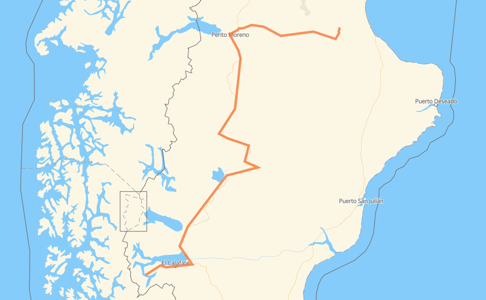
The distance from Puerto Bajo las Sombras to El Treinta y Cuatro is 623 miles by road. Road takes approximately 12 hours and 6 minutes and goes through El Calafate, Tres Lagos, Gobernador Gregores, Las Horquetas, Bajo Caracoles, Polo Productivo and San Agustín.
| Shortest distance by air | 352 mi ✈️ |
| Car route length | 623.2 mi 🚗 |
| Driving time | 12 h 6 min |
| Fuel amount | 21.2 gal |
| Fuel cost | 83.3 USD |
| Point | Distance | Time | Fuel | |
| Puerto Bajo las Sombras | 0 mi | 00 min | 0.0 gal | |
|
RP11 44 mi, 1 h 06 min
|
||||
| El Calafate | 44 mi | 1 h 06 min | 1.5 gal | |
|
RP11 RN40 111 mi, 2 h 01 min
|
||||
| Tres Lagos | 155 mi | 3 h 07 min | 4.7 gal | |
|
RN40 95 mi, 1 h 45 min
|
||||
| Gobernador Gregores | 250 mi | 4 h 52 min | 8.4 gal | |
|
RN40 42 mi, 45 min
|
||||
| Las Horquetas | 292 mi | 5 h 38 min | 8.7 gal | |
|
RN40 94 mi, 1 h 41 min
|
||||
| Bajo Caracoles | 386 mi | 7 h 20 min | 12.8 gal | |
|
RN40 93 mi, 1 h 40 min
|
||||
| Polo Productivo | 478 mi | 9 h 00 min | 16.1 gal | |
|
RN40 RP43 105 mi, 1 h 55 min
|
||||
| San Agustín | 583 mi | 10 h 56 min | 19.7 gal | |
|
RP43 12 mi, 12 min
|
||||
| Piedra Clavada | 595 mi | 11 h 08 min | 20.1 gal | |
|
RP43 27 mi, 57 min
|
||||
| El Treinta y Cuatro | 623 mi | 12 h 06 min | 21.0 gal | |
Frequently Asked Questions
How much does it cost to drive from Puerto Bajo las Sombras to El Treinta y Cuatro?
Fuel cost: 83.3 USD
This fuel cost is calculated as: (Route length 623.2 mi) / (Fuel consumption 29.4 mpg) * (Fuel price 3.93 USD / gal)
You can adjust fuel consumption and fuel price here.
How long is a car ride from Puerto Bajo las Sombras to El Treinta y Cuatro?
Driving time: 12 h 6 min
This time is calculated for driving at the maximum permitted speed, taking into account traffic rules restrictions.
- 528 mi with a maximum speed 56 mph = 9 h 24 min
- 70 mi with a maximum speed 50 mph = 1 h 24 min
- 3 mi with a maximum speed 37 mph = 4 min
- 16 mi with a maximum speed 25 mph = 37 min
- 7 mi with a maximum speed 12 mph = 35 min
The calculated driving time does not take into account intermediate stops and traffic jams.
How far is Puerto Bajo las Sombras to El Treinta y Cuatro by land?
The distance between Puerto Bajo las Sombras and El Treinta y Cuatro is 623.2 mi by road.
Precise satellite coordinates of highways were used for this calculation. The start and finish points are the centers of Puerto Bajo las Sombras and El Treinta y Cuatro respectively.
How far is Puerto Bajo las Sombras to El Treinta y Cuatro by plane?
The shortest distance (air line, as the crow flies) between Puerto Bajo las Sombras and El Treinta y Cuatro is 351.7 mi.
This distance is calculated using the Haversine formula as a great-circle distance between two points on the surface of a sphere. The start and finish points are the centers of Puerto Bajo las Sombras and El Treinta y Cuatro respectively. Actual distance between airports may be different.
How many hours is Puerto Bajo las Sombras from El Treinta y Cuatro by plane?
Boeing 737 airliner needs 42 min to cover the distance of 352 mi at a cruising speed of 497 mph.
Small plane "Cessna 172" needs 2 h 34 min to flight this distance at average speed of 136 mph.
This time is approximate and do not take into account takeoff and landing times, airport location and other real world factors.
How long is a helicopter ride from Puerto Bajo las Sombras to El Treinta y Cuatro?
Fast helicopter "Eurocopter AS350" or "Hughes OH-6 Cayuse" need 2 h 21 min to cover the distance of 352 mi at a cruising speed of 149 mph.
Popular "Robinson R44" needs 2 h 41 min to flight this distance at average speed of 130 mph.
This time is approximate and do not take into account takeoff and landing times, aerodrome location and other real world factors.
What city is halfway between Puerto Bajo las Sombras and El Treinta y Cuatro?
The halfway point between Puerto Bajo las Sombras and El Treinta y Cuatro is Las Horquetas. It is located about 19 mi from the exact midpoint by road.
The distance from Las Horquetas to Puerto Bajo las Sombras is 292 mi and driving will take about 5 h 38 min. The road between Las Horquetas and El Treinta y Cuatro has length 331 mi and will take approximately 6 h 28 min.
The other cities located close to halfway point:
Where is Puerto Bajo las Sombras in relation to El Treinta y Cuatro?
Puerto Bajo las Sombras is located 352 mi south-west of El Treinta y Cuatro.
Puerto Bajo las Sombras has geographic coordinates: latitude -50.47413, longitude -72.99404.
El Treinta y Cuatro has geographic coordinates: latitude -46.48056, longitude -68.23891.
Which highway goes from Puerto Bajo las Sombras to El Treinta y Cuatro?
The route from Puerto Bajo las Sombras to El Treinta y Cuatro follows RN40, RP43, RP11.