Distance between Río Bravo and El Zacatal
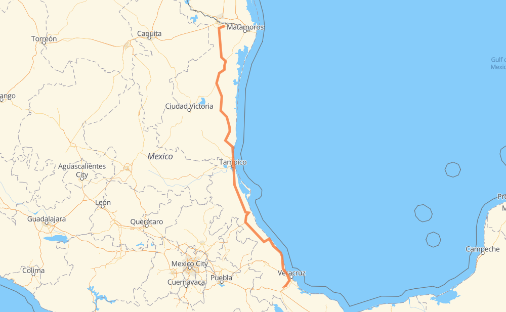
The distance from Río Bravo to El Zacatal is 621 miles by road including 100 miles on motorways. Road takes approximately 11 hours and 39 minutes and goes through Aldama, Ciudad Madero, General Francisco Villa, Altamira, Anáhuac, Alto Lucero and Túxpam de Rodríguez Cano.
| Shortest distance by air | 500 mi ✈️ |
| Car route length | 620.7 mi 🚗 |
| Driving time | 11 h 39 min |
| Fuel amount | 21.1 gal |
| Fuel cost | 82.4 USD |
| Toll roads cost | 719 + ? MXN |
| Point | Distance | Time | Fuel | |
| Río Bravo | 0 mi | 00 min | 0.0 gal | |
|
MEX 2 MEX 97 83 mi, 1 h 39 min
|
||||
| General Francisco Villa | 83 mi | 1 h 39 min | 2.7 gal | |
|
MEX 101 MEX 180 94 mi, 1 h 40 min
|
||||
| Soto la Marina | 177 mi | 3 h 20 min | 6.0 gal | |
|
MEX 180 72 mi, 1 h 17 min
|
||||
| Aldama | 249 mi | 4 h 38 min | 8.2 gal | |
|
MEX 180 TAM 113 57 mi, 1 h 05 min
|
||||
| Altamira | 306 mi | 5 h 44 min | 10.2 gal | |
|
MEX 80 MEX 180 11 mi, 12 min
|
||||
| Ciudad Madero | 317 mi | 5 h 56 min | 10.7 gal | |
|
MEX 180 99 mi, 1 h 47 min
|
||||
| Alto Lucero | 416 mi | 7 h 44 min | 14.1 gal | |
|
MEX 132 3 mi, 04 min
|
||||
| Túxpam de Rodríguez Cano | 419 mi | 7 h 48 min | 14.2 gal | |
|
MEX 132 MEX 180 163 mi, 3 h 06 min
|
||||
| José Cardel | 583 mi | 10 h 55 min | 19.8 gal | |
|
MEX 180 MEX 150D 43 mi, 44 min
|
||||
| El Zacatal | 626 mi | 11 h 39 min | 21.3 gal | |
Frequently Asked Questions
How many toll booths are there from Río Bravo to El Zacatal?
There are 9 toll booths between Río Bravo and El Zacatal: San Fernando, Tampico, Naranjos, Tuxpan, Cardel - Posa Rica, Nautla, La Antigua, San Julián and Paso del Toro.
How much does the toll booths cost from Río Bravo to El Zacatal?
Toll roads cost: San Fernando (26 MXN) + Tampico (35 MXN) + Naranjos (297 MXN) + Tuxpan (45 MXN) + Cardel - Posa Rica (205 MXN) + Nautla (24 MXN) + La Antigua (?) + San Julián (?) + Paso del Toro (87 MXN) = 719 + ? MXN
How much does it cost to drive from Río Bravo to El Zacatal?
Fuel cost: 82.4 USD
This fuel cost is calculated as: (Route length 620.7 mi) / (Fuel consumption 29.4 mpg) * (Fuel price 3.9 USD / gal)
You can adjust fuel consumption and fuel price here.
Toll roads cost: 719 + ? MXN
How long is a car ride from Río Bravo to El Zacatal?
Driving time: 11 h 39 min
This time is calculated for driving at the maximum permitted speed, taking into account traffic rules restrictions.
- 11 mi with a maximum speed 68 mph = 10 min
- 60 mi with a maximum speed 62 mph = 58 min
- 149 mi with a maximum speed 56 mph = 2 h 39 min
- 154 mi with a maximum speed 56 mph = 2 h 45 min
- 246 mi with a maximum speed 50 mph = 4 h 56 min
- 4 mi with a maximum speed 37 mph = 5 min
- 1 mi with a maximum speed 31 mph = 1 min
- 1 mi with a maximum speed 25 mph = 2 min
The calculated driving time does not take into account intermediate stops and traffic jams.
How far is Río Bravo to El Zacatal by land?
The distance between Río Bravo and El Zacatal is 620.7 mi by road including 100 mi on motorways.
Precise satellite coordinates of highways were used for this calculation. The start and finish points are the centers of Río Bravo and El Zacatal respectively.
How far is Río Bravo to El Zacatal by plane?
The shortest distance (air line, as the crow flies) between Río Bravo and El Zacatal is 499.6 mi.
This distance is calculated using the Haversine formula as a great-circle distance between two points on the surface of a sphere. The start and finish points are the centers of Río Bravo and El Zacatal respectively. Actual distance between airports may be different.
How many hours is Río Bravo from El Zacatal by plane?
Boeing 737 airliner needs 1 h to cover the distance of 500 mi at a cruising speed of 497 mph.
Small plane "Cessna 172" needs 3 h 39 min to flight this distance at average speed of 136 mph.
This time is approximate and do not take into account takeoff and landing times, airport location and other real world factors.
How long is a helicopter ride from Río Bravo to El Zacatal?
Fast helicopter "Eurocopter AS350" or "Hughes OH-6 Cayuse" need 3 h 21 min to cover the distance of 500 mi at a cruising speed of 149 mph.
Popular "Robinson R44" needs 3 h 49 min to flight this distance at average speed of 130 mph.
This time is approximate and do not take into account takeoff and landing times, aerodrome location and other real world factors.
What city is halfway between Río Bravo and El Zacatal?
The halfway point between Río Bravo and El Zacatal is Altamira. It is located about 4 mi from the exact midpoint by road.
The distance from Altamira to Río Bravo is 306 mi and driving will take about 5 h 44 min. The road between Altamira and El Zacatal has length 315 mi and will take approximately 5 h 55 min.
The other cities located close to halfway point:
Where is Río Bravo in relation to El Zacatal?
Río Bravo is located 500 mi north of El Zacatal.
Río Bravo has geographic coordinates: latitude 25.987, longitude -98.09761.
El Zacatal has geographic coordinates: latitude 18.95083, longitude -96.28472.
Which highway goes from Río Bravo to El Zacatal?
The route from Río Bravo to El Zacatal follows MEX 180, MEX 180D, MEX 97.
Other minor sections pass along the road:
- MEX 101: 49 mi
- TAM 113: 36 mi
- MEX 135D: 28 mi
- MEX: 19 mi
- MEX 129: 14 mi
- MEX 150D: 14 mi
- MEX 80: 11 mi
- MEX 40D: 9 mi
- MEX 132D: 8 mi
- MEX 132: 6 mi
- MEX 2: 4 mi
- VER: 3 mi