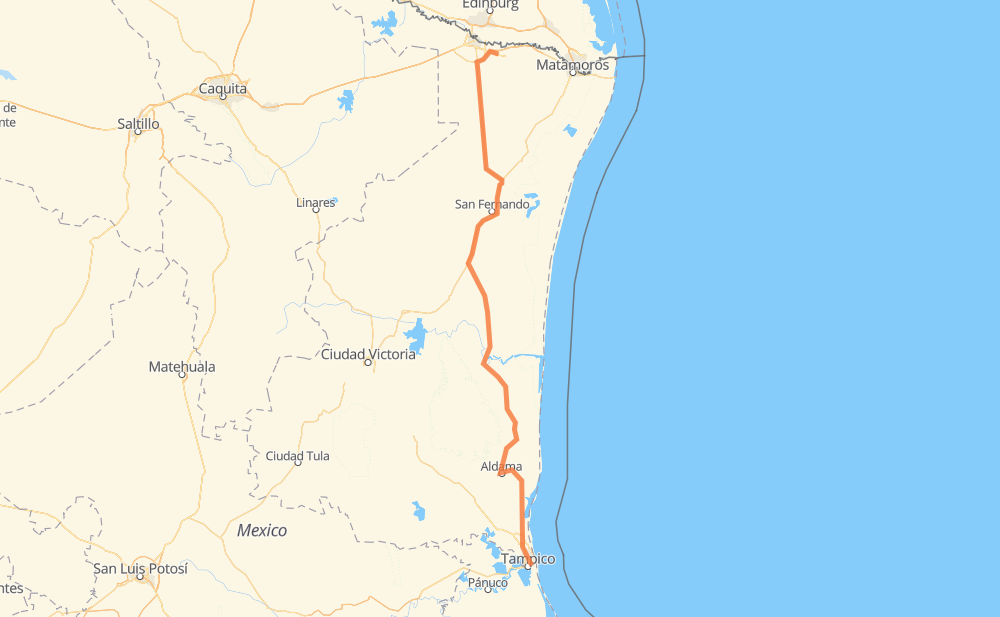
Distance between Río Bravo and Hidalgo
The distance from Río Bravo to Hidalgo is 318 miles by road including 1 mile on motorways. Road takes approximately 6 hours and 4 minutes and goes through Aldama, Ciudad Madero, General Francisco Villa, Altamira and Anáhuac.
| Shortest distance by air | 260 mi ✈️ |
| Car route length | 317.5 mi 🚗 |
| Driving time | 6 h 4 min |
| Fuel amount | 10.8 gal |
| Fuel cost | 42.2 USD |
| Toll roads cost | 61 MXN |
| Point | Distance | Time | Fuel | |
| Río Bravo | 0 mi | 00 min | 0.0 gal | |
|
MEX 2 MEX 97 83 mi, 1 h 39 min
|
||||
| General Francisco Villa | 83 mi | 1 h 39 min | 2.7 gal | |
|
MEX 101 MEX 180 94 mi, 1 h 40 min
|
||||
| Soto la Marina | 177 mi | 3 h 20 min | 6.0 gal | |
|
MEX 180 72 mi, 1 h 17 min
|
||||
| Aldama | 249 mi | 4 h 38 min | 8.2 gal | |
|
MEX 180 TAM 113 57 mi, 1 h 05 min
|
||||
| Altamira | 306 mi | 5 h 44 min | 10.2 gal | |
|
MEX 80 MEX 180 11 mi, 12 min
|
||||
| Ciudad Madero | 317 mi | 5 h 56 min | 10.7 gal | |
|
MEX 180 2 mi, 04 min
|
||||
| Ampliación Ejido Primero de Mayo | 319 mi | 6 h 00 min | 10.9 gal | |
|
MEX 180 2 mi, 02 min
|
||||
| Primero de Mayo (Los Mangos) | 322 mi | 6 h 03 min | 10.9 gal | |
|
20 de Noviembre 1 mi, 01 min
|
||||
| Ciudad Madero | 322 mi | 6 h 04 min | 11.0 gal | |
Frequently Asked Questions
How many toll booths are there from Río Bravo to Hidalgo?
There are 2 toll booths between Río Bravo and Hidalgo: San Fernando and Tampico.
How much does the toll booths cost from Río Bravo to Hidalgo?
Toll roads cost: San Fernando (26 MXN) + Tampico (35 MXN) = 61 MXN
How much does it cost to drive from Río Bravo to Hidalgo?
Fuel cost: 42.2 USD
This fuel cost is calculated as: (Route length 317.5 mi) / (Fuel consumption 29.4 mpg) * (Fuel price 3.9 USD / gal)
You can adjust fuel consumption and fuel price here.
Toll roads cost: 61 MXN
How long is a car ride from Río Bravo to Hidalgo?
Driving time: 6 h 4 min
This time is calculated for driving at the maximum permitted speed, taking into account traffic rules restrictions.
- 53 mi with a maximum speed 56 mph = 56 min
- 151 mi with a maximum speed 56 mph = 2 h 41 min
- 113 mi with a maximum speed 50 mph = 2 h 16 min
- 3 mi with a maximum speed 37 mph = 5 min
- 1 mi with a maximum speed 25 mph = 2 min
The calculated driving time does not take into account intermediate stops and traffic jams.
How far is Río Bravo to Hidalgo by land?
The distance between Río Bravo and Hidalgo is 317.5 mi by road including 0.6 mi on motorways.
Precise satellite coordinates of highways were used for this calculation. The start and finish points are the centers of Río Bravo and Hidalgo respectively.
How far is Río Bravo to Hidalgo by plane?
The shortest distance (air line, as the crow flies) between Río Bravo and Hidalgo is 259.7 mi.
This distance is calculated using the Haversine formula as a great-circle distance between two points on the surface of a sphere. The start and finish points are the centers of Río Bravo and Hidalgo respectively. Actual distance between airports may be different.
How many hours is Río Bravo from Hidalgo by plane?
Boeing 737 airliner needs 31 min to cover the distance of 260 mi at a cruising speed of 497 mph.
Small plane "Cessna 172" needs 1 h 54 min to flight this distance at average speed of 136 mph.
This time is approximate and do not take into account takeoff and landing times, airport location and other real world factors.
How long is a helicopter ride from Río Bravo to Hidalgo?
Fast helicopter "Eurocopter AS350" or "Hughes OH-6 Cayuse" need 1 h 44 min to cover the distance of 260 mi at a cruising speed of 149 mph.
Popular "Robinson R44" needs 1 h 59 min to flight this distance at average speed of 130 mph.
This time is approximate and do not take into account takeoff and landing times, aerodrome location and other real world factors.
What city is halfway between Río Bravo and Hidalgo?
The halfway point between Río Bravo and Hidalgo is Soto la Marina. It is located about 18 mi from the exact midpoint by road.
The distance from Soto la Marina to Río Bravo is 177 mi and driving will take about 3 h 20 min. The road between Soto la Marina and Hidalgo has length 140 mi and will take approximately 2 h 43 min.
Where is Río Bravo in relation to Hidalgo?
Río Bravo is located 260 mi north of Hidalgo.
Río Bravo has geographic coordinates: latitude 25.987, longitude -98.09761.
Hidalgo has geographic coordinates: latitude 22.23389, longitude -97.83028.
Which highway goes from Río Bravo to Hidalgo?
The route from Río Bravo to Hidalgo follows MEX 180, MEX 97.
Other minor sections pass along the road:
- MEX 101: 49 mi
- TAM 113: 36 mi
- MEX 80: 11 mi
- MEX 40D: 9 mi
- MEX 2: 4 mi