Distance between Roberts Creek BC and Magog QC
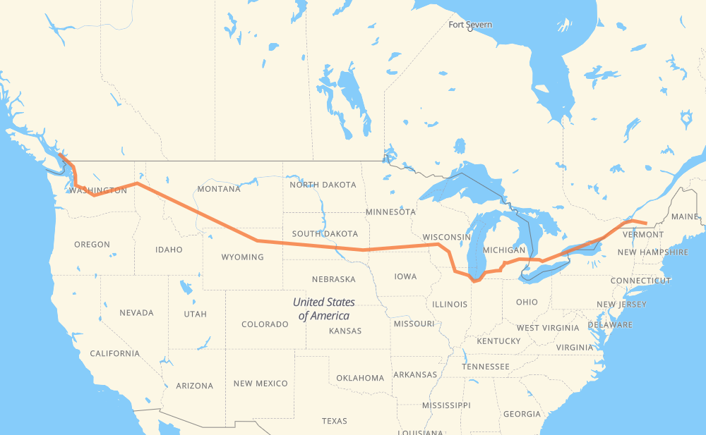
The distance from Roberts Creek to Magog is 3,191 miles by road including 3,153 miles on motorways. Road takes approximately 49 hours and 51 minutes and goes through West Vancouver, District of North Vancouver, Vancouver, Burnaby, New Westminster, Bellingham and Everett.
| Shortest distance by air | 2,381 mi ✈️ |
| Car route length | 3,190.7 mi 🚗 |
| Driving time | 49 h 51 min |
| Fuel amount | 108.5 gal |
| Fuel cost | 418.9 USD |
| Point | Distance | Time | Fuel | |
| Roberts Creek | 0 mi | 00 min | 0.0 gal | |
|
101 20 mi, 46 min
|
||||
| West Vancouver | 20 mi | 46 min | 0.3 gal | |
|
3 13 mi, 36 min
|
||||
| District of North Vancouver | 33 mi | 1 h 23 min | 1.0 gal | |
|
1 4 mi, 05 min
|
||||
| Vancouver | 37 mi | 1 h 28 min | 1.2 gal | |
|
1 4 mi, 05 min
|
||||
| Burnaby | 42 mi | 1 h 34 min | 1.3 gal | |
|
1 4 mi, 06 min
|
||||
| New Westminster | 46 mi | 1 h 40 min | 1.5 gal | |
|
91A I 5 45 mi, 45 min
|
||||
| Bellingham | 91 mi | 2 h 26 min | 2.9 gal | |
|
I 5 58 mi, 54 min
|
||||
| Everett | 149 mi | 3 h 20 min | 4.9 gal | |
|
I 5 I 405 28 mi, 28 min
|
||||
| Bellevue | 177 mi | 3 h 48 min | 5.8 gal | |
|
I 405 I 90 158 mi, 2 h 21 min
|
||||
| Moses Lake | 335 mi | 6 h 10 min | 10.9 gal | |
|
I 90 113 mi, 1 h 40 min
|
||||
| Spokane | 448 mi | 7 h 50 min | 15.1 gal | |
|
I 90 32 mi, 29 min
|
||||
| Coeur d'Alene | 480 mi | 8 h 20 min | 16.2 gal | |
|
I 90 165 mi, 2 h 27 min
|
||||
| Missoula | 644 mi | 10 h 47 min | 21.9 gal | |
|
I 90 114 mi, 1 h 40 min
|
||||
| Butte | 759 mi | 12 h 28 min | 25.3 gal | |
|
I 90 226 mi, 3 h 24 min
|
||||
| Billings | 985 mi | 15 h 53 min | 33.3 gal | |
|
I 90 134 mi, 2 h 16 min
|
||||
| Sheridan | 1,119 mi | 18 h 09 min | 37.8 gal | |
|
I 90 99 mi, 1 h 27 min
|
||||
| Gillette | 1,219 mi | 19 h 37 min | 41.3 gal | |
|
I 90 97 mi, 1 h 29 min
|
||||
| Spearfish | 1,315 mi | 21 h 07 min | 44.5 gal | |
|
I 90 42 mi, 37 min
|
||||
| Rapid City | 1,358 mi | 21 h 44 min | 46.1 gal | |
|
I 90 11 mi, 10 min
|
||||
| Box Elder | 1,369 mi | 21 h 54 min | 46.4 gal | |
|
I 90 255 mi, 3 h 45 min
|
||||
| Mitchell | 1,624 mi | 25 h 40 min | 55.0 gal | |
|
I 90 72 mi, 1 h 03 min
|
||||
| Sioux Falls | 1,697 mi | 26 h 44 min | 57.6 gal | |
|
I 90 7 mi, 06 min
|
||||
| Brandon | 1,704 mi | 26 h 50 min | 57.9 gal | |
|
I 90 420 mi, 6 h 13 min
|
||||
| Madison | 2,124 mi | 33 h 04 min | 72.0 gal | |
|
I 39 35 mi, 30 min
|
||||
| Janesville | 2,159 mi | 33 h 34 min | 73.3 gal | |
|
I 39 I 90 107 mi, 1 h 39 min
|
||||
| Chicago | 2,266 mi | 35 h 14 min | 76.6 gal | |
|
I 90 I 94 144 mi, 2 h 12 min
|
||||
| Kalamazoo | 2,410 mi | 37 h 27 min | 81.9 gal | |
|
I 94 I 69 65 mi, 56 min
|
||||
| Lansing | 2,474 mi | 38 h 24 min | 84.1 gal | |
|
I 69 62 mi, 54 min
|
||||
| Flint | 2,536 mi | 39 h 18 min | 86.2 gal | |
|
I 69 76 mi, 1 h 14 min
|
||||
| Sarnia | 2,612 mi | 40 h 33 min | 88.7 gal | |
|
402 87 mi, 1 h 19 min
|
||||
| Woodstock | 2,699 mi | 41 h 53 min | 91.7 gal | |
|
401 26 mi, 25 min
|
||||
| Kitchener | 2,725 mi | 42 h 18 min | 92.6 gal | |
|
401 41 mi, 39 min
|
||||
| Mississauga | 2,766 mi | 42 h 58 min | 93.9 gal | |
|
401 19 mi, 18 min
|
||||
| Toronto | 2,786 mi | 43 h 16 min | 94.3 gal | |
|
401 20 mi, 19 min
|
||||
| Ajax | 2,805 mi | 43 h 35 min | 95.4 gal | |
|
401 9 mi, 08 min
|
||||
| Oshawa | 2,814 mi | 43 h 44 min | 95.6 gal | |
|
401 80 mi, 1 h 16 min
|
||||
| Belleville | 2,893 mi | 45 h 00 min | 98.3 gal | |
|
401 47 mi, 45 min
|
||||
| Kingston | 2,940 mi | 45 h 45 min | 99.6 gal | |
|
401 49 mi, 47 min
|
||||
| Brockville | 2,989 mi | 46 h 32 min | 101.5 gal | |
|
401 57 mi, 55 min
|
||||
| Cornwall | 3,046 mi | 47 h 28 min | 103.5 gal | |
|
401 10 145 mi, 2 h 22 min
|
||||
| Magog | 3,191 mi | 49 h 50 min | 108.5 gal | |
Hotels of Magog
Frequently Asked Questions
How much does it cost to drive from Roberts Creek to Magog?
Fuel cost: 418.9 USD
This fuel cost is calculated as: (Route length 3,190.7 mi) / (Fuel consumption 29.4 mpg) * (Fuel price 3.86 USD / gal)
You can adjust fuel consumption and fuel price here.
How long is a car ride from Roberts Creek to Magog?
Driving time: 49 h 51 min
This time is calculated for driving at the maximum permitted speed, taking into account traffic rules restrictions.
- 2,103 mi with a maximum speed 68 mph = 30 h 55 min
- 99 mi with a maximum speed 65 mph = 1 h 31 min
- 715 mi with a maximum speed 62 mph = 11 h 30 min
- 113 mi with a maximum speed 60 mph = 1 h 53 min
- 5 mi with a maximum speed 56 mph = 5 min
- 18 mi with a maximum speed 56 mph = 19 min
- 18 mi with a maximum speed 55 mph = 19 min
- 81 mi with a maximum speed 50 mph = 1 h 38 min
- 8 mi with a maximum speed 45 mph = 10 min
- 6 mi with a maximum speed 43 mph = 7 min
- 1 mi with a maximum speed 40 mph = 1 min
- 3 mi with a maximum speed 37 mph = 4 min
- 1 mi with a maximum speed 35 mph = 1 min
- 6 mi with a maximum speed 31 mph = 10 min
- 1 mi with a maximum speed 30 mph = 1 min
- 1 mi with a maximum speed 25 mph = 2 min
- 12 mi with a maximum speed 12 mph = 55 min
The calculated driving time does not take into account intermediate stops and traffic jams.
How far is Roberts Creek to Magog by land?
The distance between Roberts Creek and Magog is 3,190.7 mi by road including 3,153.5 mi on motorways.
Precise satellite coordinates of highways were used for this calculation. The start and finish points are the centers of Roberts Creek and Magog respectively.
How far is Roberts Creek to Magog by plane?
The shortest distance (air line, as the crow flies) between Roberts Creek and Magog is 2,381.1 mi.
This distance is calculated using the Haversine formula as a great-circle distance between two points on the surface of a sphere. The start and finish points are the centers of Roberts Creek and Magog respectively. Actual distance between airports may be different.
How many hours is Roberts Creek from Magog by plane?
Boeing 737 airliner needs 4 h 47 min to cover the distance of 2,381 mi at a cruising speed of 497 mph.
Small plane "Cessna 172" needs 17 h 25 min to flight this distance at average speed of 136 mph.
This time is approximate and do not take into account takeoff and landing times, airport location and other real world factors.
How long is a helicopter ride from Roberts Creek to Magog?
Fast helicopter "Eurocopter AS350" or "Hughes OH-6 Cayuse" need 15 h 58 min to cover the distance of 2,381 mi at a cruising speed of 149 mph.
Popular "Robinson R44" needs 18 h 14 min to flight this distance at average speed of 130 mph.
This time is approximate and do not take into account takeoff and landing times, aerodrome location and other real world factors.
What city is halfway between Roberts Creek and Magog?
The halfway point between Roberts Creek and Magog is Kimball. It is located about 14 mi from the exact midpoint by road.
The distance from Kimball to Roberts Creek is 1,582 mi and driving will take about 25 h. The road between Kimball and Magog has length 1,609 mi and will take approximately 24 h 50 min.
The other cities located close to halfway point:
Where is Roberts Creek in relation to Magog?
Roberts Creek is located 2,381 mi west of Magog.
Roberts Creek has geographic coordinates: latitude 49.42126, longitude -123.64194.
Magog has geographic coordinates: latitude 45.26546, longitude -72.14791.
Which highway goes from Roberts Creek to Magog?
The route from Roberts Creek to Magog follows I 90, 401, I 94, US 14, I 69, US 87, I 39, I 5, US 212, US 12, 402, 10.
Other minor sections pass along the road:
- US 395: 60 mi
- US 191: 57 mi
- 30: 35 mi
- SD 79: 31 mi
- US 16: 25 mi
- US 51: 20 mi
- US 83: 19 mi
- 1: 18 mi
- I 405: 18 mi
- 99: 16 mi
- MT 200: 13 mi
- 20: 11 mi
- 3: 11 mi
- I 15: 7 mi
- US 85: 7 mi
- US 89: 7 mi
- SD 63: 7 mi
- 91: 6 mi
- SD 73: 6 mi
- SD 50: 6 mi
- 338: 6 mi
- SD 34: 6 mi
- 101: 5 mi
- US 93: 5 mi
- SD 45: 4 mi
- US 61: 4 mi
- I 96: 4 mi
- US 97: 4 mi
- US 16 Truck: 4 mi
- 112: 3 mi
- US 31: 3 mi
- US 2: 2 mi
- 91A: 2 mi
- MN 43: 2 mi
- US 218: 2 mi
- WI 11: 2 mi
- 201: 1 mi
- SD 37: 1 mi
- US 53: 1 mi
- 99A: 1 mi
- 1A: 1 mi