Distance between Roque Saenz Peña and Antofagasta
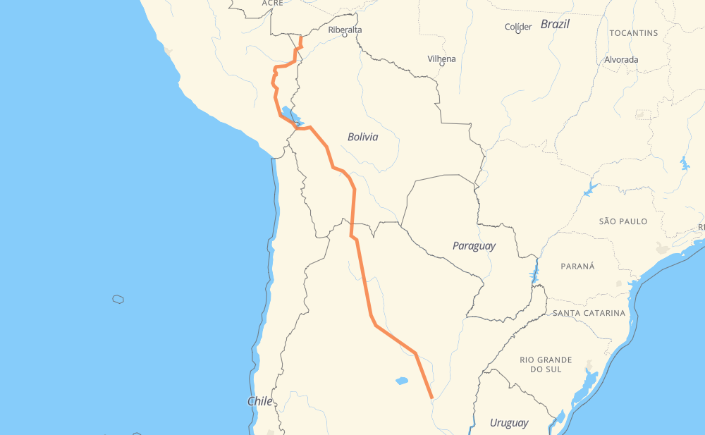
The distance from Roque Saenz Peña to Antofagasta is 2,065 miles by road including 37 miles on motorways. Road takes approximately 42 hours and 13 minutes and goes through San Salvador de Jujuy, Villazón, Tupiza, Potosí, Oruro, El Alto and Puno.
| Shortest distance by air | 1,511 mi ✈️ |
| Car route length | 2,064.8 mi 🚗 |
| Driving time | 42 h 13 min |
| Fuel amount | 70.2 gal |
| Fuel cost | 276 USD |
| Point | Distance | Time | Fuel | |
| Roque Saenz Peña | 0 mi | 00 min | 0.0 gal | |
|
RN34 677 mi, 12 h 41 min
|
||||
| San Salvador de Jujuy | 677 mi | 12 h 41 min | 23.0 gal | |
|
RN9 176 mi, 3 h 19 min
|
||||
| Villazón | 854 mi | 16 h 00 min | 29.0 gal | |
|
F14 57 mi, 1 h 07 min
|
||||
| Tupiza | 912 mi | 17 h 08 min | 30.8 gal | |
|
F14 155 mi, 3 h 00 min
|
||||
| Potosí | 1,066 mi | 20 h 08 min | 36.1 gal | |
|
F1 194 mi, 3 h 51 min
|
||||
| Oruro | 1,261 mi | 24 h 00 min | 42.8 gal | |
|
F1 137 mi, 2 h 41 min
|
||||
| El Alto | 1,397 mi | 26 h 42 min | 47.5 gal | |
|
PE-3S 155 mi, 3 h 12 min
|
||||
| Puno | 1,553 mi | 29 h 54 min | 52.6 gal | |
|
PE-3S 19 mi, 28 min
|
||||
| Juliaca | 1,572 mi | 30 h 23 min | 53.2 gal | |
|
PE-3S PE-34B 356 mi, 8 h 35 min
|
||||
| Puerto Maldonado | 1,928 mi | 38 h 58 min | 65.5 gal | |
|
PE-30C 137 mi, 3 h 14 min
|
||||
| Antofagasta | 2,065 mi | 42 h 12 min | 70.2 gal | |
Frequently Asked Questions
How much does it cost to drive from Roque Saenz Peña to Antofagasta?
Fuel cost: 276 USD
This fuel cost is calculated as: (Route length 2,064.8 mi) / (Fuel consumption 29.4 mpg) * (Fuel price 3.93 USD / gal)
You can adjust fuel consumption and fuel price here.
How long is a car ride from Roque Saenz Peña to Antofagasta?
Driving time: 42 h 13 min
This time is calculated for driving at the maximum permitted speed, taking into account traffic rules restrictions.
- 11 mi with a maximum speed 68 mph = 9 min
- 18 mi with a maximum speed 62 mph = 17 min
- 812 mi with a maximum speed 56 mph = 14 h 30 min
- 21 mi with a maximum speed 56 mph = 22 min
- 1,025 mi with a maximum speed 50 mph = 20 h 37 min
- 7 mi with a maximum speed 43 mph = 10 min
- 94 mi with a maximum speed 37 mph = 2 h 31 min
- 4 mi with a maximum speed 34 mph = 7 min
- 17 mi with a maximum speed 31 mph = 31 min
- 1 mi with a maximum speed 28 mph = 1 min
- 6 mi with a maximum speed 25 mph = 14 min
- 1 mi with a maximum speed 22 mph = 3 min
- 48 mi with a maximum speed 19 mph = 2 h 34 min
- 1 mi with a maximum speed 9 mph = 2 min
The calculated driving time does not take into account intermediate stops and traffic jams.
How far is Roque Saenz Peña to Antofagasta by land?
The distance between Roque Saenz Peña and Antofagasta is 2,064.8 mi by road including 37.3 mi on motorways.
Precise satellite coordinates of highways were used for this calculation. The start and finish points are the centers of Roque Saenz Peña and Antofagasta respectively.
How far is Roque Saenz Peña to Antofagasta by plane?
The shortest distance (air line, as the crow flies) between Roque Saenz Peña and Antofagasta is 1,511.2 mi.
This distance is calculated using the Haversine formula as a great-circle distance between two points on the surface of a sphere. The start and finish points are the centers of Roque Saenz Peña and Antofagasta respectively. Actual distance between airports may be different.
How many hours is Roque Saenz Peña from Antofagasta by plane?
Boeing 737 airliner needs 3 h 2 min to cover the distance of 1,511 mi at a cruising speed of 497 mph.
Small plane "Cessna 172" needs 11 h 3 min to flight this distance at average speed of 136 mph.
This time is approximate and do not take into account takeoff and landing times, airport location and other real world factors.
How long is a helicopter ride from Roque Saenz Peña to Antofagasta?
Fast helicopter "Eurocopter AS350" or "Hughes OH-6 Cayuse" need 10 h 8 min to cover the distance of 1,511 mi at a cruising speed of 149 mph.
Popular "Robinson R44" needs 11 h 34 min to flight this distance at average speed of 130 mph.
This time is approximate and do not take into account takeoff and landing times, aerodrome location and other real world factors.
What city is halfway between Roque Saenz Peña and Antofagasta?
The halfway point between Roque Saenz Peña and Antofagasta is Cuchu Ingenio. It is located about 10 mi from the exact midpoint by road.
The distance from Cuchu Ingenio to Roque Saenz Peña is 1,042 mi and driving will take about 19 h 38 min. The road between Cuchu Ingenio and Antofagasta has length 1,023 mi and will take approximately 22 h 34 min.
The other cities located close to halfway point:
Where is Roque Saenz Peña in relation to Antofagasta?
Roque Saenz Peña is located 1,511 mi south-east of Antofagasta.
Roque Saenz Peña has geographic coordinates: latitude -31.65033, longitude -60.72617.
Antofagasta has geographic coordinates: latitude -11.09186, longitude -68.7727.
Which highway goes from Roque Saenz Peña to Antofagasta?
The route from Roque Saenz Peña to Antofagasta follows F1, RN34, RN9, PE-34B, F14, PE-30C, PE-3S, RP2.
Other minor sections pass along the road:
- RP4: 52 mi
- RP21: 45 mi
- RN11: 42 mi
- F16: 37 mi
- RN98: 28 mi
- RNA007: 16 mi
- RN66: 16 mi
- RP62: 12 mi
- RP92: 11 mi
- F13: 11 mi
- RN1V66: 7 mi