Distance between Sabinas and San Francisco el Grande
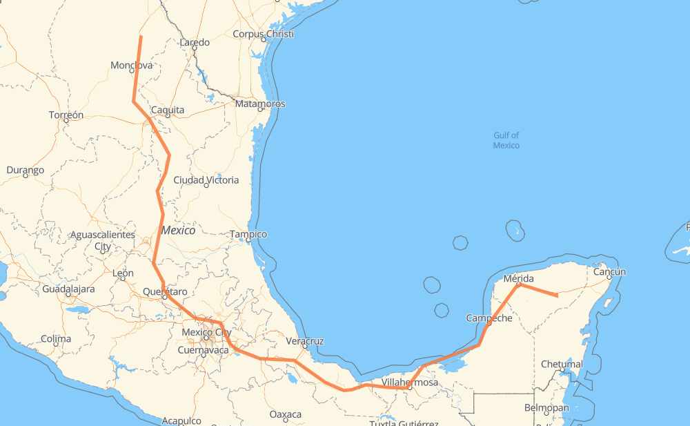
The distance from Sabinas to San Francisco el Grande is 1,592 miles by road including 994 miles on motorways. Road takes approximately 28 hours and 2 minutes and goes through Monclova, San Juan del Rio, Orizaba, Mérida and Kanasín.
| Shortest distance by air | 937 mi ✈️ |
| Car route length | 1,592 mi 🚗 |
| Driving time | 28 h 2 min |
| Fuel amount | 54.1 gal |
| Fuel cost | 211.1 USD |
| Toll roads cost | 1,279 + ? MXN |
| Point | Distance | Time | Fuel | |
| Sabinas | 0 mi | 00 min | 0.0 gal | |
|
MEX 57 71 mi, 1 h 20 min
|
||||
| Monclova | 71 mi | 1 h 20 min | 2.3 gal | |
|
MEX 57 7 mi, 09 min
|
||||
| Castaños | 79 mi | 1 h 30 min | 2.6 gal | |
|
MEX 57 110 mi, 1 h 59 min
|
||||
| Arteaga | 189 mi | 3 h 29 min | 6.4 gal | |
|
MEX 57D 40 mi, 38 min
|
||||
| San Rafael | 229 mi | 4 h 07 min | 7.7 gal | |
|
MEX 57 374 mi, 6 h 20 min
|
||||
| San Juan del Rio | 604 mi | 10 h 28 min | 20.4 gal | |
|
MEX 57 MEX M40D 258 mi, 4 h 29 min
|
||||
| Orizaba | 862 mi | 14 h 58 min | 29.2 gal | |
|
MEX 150D MEX 180 642 mi, 11 h 26 min
|
||||
| Mérida | 1,504 mi | 26 h 24 min | 51.1 gal | |
|
15 mi, 17 min
|
||||
| Kanasín | 1,519 mi | 26 h 42 min | 51.3 gal | |
|
MEX 180 MEX 180D 75 mi, 1 h 20 min
|
||||
| San Francisco el Grande | 1,594 mi | 28 h 02 min | 54.1 gal | |
Frequently Asked Questions
How many toll booths are there from Sabinas to San Francisco el Grande?
There are 23 toll booths between Sabinas and San Francisco el Grande: La Carbonera, Los Chorros, Matehuala Omega, Fortín, Cuitláhuac, Cosamaloapan, Acayucan, Antonio Dovali, Libramiento Oriente De SLP, Chichimequillas, Queretaro, Palmillas, San Martin Texmelucan, San Martín, Viaducto Elevado de Puebla, Amozoc, Esperanza 27, Sánchez Magallanes, Villahermosa Nacajuca, Zacatal, Unidad, Seybaplaya and Pisté.
How much does the toll booths cost from Sabinas to San Francisco el Grande?
Toll roads cost: La Carbonera (42 MXN) + Los Chorros (66 MXN) + Matehuala Omega (?) + Libramiento Oriente De SLP (70 MXN) + Chichimequillas (51 MXN) + Palmillas (89 MXN) + Queretaro (?) + San Martin Texmelucan (?) + San Martín (42 MXN) + Viaducto Elevado de Puebla (?) + Amozoc (72 MXN) + Esperanza 27 (140 MXN) + Fortín (33 MXN) + Cuitláhuac (114 MXN) + Cosamaloapan (229 MXN) + Acayucan (?) + Antonio Dovali (20 MXN) + Sánchez Magallanes (82 MXN) + Villahermosa Nacajuca (62 MXN) + Zacatal (90 MXN) + Unidad (?) + Seybaplaya (77 MXN) + Pisté (?) = 1,279 + ? MXN
How much does it cost to drive from Sabinas to San Francisco el Grande?
Fuel cost: 211.1 USD
This fuel cost is calculated as: (Route length 1,592 mi) / (Fuel consumption 29.4 mpg) * (Fuel price 3.9 USD / gal)
You can adjust fuel consumption and fuel price here.
Toll roads cost: 1,279 + ? MXN
How long is a car ride from Sabinas to San Francisco el Grande?
Driving time: 28 h 2 min
This time is calculated for driving at the maximum permitted speed, taking into account traffic rules restrictions.
- 171 mi with a maximum speed 68 mph = 2 h 31 min
- 541 mi with a maximum speed 62 mph = 8 h 42 min
- 190 mi with a maximum speed 56 mph = 3 h 23 min
- 264 mi with a maximum speed 56 mph = 4 h 43 min
- 416 mi with a maximum speed 50 mph = 8 h 21 min
- 4 mi with a maximum speed 43 mph = 4 min
- 2 mi with a maximum speed 37 mph = 2 min
- 6 mi with a maximum speed 31 mph = 10 min
- 1 mi with a maximum speed 25 mph = 2 min
The calculated driving time does not take into account intermediate stops and traffic jams.
How far is Sabinas to San Francisco el Grande by land?
The distance between Sabinas and San Francisco el Grande is 1,592 mi by road including 993.6 mi on motorways.
Precise satellite coordinates of highways were used for this calculation. The start and finish points are the centers of Sabinas and San Francisco el Grande respectively.
How far is Sabinas to San Francisco el Grande by plane?
The shortest distance (air line, as the crow flies) between Sabinas and San Francisco el Grande is 937 mi.
This distance is calculated using the Haversine formula as a great-circle distance between two points on the surface of a sphere. The start and finish points are the centers of Sabinas and San Francisco el Grande respectively. Actual distance between airports may be different.
How many hours is Sabinas from San Francisco el Grande by plane?
Boeing 737 airliner needs 1 h 53 min to cover the distance of 937 mi at a cruising speed of 497 mph.
Small plane "Cessna 172" needs 6 h 51 min to flight this distance at average speed of 136 mph.
This time is approximate and do not take into account takeoff and landing times, airport location and other real world factors.
How long is a helicopter ride from Sabinas to San Francisco el Grande?
Fast helicopter "Eurocopter AS350" or "Hughes OH-6 Cayuse" need 6 h 17 min to cover the distance of 937 mi at a cruising speed of 149 mph.
Popular "Robinson R44" needs 7 h 10 min to flight this distance at average speed of 130 mph.
This time is approximate and do not take into account takeoff and landing times, aerodrome location and other real world factors.
What city is halfway between Sabinas and San Francisco el Grande?
The halfway point between Sabinas and San Francisco el Grande is San Bartolomé Hueyapan. It is located about 2 mi from the exact midpoint by road.
The distance from San Bartolomé Hueyapan to Sabinas is 798 mi and driving will take about 13 h 45 min. The road between San Bartolomé Hueyapan and San Francisco el Grande has length 794 mi and will take approximately 14 h 17 min.
The other cities located close to halfway point:
Where is Sabinas in relation to San Francisco el Grande?
Sabinas is located 937 mi north-west of San Francisco el Grande.
Sabinas has geographic coordinates: latitude 27.85319, longitude -101.12679.
San Francisco el Grande has geographic coordinates: latitude 20.7001, longitude -88.4729.
Which highway goes from Sabinas to San Francisco el Grande?
The route from Sabinas to San Francisco el Grande follows MEX 57, MEX 180, MEX 150D, MEX 145D, MEX 57D, MEX 180D, MEX M40D.
Other minor sections pass along the road:
- MEX 80: 51 mi
- MEX 45: 25 mi
- MEX 120: 7 mi