Distance between Sacramento CA and Chihuahua
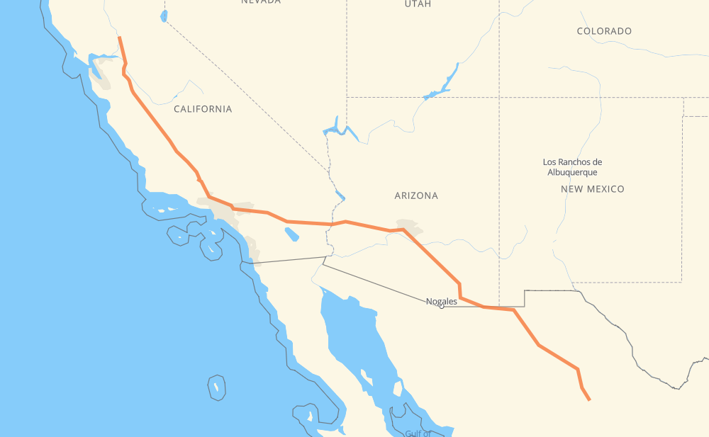
The distance from Sacramento to Chihuahua is 1,310 miles by road including 908 miles on motorways. Road takes approximately 21 hours and 16 minutes and goes through Stockton, Santa Clarita, Los Angeles, Glendale, La Cañada Flintridge, Pasadena and Arcadia.
| Shortest distance by air | 1,118 mi ✈️ |
| Car route length | 1,309.9 mi 🚗 |
| Driving time | 21 h 16 min |
| Fuel amount | 44.5 gal |
| Fuel cost | 173.7 USD |
| Toll roads cost | 282 MXN |
| Point | Distance | Time | Fuel | |
| Sacramento | 0 mi | 00 min | 0.0 gal | |
|
I 5 45 mi, 41 min
|
||||
| Stockton | 45 mi | 41 min | 1.3 gal | |
|
I 5 306 mi, 4 h 32 min
|
||||
| Santa Clarita | 352 mi | 5 h 13 min | 11.8 gal | |
|
I 5 15 mi, 13 min
|
||||
| Los Angeles | 367 mi | 5 h 27 min | 12.2 gal | |
|
I 210 10 mi, 08 min
|
||||
| Glendale | 377 mi | 5 h 36 min | 12.8 gal | |
|
I 210 4 mi, 03 min
|
||||
| La Cañada Flintridge | 380 mi | 5 h 39 min | 12.9 gal | |
|
I 210 6 mi, 05 min
|
||||
| Pasadena | 385 mi | 5 h 44 min | 13.0 gal | |
|
I 210 6 mi, 05 min
|
||||
| Arcadia | 391 mi | 5 h 50 min | 13.3 gal | |
|
I 210 2 mi, 02 min
|
||||
| Monrovia | 393 mi | 5 h 52 min | 13.4 gal | |
|
I 210 6 mi, 05 min
|
||||
| Azusa | 399 mi | 5 h 57 min | 13.5 gal | |
|
I 210 CA 57 12 mi, 11 min
|
||||
| Pomona | 411 mi | 6 h 09 min | 13.9 gal | |
|
CA 71 5 mi, 05 min
|
||||
| Chino | 416 mi | 6 h 14 min | 14.1 gal | |
|
CA 60 5 mi, 05 min
|
||||
| Ontario | 421 mi | 6 h 20 min | 14.2 gal | |
|
CA 60 17 mi, 17 min
|
||||
| Riverside | 438 mi | 6 h 38 min | 14.8 gal | |
|
CA 60 11 mi, 12 min
|
||||
| Moreno Valley | 449 mi | 6 h 51 min | 15.0 gal | |
|
CA 60 I 10 32 mi, 30 min
|
||||
| Palm Springs | 482 mi | 7 h 22 min | 16.2 gal | |
|
I 10 22 mi, 19 min
|
||||
| Indio | 504 mi | 7 h 41 min | 16.9 gal | |
|
I 10 238 mi, 3 h 30 min
|
||||
| Tolleson | 742 mi | 11 h 12 min | 25.2 gal | |
|
I 10 14 mi, 13 min
|
||||
| Phoenix | 756 mi | 11 h 25 min | 25.3 gal | |
|
AZ 202 Loop I 10 116 mi, 1 h 46 min
|
||||
| Tucson | 872 mi | 13 h 12 min | 29.2 gal | |
|
I 10 AZ 90 119 mi, 2 h 08 min
|
||||
| Agua Prieta | 991 mi | 15 h 21 min | 33.7 gal | |
|
MEX 2 137 mi, 2 h 35 min
|
||||
| Nuevo Casas Grandes | 1,128 mi | 17 h 56 min | 38.3 gal | |
|
MEX 10 MEX 45 181 mi, 3 h 19 min
|
||||
| Chihuahua | 1,310 mi | 21 h 16 min | 44.4 gal | |
Hotels of Chihuahua
Frequently Asked Questions
How many toll booths are there from Sacramento to Chihuahua?
There are 3 toll booths between Sacramento and Chihuahua: Galeana, Ojo Laguna and Sacramento.
How much does the toll booths cost from Sacramento to Chihuahua?
Toll roads cost: Galeana (115 MXN) + Ojo Laguna (96 MXN) + Sacramento (71 MXN) = 282 MXN
How much does it cost to drive from Sacramento to Chihuahua?
Fuel cost: 173.7 USD
This fuel cost is calculated as: (Route length 1,309.9 mi) / (Fuel consumption 29.4 mpg) * (Fuel price 3.9 USD / gal)
You can adjust fuel consumption and fuel price here.
Toll roads cost: 282 MXN
How long is a car ride from Sacramento to Chihuahua?
Driving time: 21 h 16 min
This time is calculated for driving at the maximum permitted speed, taking into account traffic rules restrictions.
- 642 mi with a maximum speed 68 mph = 9 h 26 min
- 193 mi with a maximum speed 65 mph = 2 h 57 min
- 17 mi with a maximum speed 62 mph = 17 min
- 160 mi with a maximum speed 56 mph = 2 h 51 min
- 154 mi with a maximum speed 56 mph = 2 h 45 min
- 18 mi with a maximum speed 55 mph = 19 min
- 113 mi with a maximum speed 50 mph = 2 h 16 min
- 4 mi with a maximum speed 45 mph = 4 min
- 1 mi with a maximum speed 43 mph = 2 min
- 2 mi with a maximum speed 37 mph = 4 min
- 2 mi with a maximum speed 31 mph = 4 min
- 1 mi with a maximum speed 30 mph = 2 min
The calculated driving time does not take into account intermediate stops and traffic jams.
How far is Sacramento to Chihuahua by land?
The distance between Sacramento and Chihuahua is 1,309.9 mi by road including 908.4 mi on motorways.
Precise satellite coordinates of highways were used for this calculation. The start and finish points are the centers of Sacramento and Chihuahua respectively.
How far is Sacramento to Chihuahua by plane?
The shortest distance (air line, as the crow flies) between Sacramento and Chihuahua is 1,118.5 mi.
This distance is calculated using the Haversine formula as a great-circle distance between two points on the surface of a sphere. The start and finish points are the centers of Sacramento and Chihuahua respectively. Actual distance between airports may be different.
How many hours is Sacramento from Chihuahua by plane?
Boeing 737 airliner needs 2 h 15 min to cover the distance of 1,118 mi at a cruising speed of 497 mph.
Small plane "Cessna 172" needs 8 h 10 min to flight this distance at average speed of 136 mph.
This time is approximate and do not take into account takeoff and landing times, airport location and other real world factors.
How long is a helicopter ride from Sacramento to Chihuahua?
Fast helicopter "Eurocopter AS350" or "Hughes OH-6 Cayuse" need 7 h 30 min to cover the distance of 1,118 mi at a cruising speed of 149 mph.
Popular "Robinson R44" needs 8 h 34 min to flight this distance at average speed of 130 mph.
This time is approximate and do not take into account takeoff and landing times, aerodrome location and other real world factors.
What city is halfway between Sacramento and Chihuahua?
The halfway point between Sacramento and Chihuahua is New Hope. It is located about 2 mi from the exact midpoint by road.
The distance from New Hope to Sacramento is 653 mi and driving will take about 9 h 53 min. The road between New Hope and Chihuahua has length 657 mi and will take approximately 11 h 23 min.
The other cities located close to halfway point:
Where is Sacramento in relation to Chihuahua?
Sacramento is located 1,118 mi north-west of Chihuahua.
Sacramento has geographic coordinates: latitude 38.58157, longitude -121.4944.
Chihuahua has geographic coordinates: latitude 28.66057, longitude -106.07498.
Which highway goes from Sacramento to Chihuahua?
The route from Sacramento to Chihuahua follows I 10, I 5, MEX 2, MEX 10.
Other minor sections pass along the road:
- MEX 45: 54 mi
- CHIH 7: 47 mi
- AZ 90: 47 mi
- CA 60: 46 mi
- I 210: 44 mi
- CHIH 56D: 38 mi
- AZ 80: 32 mi
- AZ 202 Loop: 22 mi
- US 95: 19 mi
- CA 33: 12 mi
- MEX 45D: 8 mi
- CA 71: 4 mi
- CA 57: 4 mi
- I 215: 4 mi
- SR 80: 1 mi
- CA 126: 1 mi
- US 191 Bus: 1 mi
- CHIH 4: 1 mi
- I 5 Truck: 1 mi