Distance between Saint-Denis and Domont
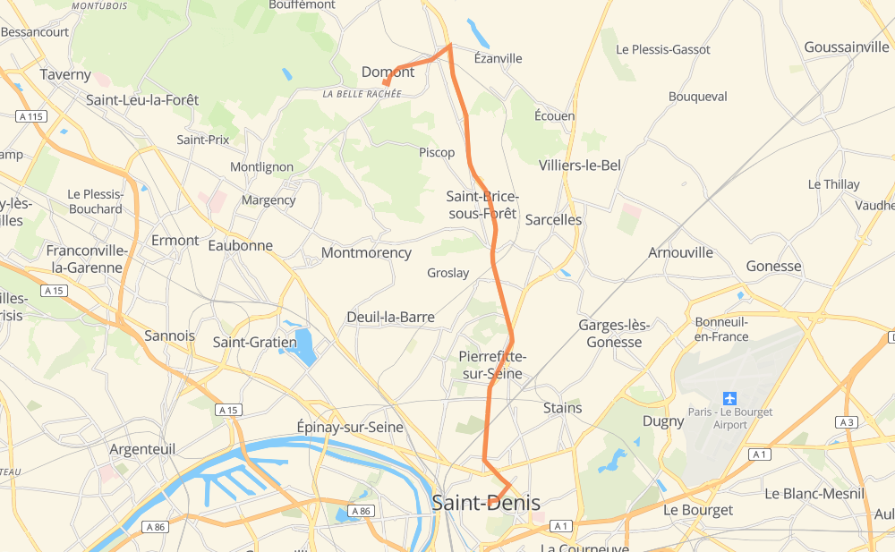
The distance from Saint-Denis to Domont is 9 miles by road. Road takes approximately 13 minutes and goes through Pierrefitte-sur-Seine, Sarcelles and Saint-Brice-sous-Forêt.
| Shortest distance by air | 6 mi ✈️ |
| Car route length | 8.7 mi 🚗 |
| Driving time | 13 min |
| Fuel amount | 0.3 gal |
| Fuel cost | 1.1 USD |
| Point | Distance | Time | Fuel | |
| Saint-Denis | 0 mi | 00 min | 0.0 gal | |
|
D 931 2 mi, 03 min
|
||||
| Pierrefitte-sur-Seine | 2 mi | 03 min | 0.0 gal | |
|
D 931 1 mi, 02 min
|
||||
| Sarcelles | 3 mi | 05 min | 0.1 gal | |
|
D 301 2 mi, 02 min
|
||||
| Saint-Brice-sous-Forêt | 6 mi | 08 min | 0.1 gal | |
|
D 301 3 mi, 04 min
|
||||
| Domont | 9 mi | 13 min | 0.2 gal | |
Frequently Asked Questions
How much does it cost to drive from Saint-Denis to Domont?
Fuel cost: 1.1 USD
This fuel cost is calculated as: (Route length 8.7 mi) / (Fuel consumption 29.4 mpg) * (Fuel price 3.9 USD / gal)
You can adjust fuel consumption and fuel price here.
How long is a car ride from Saint-Denis to Domont?
Driving time: 13 min
This time is calculated for driving at the maximum permitted speed, taking into account traffic rules restrictions.
- 3 mi with a maximum speed 56 mph = 3 min
- 1 mi with a maximum speed 50 mph = 1 min
- 4 mi with a maximum speed 31 mph = 8 min
The calculated driving time does not take into account intermediate stops and traffic jams.
How far is Saint-Denis to Domont by land?
The distance between Saint-Denis and Domont is 8.7 mi by road.
Precise satellite coordinates of highways were used for this calculation. The start and finish points are the centers of Saint-Denis and Domont respectively.
What city is halfway between Saint-Denis and Domont?
The halfway point between Saint-Denis and Domont is Sarcelles. It is located about 1 mi from the exact midpoint by road.
The distance from Sarcelles to Saint-Denis is 3 mi and driving will take about 5 min. The road between Sarcelles and Domont has length 6 mi and will take approximately 7 min.
The other cities located close to halfway point:
Where is Saint-Denis in relation to Domont?
Saint-Denis is located 6 mi south-east of Domont.
Saint-Denis has geographic coordinates: latitude 48.93577, longitude 2.35801.
Domont has geographic coordinates: latitude 49.02654, longitude 2.3246.
Which highway goes from Saint-Denis to Domont?
The route from Saint-Denis to Domont follows D 301, D 931.