Distance between Saint-Jean-Port-Joli QC and Livingston MI
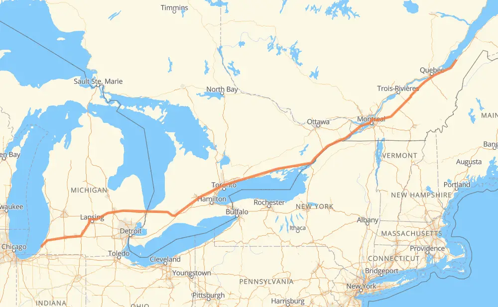
The distance from Saint-Jean-Port-Joli to Livingston is 976 miles by road including 969 miles on motorways. Road takes approximately 15 hours and 31 minutes and goes through Lévis, Drummondville, Longueuil, Montreal, Cornwall, Brockville and Kingston.
| Shortest distance by air | 877 mi ✈️ |
| Car route length | 975.6 mi 🚗 |
| Driving time | 15 h 31 min |
| Fuel amount | 33.2 gal |
| Fuel cost | 130.4 USD |
| Point | Distance | Time | Fuel | |
| Saint-Jean-Port-Joli | 0 mi | 00 min | 0.0 gal | |
|
204 20 50 mi, 48 min
|
||||
| Lévis | 50 mi | 48 min | 1.4 gal | |
|
20 99 mi, 1 h 35 min
|
||||
| Drummondville | 149 mi | 2 h 24 min | 4.9 gal | |
|
20 54 mi, 52 min
|
||||
| Longueuil | 203 mi | 3 h 16 min | 6.9 gal | |
|
25 10 mi, 12 min
|
||||
| Montreal | 213 mi | 3 h 29 min | 6.9 gal | |
|
40 401 68 mi, 1 h 09 min
|
||||
| Cornwall | 281 mi | 4 h 38 min | 9.5 gal | |
|
401 57 mi, 55 min
|
||||
| Brockville | 338 mi | 5 h 33 min | 11.3 gal | |
|
401 49 mi, 47 min
|
||||
| Kingston | 386 mi | 6 h 20 min | 12.8 gal | |
|
401 48 mi, 45 min
|
||||
| Belleville | 434 mi | 7 h 06 min | 14.5 gal | |
|
401 78 mi, 1 h 15 min
|
||||
| Oshawa | 512 mi | 8 h 21 min | 17.3 gal | |
|
401 9 mi, 08 min
|
||||
| Ajax | 521 mi | 8 h 30 min | 17.7 gal | |
|
401 20 mi, 19 min
|
||||
| Toronto | 541 mi | 8 h 49 min | 18.0 gal | |
|
401 19 mi, 18 min
|
||||
| Mississauga | 560 mi | 9 h 08 min | 18.9 gal | |
|
401 41 mi, 39 min
|
||||
| Kitchener | 601 mi | 9 h 47 min | 20.4 gal | |
|
401 26 mi, 25 min
|
||||
| Woodstock | 628 mi | 10 h 12 min | 21.2 gal | |
|
401 402 87 mi, 1 h 19 min
|
||||
| Sarnia | 715 mi | 11 h 32 min | 24.1 gal | |
|
402 I 69 76 mi, 1 h 13 min
|
||||
| Flint | 790 mi | 12 h 45 min | 26.8 gal | |
|
I 69 62 mi, 54 min
|
||||
| Lansing | 851 mi | 13 h 39 min | 28.9 gal | |
|
I 69 63 mi, 55 min
|
||||
| Kalamazoo | 915 mi | 14 h 35 min | 31.1 gal | |
|
I 94 61 mi, 55 min
|
||||
| Livingston | 976 mi | 15 h 31 min | 33.2 gal | |
Frequently Asked Questions
How much does it cost to drive from Saint-Jean-Port-Joli to Livingston?
Fuel cost: 130.4 USD
This fuel cost is calculated as: (Route length 975.6 mi) / (Fuel consumption 29.4 mpg) * (Fuel price 3.93 USD / gal)
You can adjust fuel consumption and fuel price here.
How long is a car ride from Saint-Jean-Port-Joli to Livingston?
Driving time: 15 h 31 min
This time is calculated for driving at the maximum permitted speed, taking into account traffic rules restrictions.
- 252 mi with a maximum speed 68 mph = 3 h 42 min
- 695 mi with a maximum speed 62 mph = 11 h 11 min
- 1 mi with a maximum speed 56 mph = 1 min
- 7 mi with a maximum speed 50 mph = 9 min
- 16 mi with a maximum speed 43 mph = 21 min
- 2 mi with a maximum speed 40 mph = 2 min
- 1 mi with a maximum speed 31 mph = 1 min
The calculated driving time does not take into account intermediate stops and traffic jams.
How far is Saint-Jean-Port-Joli to Livingston by land?
The distance between Saint-Jean-Port-Joli and Livingston is 975.6 mi by road including 968.7 mi on motorways.
Precise satellite coordinates of highways were used for this calculation. The start and finish points are the centers of Saint-Jean-Port-Joli and Livingston respectively.
How far is Saint-Jean-Port-Joli to Livingston by plane?
The shortest distance (air line, as the crow flies) between Saint-Jean-Port-Joli and Livingston is 876.8 mi.
This distance is calculated using the Haversine formula as a great-circle distance between two points on the surface of a sphere. The start and finish points are the centers of Saint-Jean-Port-Joli and Livingston respectively. Actual distance between airports may be different.
How many hours is Saint-Jean-Port-Joli from Livingston by plane?
Boeing 737 airliner needs 1 h 45 min to cover the distance of 877 mi at a cruising speed of 497 mph.
Small plane "Cessna 172" needs 6 h 24 min to flight this distance at average speed of 136 mph.
This time is approximate and do not take into account takeoff and landing times, airport location and other real world factors.
How long is a helicopter ride from Saint-Jean-Port-Joli to Livingston?
Fast helicopter "Eurocopter AS350" or "Hughes OH-6 Cayuse" need 5 h 52 min to cover the distance of 877 mi at a cruising speed of 149 mph.
Popular "Robinson R44" needs 6 h 43 min to flight this distance at average speed of 130 mph.
This time is approximate and do not take into account takeoff and landing times, aerodrome location and other real world factors.
What city is halfway between Saint-Jean-Port-Joli and Livingston?
The halfway point between Saint-Jean-Port-Joli and Livingston is Port Hope. It is located about 1 mi from the exact midpoint by road.
The distance from Port Hope to Saint-Jean-Port-Joli is 487 mi and driving will take about 7 h 57 min. The road between Port Hope and Livingston has length 488 mi and will take approximately 7 h 34 min.
The other cities located close to halfway point:
Where is Saint-Jean-Port-Joli in relation to Livingston?
Saint-Jean-Port-Joli is located 877 mi north-east of Livingston.
Saint-Jean-Port-Joli has geographic coordinates: latitude 47.2149, longitude -70.26924.
Livingston has geographic coordinates: latitude 41.96814, longitude -86.54274.
Which highway goes from Saint-Jean-Port-Joli to Livingston?
The route from Saint-Jean-Port-Joli to Livingston follows 401, 20, I 69, I 94, 402.
Other minor sections pass along the road:
- 40: 29 mi
- 55: 22 mi
- 25: 5 mi
- I 96: 5 mi
- 116: 3 mi
- US 31: 3 mi
- 204: 2 mi
- 15: 1 mi
- 30: 1 mi
- 201: 1 mi