Distance between Salamanca and Tlacomulco
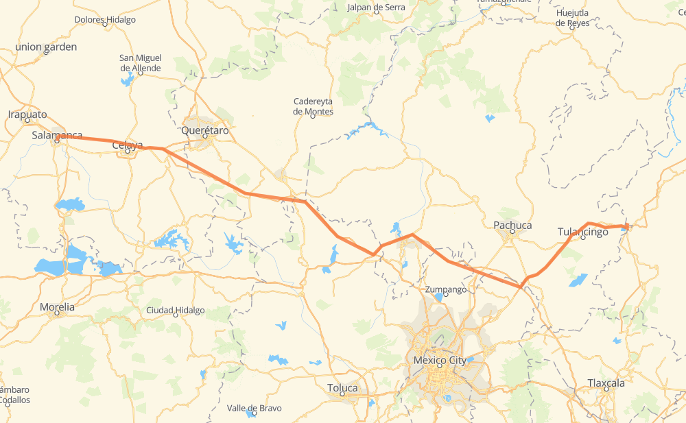
The distance from Salamanca to Tlacomulco is 239 miles by road including 234 miles on motorways. Road takes approximately 3 hours and 58 minutes and goes through Celaya, Apaseo el Grande, Santiago Tolman and San Miguel Atepoxco.
| Shortest distance by air | 201 mi ✈️ |
| Car route length | 238.6 mi 🚗 |
| Driving time | 3 h 58 min |
| Fuel amount | 8.1 gal |
| Fuel cost | 31.4 USD |
| Toll roads cost | 181 + ? MXN |
| Point | Distance | Time | Fuel | |
| Salamanca | 0 mi | 00 min | 0.0 gal | |
|
MEX 45D 6 mi, 07 min
|
||||
| Cerro Gordo | 6 mi | 07 min | 0.2 gal | |
|
MEX 45D 19 mi, 18 min
|
||||
| Celaya | 25 mi | 25 min | 0.7 gal | |
|
MEX 45D 9 mi, 08 min
|
||||
| Apaseo el Grande | 34 mi | 34 min | 1.1 gal | |
|
MEX 45D MEX 47D 19 mi, 17 min
|
||||
| El Jaral | 53 mi | 51 min | 1.8 gal | |
|
MEX 47D 34 mi, 30 min
|
||||
| Santa Bárbara de la Cueva | 88 mi | 1 h 21 min | 3.0 gal | |
|
MEX 47D MEX 57D 47 mi, 45 min
|
||||
| Xochitlán de las Flores | 135 mi | 2 h 07 min | 4.5 gal | |
|
MEX M40D 14 mi, 14 min
|
||||
| Tezoquipa | 149 mi | 2 h 21 min | 5.1 gal | |
|
MEX M40D 39 mi, 37 min
|
||||
| Santiago Tolman | 188 mi | 2 h 59 min | 6.4 gal | |
|
MEX 132 MEX 130D 50 mi, 58 min
|
||||
| Tlacomulco | 239 mi | 3 h 58 min | 8.1 gal | |
Frequently Asked Questions
How many toll booths are there from Salamanca to Tlacomulco?
There are 7 toll booths between Salamanca and Tlacomulco: Cerro Gordo, Tulancingo, Asuncion, Queretaro, Palmillas, Palmilas - Apaseo and Tejocotal.
How much does the toll booths cost from Salamanca to Tlacomulco?
Toll roads cost: Cerro Gordo (?) + Palmilas - Apaseo (?) + Palmillas (89 MXN) + Queretaro (?) + Tulancingo (?) + Asuncion (92 MXN) + Tejocotal (?) = 181 + ? MXN
How much does it cost to drive from Salamanca to Tlacomulco?
Fuel cost: 31.4 USD
This fuel cost is calculated as: (Route length 238.6 mi) / (Fuel consumption 29.4 mpg) * (Fuel price 3.86 USD / gal)
You can adjust fuel consumption and fuel price here.
Toll roads cost: 181 + ? MXN
How long is a car ride from Salamanca to Tlacomulco?
Driving time: 3 h 58 min
This time is calculated for driving at the maximum permitted speed, taking into account traffic rules restrictions.
- 80 mi with a maximum speed 68 mph = 1 h 10 min
- 101 mi with a maximum speed 62 mph = 1 h 38 min
- 5 mi with a maximum speed 56 mph = 5 min
- 49 mi with a maximum speed 50 mph = 59 min
- 2 mi with a maximum speed 31 mph = 4 min
The calculated driving time does not take into account intermediate stops and traffic jams.
How far is Salamanca to Tlacomulco by land?
The distance between Salamanca and Tlacomulco is 238.6 mi by road including 233.6 mi on motorways.
Precise satellite coordinates of highways were used for this calculation. The start and finish points are the centers of Salamanca and Tlacomulco respectively.
How far is Salamanca to Tlacomulco by plane?
The shortest distance (air line, as the crow flies) between Salamanca and Tlacomulco is 201.3 mi.
This distance is calculated using the Haversine formula as a great-circle distance between two points on the surface of a sphere. The start and finish points are the centers of Salamanca and Tlacomulco respectively. Actual distance between airports may be different.
How many hours is Salamanca from Tlacomulco by plane?
Boeing 737 airliner needs 24 min to cover the distance of 201 mi at a cruising speed of 497 mph.
Small plane "Cessna 172" needs 1 h 28 min to flight this distance at average speed of 136 mph.
This time is approximate and do not take into account takeoff and landing times, airport location and other real world factors.
How long is a helicopter ride from Salamanca to Tlacomulco?
Fast helicopter "Eurocopter AS350" or "Hughes OH-6 Cayuse" need 1 h 21 min to cover the distance of 201 mi at a cruising speed of 149 mph.
Popular "Robinson R44" needs 1 h 32 min to flight this distance at average speed of 130 mph.
This time is approximate and do not take into account takeoff and landing times, aerodrome location and other real world factors.
What city is halfway between Salamanca and Tlacomulco?
The halfway point between Salamanca and Tlacomulco is Xochitlán de las Flores. It is located about 16 mi from the exact midpoint by road.
The distance from Xochitlán de las Flores to Salamanca is 135 mi and driving will take about 2 h 7 min. The road between Xochitlán de las Flores and Tlacomulco has length 104 mi and will take approximately 1 h 51 min.
The other cities located close to halfway point:
Where is Salamanca in relation to Tlacomulco?
Salamanca is located 201 mi west of Tlacomulco.
Salamanca has geographic coordinates: latitude 20.57135, longitude -101.19244.
Tlacomulco has geographic coordinates: latitude 20.14583, longitude -98.11667.