Distance between San Francisco Ocotlán (Ocotlán) and El Ejido Tablón Número Uno (Las Cruces Cuatas)
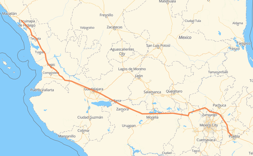
The distance from San Francisco Ocotlán (Ocotlán) to El Ejido Tablón Número Uno (Las Cruces Cuatas) is 668 miles by road including 654 miles on motorways. Road takes approximately 11 hours and 31 minutes and goes through Tonalá, Tepic, San Miguel Xoxtla, Santa María Moyotzingo, Jilotepec de Molina Enriquez, Pastores and Huaniqueo de Morales.
| Shortest distance by air | 566 mi ✈️ |
| Car route length | 668 mi 🚗 |
| Driving time | 11 h 31 min |
| Fuel amount | 22.7 gal |
| Fuel cost | 89.3 USD |
| Toll roads cost | 1,421 + ? MXN |
| Point | Distance | Time | Fuel | |
| San Francisco Ocotlán (Ocotlán) | 0 mi | 00 min | 0.0 gal | |
|
6 mi, 07 min
|
||||
| San Miguel Xoxtla | 6 mi | 07 min | 0.0 gal | |
|
MEX 150D 7 mi, 08 min
|
||||
| Santa María Moyotzingo | 12 mi | 15 min | 0.4 gal | |
|
MEX 150D MEX M40D 112 mi, 1 h 52 min
|
||||
| Jilotepec de Molina Enriquez | 124 mi | 2 h 08 min | 4.1 gal | |
|
MEX M40D MEX 15D 142 mi, 2 h 24 min
|
||||
| Huaniqueo de Morales | 265 mi | 4 h 33 min | 9.0 gal | |
|
MEX 15D 19 mi, 19 min
|
||||
| Panindicuaro | 285 mi | 4 h 52 min | 9.6 gal | |
|
MEX 15D 33 mi, 36 min
|
||||
| Ecuandureo | 318 mi | 5 h 29 min | 10.7 gal | |
|
MEX 15D 76 mi, 1 h 27 min
|
||||
| Tonalá | 393 mi | 6 h 56 min | 13.2 gal | |
|
MEX 15D 138 mi, 2 h 17 min
|
||||
| Tepic | 531 mi | 9 h 13 min | 17.9 gal | |
|
MEX 15D 137 mi, 2 h 17 min
|
||||
| El Ejido Tablón Número Uno (Las Cruces Cuatas) | 669 mi | 11 h 31 min | 22.6 gal | |
Frequently Asked Questions
How many toll booths are there from San Francisco Ocotlán (Ocotlán) to El Ejido Tablón Número Uno (Las Cruces Cuatas)?
There are 17 toll booths between San Francisco Ocotlán (Ocotlán) and El Ejido Tablón Número Uno (Las Cruces Cuatas): El Rosario, Acaponeta, Ruiz, Trapichillo, Santa Maria del Oro, Plan de Barrancas, La Joya, Ocotlán, Zinapecuaro, Contepec, Panindicuaro, Ecuandureo, Atlacomulco — Maravatio, Atlacomulco 2, San Martin Texmelucan, San Martín and Arenal.
How much does the toll booths cost from San Francisco Ocotlán (Ocotlán) to El Ejido Tablón Número Uno (Las Cruces Cuatas)?
Toll roads cost: San Martín (42 MXN) + San Martin Texmelucan (?) + Atlacomulco 2 (?) + Atlacomulco — Maravatio (50 MXN) + Contepec (?) + Zinapecuaro (161 MXN) + Panindicuaro (?) + Ecuandureo (111 MXN) + Ocotlán (226 MXN) + La Joya (?) + Arenal (131 MXN) + Plan de Barrancas (195 MXN) + Santa Maria del Oro (115 MXN) + Trapichillo (80 MXN) + Ruiz (?) + Acaponeta (240 MXN) + El Rosario (70 MXN) = 1,421 + ? MXN
How much does it cost to drive from San Francisco Ocotlán (Ocotlán) to El Ejido Tablón Número Uno (Las Cruces Cuatas)?
Fuel cost: 89.3 USD
This fuel cost is calculated as: (Route length 668 mi) / (Fuel consumption 29.4 mpg) * (Fuel price 3.93 USD / gal)
You can adjust fuel consumption and fuel price here.
Toll roads cost: 1,421 + ? MXN
How long is a car ride from San Francisco Ocotlán (Ocotlán) to El Ejido Tablón Número Uno (Las Cruces Cuatas)?
Driving time: 11 h 31 min
This time is calculated for driving at the maximum permitted speed, taking into account traffic rules restrictions.
- 132 mi with a maximum speed 68 mph = 1 h 56 min
- 319 mi with a maximum speed 62 mph = 5 h 8 min
- 195 mi with a maximum speed 50 mph = 3 h 55 min
- 17 mi with a maximum speed 43 mph = 23 min
- 2 mi with a maximum speed 37 mph = 4 min
- 1 mi with a maximum speed 31 mph = 2 min
The calculated driving time does not take into account intermediate stops and traffic jams.
How far is San Francisco Ocotlán (Ocotlán) to El Ejido Tablón Número Uno (Las Cruces Cuatas) by land?
The distance between San Francisco Ocotlán (Ocotlán) and El Ejido Tablón Número Uno (Las Cruces Cuatas) is 668 mi by road including 653.7 mi on motorways.
Precise satellite coordinates of highways were used for this calculation. The start and finish points are the centers of San Francisco Ocotlán (Ocotlán) and El Ejido Tablón Número Uno (Las Cruces Cuatas) respectively.
How far is San Francisco Ocotlán (Ocotlán) to El Ejido Tablón Número Uno (Las Cruces Cuatas) by plane?
The shortest distance (air line, as the crow flies) between San Francisco Ocotlán (Ocotlán) and El Ejido Tablón Número Uno (Las Cruces Cuatas) is 566.1 mi.
This distance is calculated using the Haversine formula as a great-circle distance between two points on the surface of a sphere. The start and finish points are the centers of San Francisco Ocotlán (Ocotlán) and El Ejido Tablón Número Uno (Las Cruces Cuatas) respectively. Actual distance between airports may be different.
How many hours is San Francisco Ocotlán (Ocotlán) from El Ejido Tablón Número Uno (Las Cruces Cuatas) by plane?
Boeing 737 airliner needs 1 h 8 min to cover the distance of 566 mi at a cruising speed of 497 mph.
Small plane "Cessna 172" needs 4 h 8 min to flight this distance at average speed of 136 mph.
This time is approximate and do not take into account takeoff and landing times, airport location and other real world factors.
How long is a helicopter ride from San Francisco Ocotlán (Ocotlán) to El Ejido Tablón Número Uno (Las Cruces Cuatas)?
Fast helicopter "Eurocopter AS350" or "Hughes OH-6 Cayuse" need 3 h 47 min to cover the distance of 566 mi at a cruising speed of 149 mph.
Popular "Robinson R44" needs 4 h 20 min to flight this distance at average speed of 130 mph.
This time is approximate and do not take into account takeoff and landing times, aerodrome location and other real world factors.
What city is halfway between San Francisco Ocotlán (Ocotlán) and El Ejido Tablón Número Uno (Las Cruces Cuatas)?
The halfway point between San Francisco Ocotlán (Ocotlán) and El Ejido Tablón Número Uno (Las Cruces Cuatas) is Vista Hermosa de Negrete. It is located about 1 mi from the exact midpoint by road.
The distance from Vista Hermosa de Negrete to San Francisco Ocotlán (Ocotlán) is 335 mi and driving will take about 5 h 46 min. The road between Vista Hermosa de Negrete and El Ejido Tablón Número Uno (Las Cruces Cuatas) has length 334 mi and will take approximately 5 h 44 min.
The other cities located close to halfway point:
- San José de las Moras is in 348 mi from San Francisco Ocotlán (Ocotlán) and 320 mi from El Ejido Tablón Número Uno (Las Cruces Cuatas)
- Ecuandureo is in 318 mi from San Francisco Ocotlán (Ocotlán) and 350 mi from El Ejido Tablón Número Uno (Las Cruces Cuatas)
- Los Fresnos is in 301 mi from San Francisco Ocotlán (Ocotlán) and 367 mi from El Ejido Tablón Número Uno (Las Cruces Cuatas)
Where is San Francisco Ocotlán (Ocotlán) in relation to El Ejido Tablón Número Uno (Las Cruces Cuatas)?
San Francisco Ocotlán (Ocotlán) is located 566 mi south-east of El Ejido Tablón Número Uno (Las Cruces Cuatas).
San Francisco Ocotlán (Ocotlán) has geographic coordinates: latitude 19.13222, longitude -98.28528.
El Ejido Tablón Número Uno (Las Cruces Cuatas) has geographic coordinates: latitude 23.07593, longitude -105.98738.
Which highway goes from San Francisco Ocotlán (Ocotlán) to El Ejido Tablón Número Uno (Las Cruces Cuatas)?
The route from San Francisco Ocotlán (Ocotlán) to El Ejido Tablón Número Uno (Las Cruces Cuatas) follows MEX 15D, MEX M40D.
Other minor sections pass along the road:
- MEX 70: 21 mi
- MEX 90: 21 mi
- MEX 150D: 13 mi
- MEX 80D: 11 mi
- MEX 15: 10 mi
- MEX 80: 7 mi
- MEX 23: 5 mi
- MEX 040D: 4 mi
- SIN 5-19: 2 mi