Distance between San Pedro Tlaquepaque and Tlalminulpa
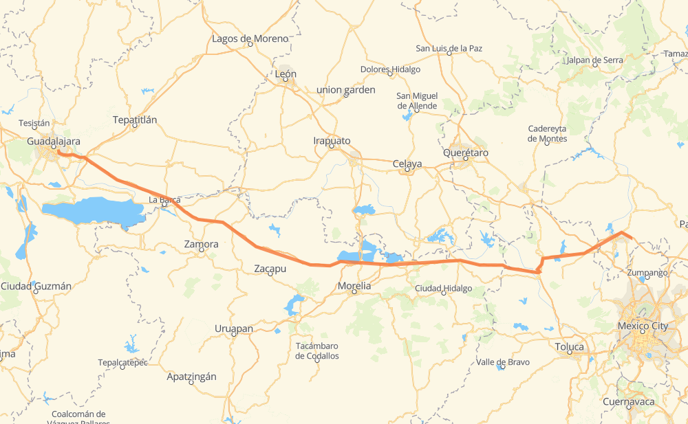
The distance from San Pedro Tlaquepaque to Tlalminulpa is 301 miles by road including 300 miles on motorways. Road takes approximately 5 hours and 22 minutes and goes through Tonalá, Vista Hermosa de Negrete, Ecuandureo, Panindicuaro, Huaniqueo de Morales, Maravatio and Pastores.
| Shortest distance by air | 268 mi ✈️ |
| Car route length | 301.4 mi 🚗 |
| Driving time | 5 h 22 min |
| Fuel amount | 10.3 gal |
| Fuel cost | 40 USD |
| Toll roads cost | 548 + ? MXN |
| Point | Distance | Time | Fuel | |
| San Pedro Tlaquepaque | 0 mi | 00 min | 0.0 gal | |
|
MEX 80 7 mi, 08 min
|
||||
| Tonalá | 7 mi | 08 min | 0.1 gal | |
|
MEX 15D 22 mi, 26 min
|
||||
| Coralillos | 30 mi | 35 min | 0.5 gal | |
|
MEX 15D 36 mi, 42 min
|
||||
| Vista Hermosa de Negrete | 66 mi | 1 h 18 min | 2.1 gal | |
|
MEX 15D 17 mi, 18 min
|
||||
| Ecuandureo | 83 mi | 1 h 36 min | 2.7 gal | |
|
MEX 15D 33 mi, 36 min
|
||||
| Panindicuaro | 116 mi | 2 h 12 min | 3.8 gal | |
|
MEX 15D 19 mi, 19 min
|
||||
| Huaniqueo de Morales | 135 mi | 2 h 32 min | 4.5 gal | |
|
MEX 15D 70 mi, 1 h 08 min
|
||||
| Maravatio | 205 mi | 3 h 40 min | 6.9 gal | |
|
MEX 15D 72 mi, 1 h 16 min
|
||||
| Jilotepec de Molina Enriquez | 277 mi | 4 h 56 min | 9.3 gal | |
|
MEX M40D 25 mi, 25 min
|
||||
| Tlalminulpa | 301 mi | 5 h 22 min | 10.3 gal | |
Frequently Asked Questions
How many toll booths are there from San Pedro Tlaquepaque to Tlalminulpa?
There are 9 toll booths between San Pedro Tlaquepaque and Tlalminulpa: La Joya, Ocotlán, Zinapecuaro, Contepec, Panindicuaro, Ecuandureo, Atitalquia, Atlacomulco — Maravatio and Atlacomulco 2.
How much does the toll booths cost from San Pedro Tlaquepaque to Tlalminulpa?
Toll roads cost: La Joya (?) + Ocotlán (226 MXN) + Ecuandureo (111 MXN) + Panindicuaro (?) + Zinapecuaro (161 MXN) + Contepec (?) + Atlacomulco — Maravatio (50 MXN) + Atlacomulco 2 (?) + Atitalquia (?) = 548 + ? MXN
How much does it cost to drive from San Pedro Tlaquepaque to Tlalminulpa?
Fuel cost: 40 USD
This fuel cost is calculated as: (Route length 301.4 mi) / (Fuel consumption 29.4 mpg) * (Fuel price 3.9 USD / gal)
You can adjust fuel consumption and fuel price here.
Toll roads cost: 548 + ? MXN
How long is a car ride from San Pedro Tlaquepaque to Tlalminulpa?
Driving time: 5 h 22 min
This time is calculated for driving at the maximum permitted speed, taking into account traffic rules restrictions.
- 25 mi with a maximum speed 68 mph = 22 min
- 138 mi with a maximum speed 62 mph = 2 h 13 min
- 1 mi with a maximum speed 56 mph = 1 min
- 136 mi with a maximum speed 50 mph = 2 h 44 min
- 1 mi with a maximum speed 31 mph = 1 min
The calculated driving time does not take into account intermediate stops and traffic jams.
How far is San Pedro Tlaquepaque to Tlalminulpa by land?
The distance between San Pedro Tlaquepaque and Tlalminulpa is 301.4 mi by road including 299.5 mi on motorways.
Precise satellite coordinates of highways were used for this calculation. The start and finish points are the centers of San Pedro Tlaquepaque and Tlalminulpa respectively.
How far is San Pedro Tlaquepaque to Tlalminulpa by plane?
The shortest distance (air line, as the crow flies) between San Pedro Tlaquepaque and Tlalminulpa is 267.8 mi.
This distance is calculated using the Haversine formula as a great-circle distance between two points on the surface of a sphere. The start and finish points are the centers of San Pedro Tlaquepaque and Tlalminulpa respectively. Actual distance between airports may be different.
How many hours is San Pedro Tlaquepaque from Tlalminulpa by plane?
Boeing 737 airliner needs 32 min to cover the distance of 268 mi at a cruising speed of 497 mph.
Small plane "Cessna 172" needs 1 h 57 min to flight this distance at average speed of 136 mph.
This time is approximate and do not take into account takeoff and landing times, airport location and other real world factors.
How long is a helicopter ride from San Pedro Tlaquepaque to Tlalminulpa?
Fast helicopter "Eurocopter AS350" or "Hughes OH-6 Cayuse" need 1 h 47 min to cover the distance of 268 mi at a cruising speed of 149 mph.
Popular "Robinson R44" needs 2 h 3 min to flight this distance at average speed of 130 mph.
This time is approximate and do not take into account takeoff and landing times, aerodrome location and other real world factors.
What city is halfway between San Pedro Tlaquepaque and Tlalminulpa?
The halfway point between San Pedro Tlaquepaque and Tlalminulpa is Santa Rita. It is located about 2 mi from the exact midpoint by road.
The distance from Santa Rita to San Pedro Tlaquepaque is 152 mi and driving will take about 2 h 50 min. The road between Santa Rita and Tlalminulpa has length 149 mi and will take approximately 2 h 32 min.
The other cities located close to halfway point:
Where is San Pedro Tlaquepaque in relation to Tlalminulpa?
San Pedro Tlaquepaque is located 268 mi west of Tlalminulpa.
San Pedro Tlaquepaque has geographic coordinates: latitude 20.63965, longitude -103.31185.
Tlalminulpa has geographic coordinates: latitude 20.07222, longitude -99.22083.
Which highway goes from San Pedro Tlaquepaque to Tlalminulpa?
The route from San Pedro Tlaquepaque to Tlalminulpa follows MEX 15D.
Other minor sections pass along the road:
- MEX M40D: 50 mi
- MEX 80D: 11 mi
- MEX 040D: 4 mi
- MEX 80: 1 mi