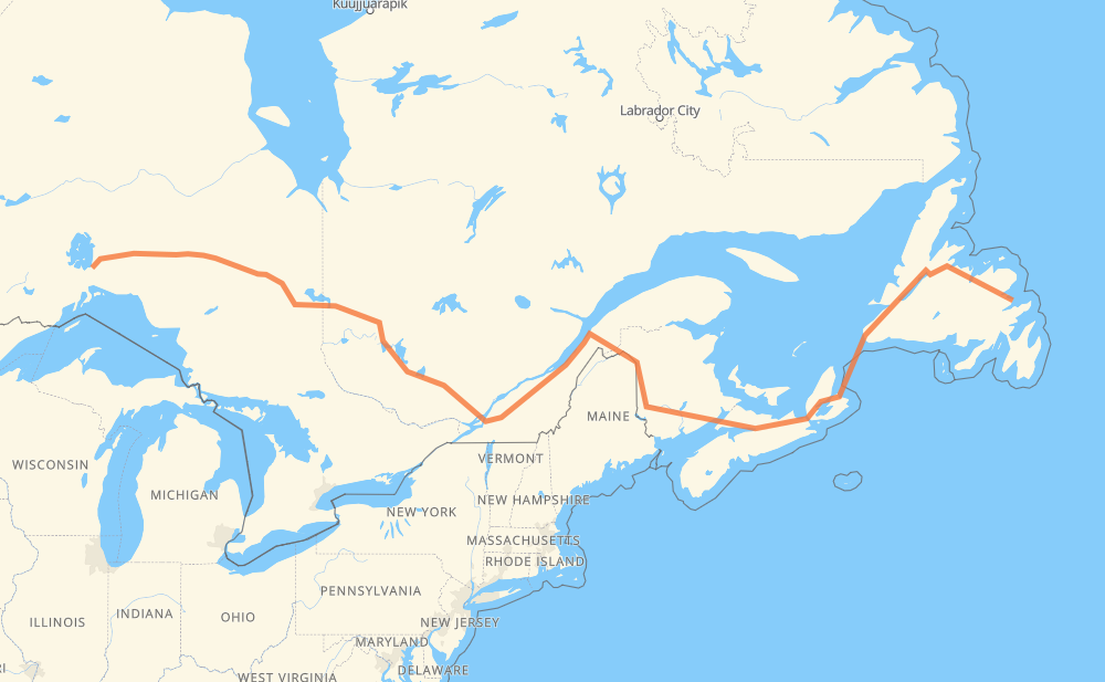
The distance from Sandy Cove to Macdiarmid is 2,298 miles by road including 860 miles on motorways. Road takes approximately 46 hours and 36 minutes and goes through Corner Brook, Moncton, Fredericton, Lévis, Drummondville, Longueuil and Montreal.
You can adjust fuel consumption and fuel price here.
How long is a car ride from Sandy Cove to Macdiarmid?
Driving time:
46 h 36 min
This time is calculated for driving at the maximum permitted speed, taking into account traffic rules restrictions.
421 mi with a maximum speed 68 mph = 6 h 11 min
426 mi with a maximum speed 62 mph = 6 h 51 min
467 mi with a maximum speed 56 mph = 8 h 20 min
738 mi with a maximum speed 56 mph = 13 h 11 min
71 mi with a maximum speed 50 mph = 1 h 26 min
35 mi with a maximum speed 43 mph = 49 min
6 mi with a maximum speed 37 mph = 10 min
22 mi with a maximum speed 31 mph = 42 min
110 mi with a maximum speed 12 mph = 8 h 52 min
The calculated driving time does not take into account intermediate stops and traffic jams.
How far is Sandy Cove to Macdiarmid by land?
The distance between Sandy Cove and Macdiarmid is 2,297.8 mi by road including 860 mi on motorways.
Precise satellite coordinates of highways were used for this calculation. The start and finish points are the centers of Sandy Cove and Macdiarmid respectively.
How far is Sandy Cove to Macdiarmid by plane?
The shortest distance (air line, as the crow flies) between Sandy Cove and Macdiarmid is 1,546 mi.
This distance is calculated using the Haversine formula as a great-circle distance between two points on the surface of a sphere. The start and finish points are the centers of Sandy Cove and Macdiarmid respectively. Actual distance between airports may be different.
How many hours is Sandy Cove from Macdiarmid by plane?
Boeing 737 airliner needs 3 h 6 min to cover the distance of 1,546 mi at a cruising speed of 497 mph.
Small plane "Cessna 172" needs 11 h 18 min to flight this distance at average speed of 136 mph.
This time is approximate and do not take into account takeoff and landing times, airport location and other real world factors.
How long is a helicopter ride from Sandy Cove to Macdiarmid?
Fast helicopter "Eurocopter AS350" or "Hughes OH-6 Cayuse" need 10 h 22 min to cover the distance of 1,546 mi at a cruising speed of 149 mph.
Popular "Robinson R44" needs 11 h 50 min to flight this distance at average speed of 130 mph.
This time is approximate and do not take into account takeoff and landing times, aerodrome location and other real world factors.
What city is halfway between Sandy Cove and Macdiarmid?
The halfway point between Sandy Cove and Macdiarmid is Rivière-du-Loup. It is located about 9 mi from the exact midpoint by road.
The distance from Rivière-du-Loup to Sandy Cove is 1,158 mi and driving will take about 26 h 5 min. The road between Rivière-du-Loup and Macdiarmid has length 1,141 mi and will take approximately 20 h 30 min.
The other cities located close to halfway point:
Notre-Dame-du-Portage is in 1,161 mi from Sandy Cove and 1,136 mi from Macdiarmid
Saint-Pascal is in 1,181 mi from Sandy Cove and 1,117 mi from Macdiarmid
Saint-Philippe-de-Néri is in 1,187 mi from Sandy Cove and 1,110 mi from Macdiarmid
Where is Sandy Cove in relation to Macdiarmid?
Sandy Cove is located 1,546 mi east of Macdiarmid.
Sandy Cove has geographic coordinates: latitude 48.64131, longitude -53.73525.
Macdiarmid has geographic coordinates: latitude 49.43686, longitude -88.13.
Which highway goes from Sandy Cove to Macdiarmid?
The route from Sandy Cove to Macdiarmid follows 1, 11, TCH, 117, 2, 20, NS 104, NS 105, 101.