Distance between Santa Elena de Uairén and El Maco
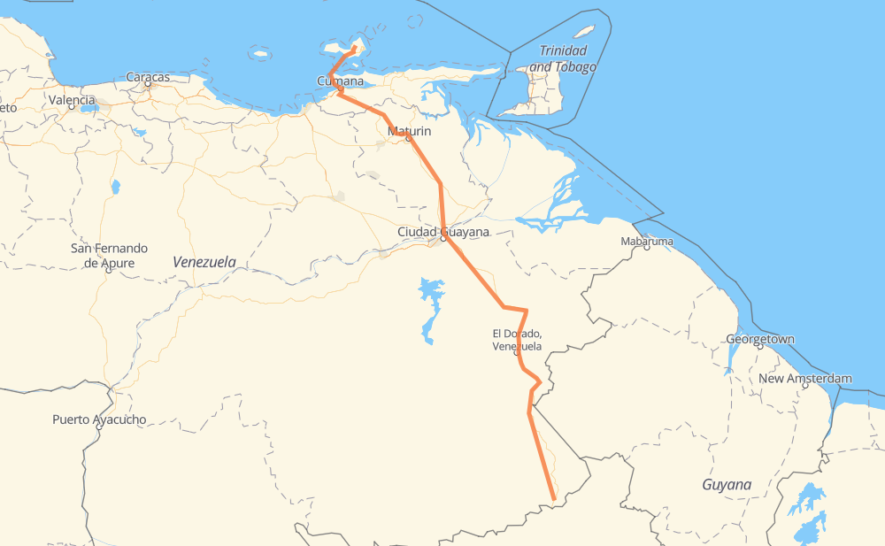
The distance from Santa Elena de Uairén to El Maco is 656 miles by road including 22 miles on motorways. Road takes approximately 15 hours and 23 minutes and goes through Maturin, Cumana, Kilómetro 88, Las Claritas, El Dorado, El Callao and Mercado Municipal Chirica.
| Shortest distance by air | 486 mi ✈️ |
| Car route length | 655.5 mi 🚗 |
| Driving time | 15 h 23 min |
| Fuel amount | 22.3 gal |
| Fuel cost | 87.7 USD |
| Point | Distance | Time | Fuel | |
| 4.60745, -61.10369 | 0 mi | 00 min | 0.0 gal | |
|
T-10 191 mi, 3 h 38 min
|
||||
| El Dorado | 191 mi | 3 h 38 min | 7.6 gal | |
|
T-10 179 mi, 3 h 32 min
|
||||
| Mercado Municipal Chirica | 370 mi | 7 h 10 min | 16.0 gal | |
|
T-10 14 mi, 24 min
|
||||
| Los Barrancos de Fajardo | 383 mi | 7 h 35 min | 16.7 gal | |
|
T-10 103 mi, 1 h 54 min
|
||||
| Santa Ines | 487 mi | 9 h 29 min | 20.2 gal | |
|
T-10 4 mi, 04 min
|
||||
| Maturin | 490 mi | 9 h 33 min | 20.4 gal | |
|
T-10 3 mi, 03 min
|
||||
| Boqueron | 493 mi | 9 h 37 min | 20.5 gal | |
|
T-10 Local 3 27 mi, 33 min
|
||||
| Aragua de Maturín | 521 mi | 10 h 10 min | 20.9 gal | |
|
Local 1 17 mi, 21 min
|
||||
| Guanaguana | 538 mi | 10 h 32 min | 22.0 gal | |
|
Local 1 70 mi, 1 h 21 min
|
||||
| Cumana | 608 mi | 11 h 53 min | 24.4 gal | |
|
Ramal 4 59 mi, 3 h 29 min
|
||||
| El Maco | 667 mi | 15 h 23 min | 26.4 gal | |
Frequently Asked Questions
How much does it cost to drive from Santa Elena de Uairén to El Maco?
Fuel cost: 87.7 USD
This fuel cost is calculated as: (Route length 655.5 mi) / (Fuel consumption 29.4 mpg) * (Fuel price 3.93 USD / gal)
You can adjust fuel consumption and fuel price here.
How long is a car ride from Santa Elena de Uairén to El Maco?
Driving time: 15 h 23 min
This time is calculated for driving at the maximum permitted speed, taking into account traffic rules restrictions.
- 22 mi with a maximum speed 62 mph = 21 min
- 187 mi with a maximum speed 56 mph = 3 h 20 min
- 48 mi with a maximum speed 56 mph = 52 min
- 348 mi with a maximum speed 50 mph = 7 h
- 19 mi with a maximum speed 37 mph = 29 min
- 1 mi with a maximum speed 31 mph = 2 min
- 1 mi with a maximum speed 25 mph = 1 min
- 40 mi with a maximum speed 12 mph = 3 h 14 min
The calculated driving time does not take into account intermediate stops and traffic jams.
How far is Santa Elena de Uairén to El Maco by land?
The distance between Santa Elena de Uairén and El Maco is 655.5 mi by road including 22.4 mi on motorways.
Precise satellite coordinates of highways were used for this calculation. The start and finish points are the centers of Santa Elena de Uairén and El Maco respectively.
How far is Santa Elena de Uairén to El Maco by plane?
The shortest distance (air line, as the crow flies) between Santa Elena de Uairén and El Maco is 485.9 mi.
This distance is calculated using the Haversine formula as a great-circle distance between two points on the surface of a sphere. The start and finish points are the centers of Santa Elena de Uairén and El Maco respectively. Actual distance between airports may be different.
How many hours is Santa Elena de Uairén from El Maco by plane?
Boeing 737 airliner needs 58 min to cover the distance of 486 mi at a cruising speed of 497 mph.
Small plane "Cessna 172" needs 3 h 33 min to flight this distance at average speed of 136 mph.
This time is approximate and do not take into account takeoff and landing times, airport location and other real world factors.
How long is a helicopter ride from Santa Elena de Uairén to El Maco?
Fast helicopter "Eurocopter AS350" or "Hughes OH-6 Cayuse" need 3 h 15 min to cover the distance of 486 mi at a cruising speed of 149 mph.
Popular "Robinson R44" needs 3 h 43 min to flight this distance at average speed of 130 mph.
This time is approximate and do not take into account takeoff and landing times, aerodrome location and other real world factors.
What city is halfway between Santa Elena de Uairén and El Maco?
The halfway point between Santa Elena de Uairén and El Maco is Los Rosos. It is located about 24 mi from the exact midpoint by road.
The distance from Los Rosos to Santa Elena de Uairén is 351 mi and driving will take about 6 h 46 min. The road between Los Rosos and El Maco has length 304 mi and will take approximately 8 h 36 min.
The other cities located close to halfway point:
Where is Santa Elena de Uairén in relation to El Maco?
Santa Elena de Uairén is located 486 mi south-east of El Maco.
Santa Elena de Uairén has geographic coordinates: latitude 4.60745, longitude -61.10369.
El Maco has geographic coordinates: latitude 11.04768, longitude -63.94329.
Which highway goes from Santa Elena de Uairén to El Maco?
The route from Santa Elena de Uairén to El Maco follows T-10, Local 1.
Other minor sections pass along the road:
- Local 3: 9 mi
- Ramal 4: 6 mi
- Local 5: 6 mi
- Ramal 11: 3 mi
- Ramal 3: 1 mi