Distance between Setor Galiléia and Santana
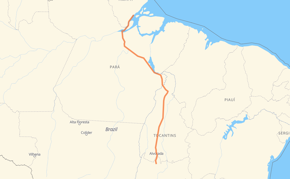
The distance from Setor Galiléia to Santana is 1,174 miles by road. Road takes approximately 36 hours and 37 minutes and goes through Maraba, Santana, Serrano II and Vila Residencial Belo Monte.
| Shortest distance by air | 934 mi ✈️ |
| Car route length | 1,174.4 mi 🚗 |
| Driving time | 36 h 37 min |
| Fuel amount | 39.9 gal |
| Fuel cost | 157 USD |
| Point | Distance | Time | Fuel | |
| Setor Galiléia | 0 mi | 00 min | 0.0 gal | |
|
BR-153 24 mi, 28 min
|
||||
| Cajueiro | 24 mi | 28 min | 0.6 gal | |
|
BR-153 199 mi, 3 h 35 min
|
||||
| Santana | 223 mi | 4 h 03 min | 7.4 gal | |
|
BR-153 11 mi, 12 min
|
||||
| Serrano II | 234 mi | 4 h 16 min | 7.9 gal | |
|
BR-153 247 mi, 4 h 26 min
|
||||
| Ponta do Asfalto | 480 mi | 8 h 42 min | 15.9 gal | |
|
TO-420 BR-153 103 mi, 2 h 00 min
|
||||
| São José | 583 mi | 10 h 43 min | 19.6 gal | |
|
BR-153 17 mi, 20 min
|
||||
| Vila Diamante | 601 mi | 11 h 03 min | 20.4 gal | |
|
BR-153 11 mi, 12 min
|
||||
| Ponta de Pedro | 611 mi | 11 h 16 min | 20.5 gal | |
|
BR-153 13 mi, 16 min
|
||||
| Maraba | 625 mi | 11 h 32 min | 21.1 gal | |
|
BR-230 277 mi, 5 h 13 min
|
||||
| Vila Residencial Belo Monte | 902 mi | 16 h 45 min | 30.6 gal | |
|
BR-230 273 mi, 19 h 51 min
|
||||
| -0.05543, -51.17677 | 1,174 mi | 36 h 37 min | 39.9 gal | |
Frequently Asked Questions
How much does it cost to drive from Setor Galiléia to Santana?
Fuel cost: 157 USD
This fuel cost is calculated as: (Route length 1,174.4 mi) / (Fuel consumption 29.4 mpg) * (Fuel price 3.93 USD / gal)
You can adjust fuel consumption and fuel price here.
How long is a car ride from Setor Galiléia to Santana?
Driving time: 36 h 37 min
This time is calculated for driving at the maximum permitted speed, taking into account traffic rules restrictions.
- 649 mi with a maximum speed 56 mph = 11 h 34 min
- 286 mi with a maximum speed 50 mph = 5 h 44 min
- 240 mi with a maximum speed 12 mph = 19 h 16 min
The calculated driving time does not take into account intermediate stops and traffic jams.
How far is Setor Galiléia to Santana by land?
The distance between Setor Galiléia and Santana is 1,174.4 mi by road.
Precise satellite coordinates of highways were used for this calculation. The start and finish points are the centers of Setor Galiléia and Santana respectively.
How far is Setor Galiléia to Santana by plane?
The shortest distance (air line, as the crow flies) between Setor Galiléia and Santana is 933.9 mi.
This distance is calculated using the Haversine formula as a great-circle distance between two points on the surface of a sphere. The start and finish points are the centers of Setor Galiléia and Santana respectively. Actual distance between airports may be different.
How many hours is Setor Galiléia from Santana by plane?
Boeing 737 airliner needs 1 h 52 min to cover the distance of 934 mi at a cruising speed of 497 mph.
Small plane "Cessna 172" needs 6 h 49 min to flight this distance at average speed of 136 mph.
This time is approximate and do not take into account takeoff and landing times, airport location and other real world factors.
How long is a helicopter ride from Setor Galiléia to Santana?
Fast helicopter "Eurocopter AS350" or "Hughes OH-6 Cayuse" need 6 h 15 min to cover the distance of 934 mi at a cruising speed of 149 mph.
Popular "Robinson R44" needs 7 h 9 min to flight this distance at average speed of 130 mph.
This time is approximate and do not take into account takeoff and landing times, aerodrome location and other real world factors.
What city is halfway between Setor Galiléia and Santana?
The halfway point between Setor Galiléia and Santana is São José. It is located about 4 mi from the exact midpoint by road.
The distance from São José to Setor Galiléia is 583 mi and driving will take about 10 h 43 min. The road between São José and Santana has length 591 mi and will take approximately 25 h 54 min.
The other cities located close to halfway point:
Where is Setor Galiléia in relation to Santana?
Setor Galiléia is located 934 mi south of Santana.
Setor Galiléia has geographic coordinates: latitude -13.41943, longitude -49.13721.
Santana has geographic coordinates: latitude -0.05543, longitude -51.17677.
Which highway goes from Setor Galiléia to Santana?
The route from Setor Galiléia to Santana follows BR-153, BR-230.
Other minor sections pass along the road:
- TO-420: 24 mi
- BR-222: 1 mi