Distance between Steinbach MB and Northshore ON

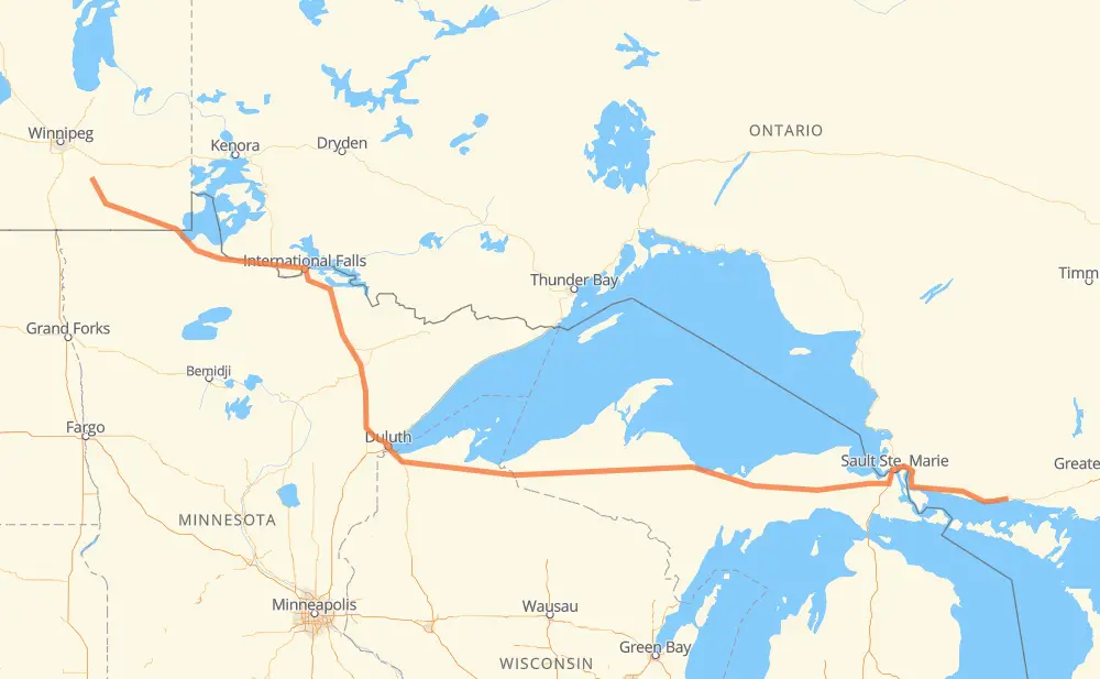
The distance from Steinbach to Northshore is 870 miles by road including 20 miles on motorways. Road takes approximately 16 hours and 19 minutes and goes through International Falls, Duluth, Marquette and Sault Ste. Marie.

There are tolls on the route.
Shortest distance by air 692 mi ✈️
Car route length 869.9 mi 🚗
Driving time 16 h 19 min
Fuel amount 29.6 gal
Fuel cost 116.3 USD
Click here to load the interactive map
Compare this route in other services:
City
Town
Village
Hamlet
Motorway
Primary
Secondary
Unclassified
Point Distance Time Fuel
Steinbach 0 mi 0:00 00 min 0.0 gal
PTH 12 70 mi, 1 h 16 min
Sprague 70 mi 1:16 1 h 16 min 2.0 gal
PTH 12 MN 11 53 mi, 1 h 00 min
Baudette 123 mi 2:16 2 h 16 min 4.2 gal
MN 11 11 39 mi, 41 min
Emo 162 mi 2:58 2 h 58 min 5.4 gal
11 18 mi, 20 min
Fort Frances 180 mi 3:19 3 h 19 min 6.1 gal
71 6 mi, 06 min
International Falls 186 mi 3:26 3 h 26 min 6.2 gal
US 53 162 mi, 2 h 57 min
Duluth 347 mi 6:23 6 h 23 min 11.6 gal
US 53 M 28 254 mi, 4 h 52 min
Marquette 601 mi 11:15 11 h 15 min 20.4 gal
US 41 M 28 166 mi, 3 h 08 min
Sault Ste. Marie 767 mi 14:24 14 h 24 min 26.0 gal
17 107 mi, 1 h 59 min
Northshore 875 mi 16:24 16 h 24 min 29.7 gal
City
Town
Village
Hamlet
Motorway
Primary
Secondary
Unclassified
Point Distance Time Fuel
Steinbach 0 mi 0:00 00 min 0.0 gal
PTH 12 22 mi, 25 min
Zhoda 22 mi 0:25 25 min 0.6 gal
PTH 12 47 mi, 50 min
Sprague 70 mi 1:16 1 h 16 min 2.0 gal
PTH 12 MN 313 14 mi, 14 min
Longworth 83 mi 1:30 1 h 30 min 2.7 gal
MN 313 4 mi, 04 min
Warroad 87 mi 1:35 1 h 35 min 2.9 gal
MN 11 12 mi, 14 min
Roosevelt 99 mi 1:49 1 h 49 min 3.0 gal
MN 11 16 mi, 17 min
Pitt 115 mi 2:07 2 h 07 min 3.8 gal
MN 11 8 mi, 09 min
Baudette 123 mi 2:16 2 h 16 min 4.2 gal
MN 11 11 2 mi, 02 min
Rainy River 125 mi 2:18 2 h 18 min 4.2 gal
11 37 mi, 39 min
Emo 162 mi 2:58 2 h 58 min 5.4 gal
11 6 mi, 06 min
Devlin 168 mi 3:05 3 h 05 min 5.7 gal
11 12 mi, 13 min
Fort Frances 180 mi 3:18 3 h 18 min 6.1 gal
71 6 mi, 06 min
International Falls 186 mi 3:25 3 h 25 min 6.2 gal
US 53 6 mi, 06 min
Ericsburg 191 mi 3:32 3 h 32 min 6.5 gal
US 53 25 mi, 26 min
Ash Lake 217 mi 3:59 3 h 59 min 6.7 gal
US 53 27 mi, 29 min
Orr 244 mi 4:28 4 h 28 min 8.0 gal
US 53 9 mi, 10 min
Cook 253 mi 4:39 4 h 39 min 8.6 gal
US 53 US 53-MN 1 5 mi, 05 min
Shermans Corner 258 mi 4:44 4 h 44 min 8.7 gal
US 53-MN 1 US 53 4 mi, 03 min
Idington 262 mi 4:48 4 h 48 min 8.8 gal
US 53 22 mi, 23 min
Virginia 283 mi 5:12 5 h 12 min 9.4 gal
US 53 8 mi, 09 min
Eveleth 291 mi 5:21 5 h 21 min 9.9 gal
US 53 26 mi, 28 min
Cotton 318 mi 5:49 5 h 49 min 10.6 gal
US 53 11 mi, 11 min
Independence 328 mi 6:00 6 h 00 min 11.2 gal
US 53 6 mi, 07 min
Twig Station 335 mi 6:08 6 h 08 min 11.2 gal
US 53 6 mi, 07 min
Hermantown 341 mi 6:15 6 h 15 min 11.6 gal
US 53 6 mi, 07 min
Duluth 347 mi 6:23 6 h 23 min 11.6 gal
US 53 11 mi, 13 min
Superior 358 mi 6:36 6 h 36 min 12.0 gal
US 53 6 mi, 07 min
Cutter 364 mi 6:44 6 h 44 min 12.3 gal
US 2 4 mi, 03 min
Amnicon Falls 367 mi 6:47 6 h 47 min 12.5 gal
US 2 2 mi, 02 min
Wentworth 370 mi 6:50 6 h 50 min 12.5 gal
US 2 2 mi, 02 min
Poplar 372 mi 6:52 6 h 52 min 12.6 gal
US 2 7 mi, 07 min
Brule 378 mi 7:00 7 h 00 min 12.7 gal
US 2 22 mi, 23 min
Ino 401 mi 7:23 7 h 23 min 13.3 gal
US 2 12 mi, 12 min
Ashland Junction 412 mi 7:36 7 h 36 min 13.9 gal
US 2 11 mi, 12 min
Ashland 423 mi 7:48 7 h 48 min 14.2 gal
US 2 15 mi, 17 min
Saxon 437 mi 8:06 8 h 06 min 14.6 gal
US 2 22 mi, 24 min
Ironwood 459 mi 8:31 8 h 31 min 15.5 gal
US 2 4 mi, 05 min
Bessemer 463 mi 8:36 8 h 36 min 15.7 gal
US 2 7 mi, 07 min
Wakefield 470 mi 8:44 8 h 44 min 15.9 gal
M 28 8 mi, 09 min
Tula 478 mi 8:53 8 h 53 min 16.2 gal
M 28 10 mi, 11 min
Bergland 488 mi 9:04 9 h 04 min 16.5 gal
M 28 9 mi, 11 min
Matchwood 497 mi 9:15 9 h 15 min 16.7 gal
M 28 8 mi, 09 min
Balitmore 505 mi 9:25 9 h 25 min 17.1 gal
M 28 5 mi, 06 min
Bruce Crossing 510 mi 9:31 9 h 31 min 17.2 gal
M 28 7 mi, 08 min
Agate 518 mi 9:40 9 h 40 min 17.5 gal
M 28 7 mi, 07 min
Kenton 524 mi 9:47 9 h 47 min 17.8 gal
M 28 6 mi, 07 min
Sidnaw 530 mi 9:54 9 h 54 min 17.8 gal
M 28 9 mi, 10 min
Watton 539 mi 10:05 10 h 05 min 18.3 gal
M 28 2 mi, 02 min
Covington 541 mi 10:08 10 h 08 min 18.3 gal
M 28 15 mi, 16 min
Nestoria 557 mi 10:24 10 h 24 min 18.9 gal
US 41 7 mi, 07 min
Michigamme 564 mi 10:32 10 h 32 min 19.0 gal
US 41 9 mi, 09 min
Champion 572 mi 10:42 10 h 42 min 19.4 gal
US 41 4 mi, 04 min
Humboldt 576 mi 10:46 10 h 46 min 19.6 gal
US 41 2 mi, 02 min
Clarksburg 578 mi 10:48 10 h 48 min 19.6 gal
US 41 5 mi, 05 min
Greenwood 583 mi 10:53 10 h 53 min 19.8 gal
US 41 6 mi, 07 min
Negaunee 590 mi 11:01 11 h 01 min 20.0 gal
US 41 9 mi, 09 min
Brookton Corners 598 mi 11:10 11 h 10 min 20.3 gal
US 41 3 mi, 04 min
Marquette 601 mi 11:15 11 h 15 min 20.4 gal
US 41 4 mi, 04 min
Harvey 605 mi 11:19 11 h 19 min 20.6 gal
US 41 M 28 21 mi, 22 min
Rock River 626 mi 11:42 11 h 42 min 21.3 gal
M 28 5 mi, 05 min
Au Train 631 mi 11:47 11 h 47 min 21.3 gal
M 28 7 mi, 07 min
Christmas 639 mi 11:55 11 h 55 min 21.7 gal
M 28 4 mi, 05 min
Munising 642 mi 12:00 12 h 00 min 21.8 gal
M 28 4 mi, 05 min
Wetmore 647 mi 12:06 12 h 06 min 22.0 gal
M 28 2 mi, 02 min
Evelyn 649 mi 12:08 12 h 08 min 22.0 gal
M 28 5 mi, 05 min
Shingleton 654 mi 12:13 12 h 13 min 22.2 gal
M 28 4 mi, 04 min
Star 659 mi 12:18 12 h 18 min 22.4 gal
M 28 6 mi, 06 min
Creighton 664 mi 12:24 12 h 24 min 22.5 gal
M 28 17 mi, 18 min
Seney 681 mi 12:42 12 h 42 min 23.1 gal
M 28 8 mi, 09 min
McMillan 689 mi 12:52 12 h 52 min 23.3 gal
M 28 11 mi, 12 min
Roberts Corner 700 mi 13:05 13 h 05 min 23.6 gal
M 28 9 mi, 10 min
McLeods Corner 709 mi 13:16 13 h 16 min 24.1 gal
M 28 14 mi, 15 min
Eckerman Corner 723 mi 13:32 13 h 32 min 24.4 gal
M 28 37 mi, 40 min
Dafter 759 mi 14:12 14 h 12 min 25.7 gal
I 75 8 mi, 10 min
Sault Ste. Marie 768 mi 14:22 14 h 22 min 26.0 gal
17 16 mi, 17 min
Echo Bay 783 mi 14:40 14 h 40 min 26.5 gal
17 27 mi, 29 min
Bruce Mines 810 mi 15:10 15 h 10 min 27.4 gal
17 12 mi, 13 min
Thessalon 823 mi 15:24 15 h 24 min 27.9 gal
17 8 mi, 08 min
Huron Shores 831 mi 15:33 15 h 33 min 28.2 gal
17 8 mi, 09 min
Iron Bridge 839 mi 15:42 15 h 42 min 28.4 gal
17 17 mi, 19 min
Blind River 856 mi 16:01 16 h 01 min 29.0 gal
17 5 mi, 06 min
Algoma Mills 861 mi 16:07 16 h 07 min 29.2 gal
17 11 mi, 12 min
Spragge 872 mi 16:19 16 h 19 min 29.6 gal
17 2 mi, 02 min
Northshore 875 mi 16:22 16 h 22 min 29.7 gal

Frequently Asked Questions

How much does it cost to drive from Steinbach to Northshore?

Fuel cost: 116.3 USD

This fuel cost is calculated as: (Route length 869.9 mi) / (Fuel consumption 29.4 mpg) * (Fuel price 3.93 USD / gal)

You can adjust fuel consumption and fuel price here.

How long is a car ride from Steinbach to Northshore?

Driving time: 16 h 19 min

This time is calculated for driving at the maximum permitted speed, taking into account traffic rules restrictions.

  • 7 mi with a maximum speed 65 mph = 6 min
  • 397 mi with a maximum speed 56 mph = 7 h 5 min
  • 94 mi with a maximum speed 56 mph = 1 h 40 min
  • 134 mi with a maximum speed 55 mph = 2 h 25 min
  • 4 mi with a maximum speed 50 mph = 4 min
  • 198 mi with a maximum speed 50 mph = 3 h 58 min
  • 11 mi with a maximum speed 45 mph = 14 min
  • 4 mi with a maximum speed 43 mph = 6 min
  • 3 mi with a maximum speed 40 mph = 4 min
  • 4 mi with a maximum speed 37 mph = 5 min
  • 6 mi with a maximum speed 35 mph = 9 min
  • 4 mi with a maximum speed 31 mph = 7 min
  • 4 mi with a maximum speed 30 mph = 7 min

The calculated driving time does not take into account intermediate stops and traffic jams.

How far is Steinbach to Northshore by land?

The distance between Steinbach and Northshore is 869.9 mi by road including 19.9 mi on motorways.

Precise satellite coordinates of highways were used for this calculation. The start and finish points are the centers of Steinbach and Northshore respectively.

How far is Steinbach to Northshore by plane?

The shortest distance (air line, as the crow flies) between Steinbach and Northshore is 692.2 mi.

This distance is calculated using the Haversine formula as a great-circle distance between two points on the surface of a sphere. The start and finish points are the centers of Steinbach and Northshore respectively. Actual distance between airports may be different.

How many hours is Steinbach from Northshore by plane?

Boeing 737 airliner needs 1 h 23 min to cover the distance of 692 mi at a cruising speed of 497 mph.

Small plane "Cessna 172" needs 5 h 3 min to flight this distance at average speed of 136 mph.

This time is approximate and do not take into account takeoff and landing times, airport location and other real world factors.

How long is a helicopter ride from Steinbach to Northshore?

Fast helicopter "Eurocopter AS350" or "Hughes OH-6 Cayuse" need 4 h 38 min to cover the distance of 692 mi at a cruising speed of 149 mph.

Popular "Robinson R44" needs 5 h 18 min to flight this distance at average speed of 130 mph.

This time is approximate and do not take into account takeoff and landing times, aerodrome location and other real world factors.

What city is halfway between Steinbach and Northshore?

The halfway point between Steinbach and Northshore is Saxon. It is located about 2 mi from the exact midpoint by road.

The distance from Saxon to Steinbach is 437 mi and driving will take about 8 h 6 min. The road between Saxon and Northshore has length 432 mi and will take approximately 8 h 12 min.

The other cities located close to halfway point:

  • Ashland is in 423 mi from Steinbach and 447 mi from Northshore
  • Ashland Junction is in 412 mi from Steinbach and 458 mi from Northshore
  • Ironwood is in 459 mi from Steinbach and 411 mi from Northshore

Where is Steinbach in relation to Northshore?

Steinbach is located 692 mi west of Northshore.

Steinbach has geographic coordinates: latitude 49.53056, longitude -96.69342.

Northshore has geographic coordinates: latitude 46.21535, longitude -82.57041.

Which highway goes from Steinbach to Northshore?

The route from Steinbach to Northshore follows M 28, US 53, US 2, 17, PTH 12.

Other minor sections pass along the road:

  • US 41: 59 mi
  • 11: 57 mi
  • MN 11: 37 mi
  • 71: 25 mi
  • M 94: 9 mi
  • I 75: 9 mi
  • MN 194: 6 mi
  • MN 313: 6 mi
  • US 53-MN 1: 4 mi
  • US 141: 4 mi
  • M 64: 4 mi
  • MN 37: 4 mi
  • WI 13: 3 mi
  • MN 1: 2 mi
  • I 535: 2 mi
  • 611: 1 mi
  • MN 72: 1 mi
Have any questions? Contact us!