Distance between Tampico Alto and Amatepec de Vázquez (Los Pionches)
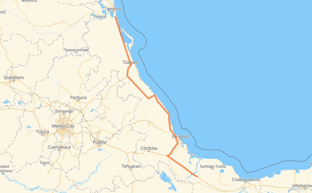
The distance from Tampico Alto to Amatepec de Vázquez (Los Pionches) is 370 miles by road including 174 miles on motorways. Road takes approximately 6 hours and 41 minutes and goes through Alto Lucero, Túxpam de Rodríguez Cano, José Cardel, La Victoria (La Peñita), La Concepcion, Vicente Herrera and Cañada Rica.
| Shortest distance by air | 299 mi ✈️ |
| Car route length | 369.7 mi 🚗 |
| Driving time | 6 h 41 min |
| Fuel amount | 12.6 gal |
| Fuel cost | 49.4 USD |
| Toll roads cost | 887 + ? MXN |
| Point | Distance | Time | Fuel | |
| Tampico Alto | 0 mi | 00 min | 0.0 gal | |
|
MEX 180 MEX 135D 89 mi, 1 h 34 min
|
||||
| Alto Lucero | 89 mi | 1 h 34 min | 2.9 gal | |
|
MEX 132 3 mi, 04 min
|
||||
| Túxpam de Rodríguez Cano | 92 mi | 1 h 38 min | 3.1 gal | |
|
MEX 132 MEX 132D 27 mi, 30 min
|
||||
| La Concepcion | 119 mi | 2 h 08 min | 4.0 gal | |
|
MEX 180D 6 mi, 07 min
|
||||
| Vicente Herrera | 126 mi | 2 h 15 min | 4.1 gal | |
|
MEX 180D 26 mi, 28 min
|
||||
| Cañada Rica | 152 mi | 2 h 44 min | 5.0 gal | |
|
MEX 180D 21 mi, 24 min
|
||||
| San Rafael, Veracruz de Ignacio de la Llave | 173 mi | 3 h 08 min | 5.6 gal | |
|
MEX 129 MEX 180 11 mi, 12 min
|
||||
| Nautla, Veracruz de Ignacio de la Llave | 183 mi | 3 h 21 min | 6.1 gal | |
|
MEX 180 71 mi, 1 h 23 min
|
||||
| José Cardel | 255 mi | 4 h 45 min | 8.7 gal | |
|
MEX 180 MEX 145D 114 mi, 1 h 55 min
|
||||
| Amatepec de Vázquez (Los Pionches) | 370 mi | 6 h 41 min | 12.6 gal | |
Frequently Asked Questions
How many toll booths are there from Tampico Alto to Amatepec de Vázquez (Los Pionches)?
There are 8 toll booths between Tampico Alto and Amatepec de Vázquez (Los Pionches): Naranjos, Tuxpan, Cardel - Posa Rica, Nautla, La Antigua, San Julián, Paso del Toro and Cosamaloapan.
How much does the toll booths cost from Tampico Alto to Amatepec de Vázquez (Los Pionches)?
Toll roads cost: Naranjos (297 MXN) + Tuxpan (45 MXN) + Cardel - Posa Rica (205 MXN) + Nautla (24 MXN) + La Antigua (?) + San Julián (?) + Paso del Toro (87 MXN) + Cosamaloapan (229 MXN) = 887 + ? MXN
How much does it cost to drive from Tampico Alto to Amatepec de Vázquez (Los Pionches)?
Fuel cost: 49.4 USD
This fuel cost is calculated as: (Route length 369.7 mi) / (Fuel consumption 29.4 mpg) * (Fuel price 3.93 USD / gal)
You can adjust fuel consumption and fuel price here.
Toll roads cost: 887 + ? MXN
How long is a car ride from Tampico Alto to Amatepec de Vázquez (Los Pionches)?
Driving time: 6 h 41 min
This time is calculated for driving at the maximum permitted speed, taking into account traffic rules restrictions.
- 11 mi with a maximum speed 68 mph = 10 min
- 121 mi with a maximum speed 62 mph = 1 h 56 min
- 94 mi with a maximum speed 56 mph = 1 h 40 min
- 143 mi with a maximum speed 50 mph = 2 h 52 min
- 1 mi with a maximum speed 31 mph = 1 min
The calculated driving time does not take into account intermediate stops and traffic jams.
How far is Tampico Alto to Amatepec de Vázquez (Los Pionches) by land?
The distance between Tampico Alto and Amatepec de Vázquez (Los Pionches) is 369.7 mi by road including 174 mi on motorways.
Precise satellite coordinates of highways were used for this calculation. The start and finish points are the centers of Tampico Alto and Amatepec de Vázquez (Los Pionches) respectively.
How far is Tampico Alto to Amatepec de Vázquez (Los Pionches) by plane?
The shortest distance (air line, as the crow flies) between Tampico Alto and Amatepec de Vázquez (Los Pionches) is 298.9 mi.
This distance is calculated using the Haversine formula as a great-circle distance between two points on the surface of a sphere. The start and finish points are the centers of Tampico Alto and Amatepec de Vázquez (Los Pionches) respectively. Actual distance between airports may be different.
How many hours is Tampico Alto from Amatepec de Vázquez (Los Pionches) by plane?
Boeing 737 airliner needs 36 min to cover the distance of 299 mi at a cruising speed of 497 mph.
Small plane "Cessna 172" needs 2 h 11 min to flight this distance at average speed of 136 mph.
This time is approximate and do not take into account takeoff and landing times, airport location and other real world factors.
How long is a helicopter ride from Tampico Alto to Amatepec de Vázquez (Los Pionches)?
Fast helicopter "Eurocopter AS350" or "Hughes OH-6 Cayuse" need 2 h to cover the distance of 299 mi at a cruising speed of 149 mph.
Popular "Robinson R44" needs 2 h 17 min to flight this distance at average speed of 130 mph.
This time is approximate and do not take into account takeoff and landing times, aerodrome location and other real world factors.
What city is halfway between Tampico Alto and Amatepec de Vázquez (Los Pionches)?
The halfway point between Tampico Alto and Amatepec de Vázquez (Los Pionches) is Nautla, Veracruz de Ignacio de la Llave. It is located about 1 mi from the exact midpoint by road.
The distance from Nautla, Veracruz de Ignacio de la Llave to Tampico Alto is 183 mi and driving will take about 3 h 21 min. The road between Nautla, Veracruz de Ignacio de la Llave and Amatepec de Vázquez (Los Pionches) has length 186 mi and will take approximately 3 h 20 min.
The other cities located close to halfway point:
- El Raudal (Raudal de las Flores) is in 190 mi from Tampico Alto and 180 mi from Amatepec de Vázquez (Los Pionches)
- El Diamante is in 196 mi from Tampico Alto and 174 mi from Amatepec de Vázquez (Los Pionches)
- San Rafael, Veracruz de Ignacio de la Llave is in 173 mi from Tampico Alto and 197 mi from Amatepec de Vázquez (Los Pionches)
Where is Tampico Alto in relation to Amatepec de Vázquez (Los Pionches)?
Tampico Alto is located 299 mi north-west of Amatepec de Vázquez (Los Pionches).
Tampico Alto has geographic coordinates: latitude 22.11358, longitude -97.80339.
Amatepec de Vázquez (Los Pionches) has geographic coordinates: latitude 18.26138, longitude -95.70639.
Which highway goes from Tampico Alto to Amatepec de Vázquez (Los Pionches)?
The route from Tampico Alto to Amatepec de Vázquez (Los Pionches) follows MEX 180, MEX 180D.
Other minor sections pass along the road:
- MEX 145D: 57 mi
- MEX 135D: 28 mi
- MEX 150D: 27 mi
- MEX: 19 mi
- MEX 129: 14 mi
- MEX 132D: 8 mi
- MEX 132: 6 mi