Distance between Tlacotalpan and San Martín de Zula
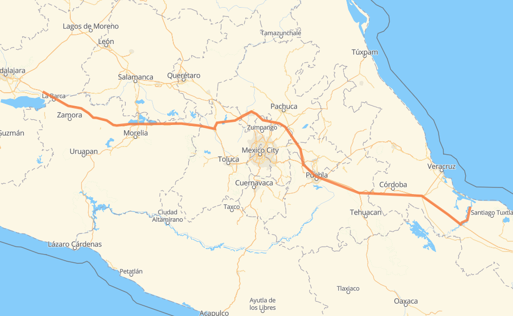
The distance from Tlacotalpan to San Martín de Zula is 586 miles by road including 554 miles on motorways. Road takes approximately 10 hours and 16 minutes and goes through Orizaba, Carlos A. Carrillo, Cosamaloapan, Ixtaczoquitlán, Nogales, Cuacnopalan and Palmarito Tochapan.
| Shortest distance by air | 477 mi ✈️ |
| Car route length | 586 mi 🚗 |
| Driving time | 10 h 16 min |
| Fuel amount | 19.9 gal |
| Fuel cost | 77.7 USD |
| Toll roads cost | 1,238 + ? MXN |
| Point | Distance | Time | Fuel | |
| Tlacotalpan | 0 mi | 00 min | 0.0 gal | |
|
MEX 175 16 mi, 19 min
|
||||
| Carlos A. Carrillo | 16 mi | 19 min | 0.0 gal | |
|
MEX 175 MEX 145D 111 mi, 1 h 49 min
|
||||
| Ixtaczoquitlán | 126 mi | 2 h 09 min | 4.3 gal | |
|
MEX 150D 3 mi, 03 min
|
||||
| Orizaba | 129 mi | 2 h 12 min | 4.3 gal | |
|
MEX 150D 4 mi, 05 min
|
||||
| Nogales | 134 mi | 2 h 18 min | 4.5 gal | |
|
MEX 150D 40 mi, 48 min
|
||||
| Cuacnopalan | 174 mi | 3 h 06 min | 5.7 gal | |
|
MEX 150D 8 mi, 09 min
|
||||
| Palmarito Tochapan | 182 mi | 3 h 15 min | 6.1 gal | |
|
MEX 150D 9 mi, 09 min
|
||||
| Acatzingo de Hidalgo | 191 mi | 3 h 24 min | 6.4 gal | |
|
MEX 150D 38 mi, 37 min
|
||||
| San Francisco Ocotlán (Ocotlán) | 228 mi | 4 h 02 min | 7.7 gal | |
|
MEX 150D MEX 15D 358 mi, 6 h 13 min
|
||||
| San Martín de Zula | 586 mi | 10 h 16 min | 19.9 gal | |
Frequently Asked Questions
How many toll booths are there from Tlacotalpan to San Martín de Zula?
There are 16 toll booths between Tlacotalpan and San Martín de Zula: Fortín, Cuitláhuac, Cosamaloapan, Ocotlán, Zinapecuaro, Contepec, Panindicuaro, Ecuandureo, Atlacomulco — Maravatio, Atlacomulco 2, San Martin Texmelucan, San Martín, Amozoc 2, Amozoc and Esperanza 27.
How much does the toll booths cost from Tlacotalpan to San Martín de Zula?
Toll roads cost: Cosamaloapan (189 MXN) + Cosamaloapan (189 MXN) + Cuitláhuac (114 MXN) + Fortín (33 MXN) + Esperanza 27 (140 MXN) + Amozoc (72 MXN) + Amozoc 2 (81 MXN) + San Martín (42 MXN) + San Martin Texmelucan (?) + Atlacomulco 2 (?) + Atlacomulco — Maravatio (50 MXN) + Contepec (?) + Zinapecuaro (161 MXN) + Panindicuaro (?) + Ecuandureo (111 MXN) + Ocotlán (56 MXN) = 1,238 + ? MXN
How much does it cost to drive from Tlacotalpan to San Martín de Zula?
Fuel cost: 77.7 USD
This fuel cost is calculated as: (Route length 586 mi) / (Fuel consumption 29.4 mpg) * (Fuel price 3.9 USD / gal)
You can adjust fuel consumption and fuel price here.
Toll roads cost: 1,238 + ? MXN
How long is a car ride from Tlacotalpan to San Martín de Zula?
Driving time: 10 h 16 min
This time is calculated for driving at the maximum permitted speed, taking into account traffic rules restrictions.
- 77 mi with a maximum speed 68 mph = 1 h 8 min
- 281 mi with a maximum speed 62 mph = 4 h 31 min
- 1 mi with a maximum speed 56 mph = 1 min
- 3 mi with a maximum speed 56 mph = 3 min
- 218 mi with a maximum speed 50 mph = 4 h 23 min
- 2 mi with a maximum speed 43 mph = 3 min
- 2 mi with a maximum speed 37 mph = 4 min
- 1 mi with a maximum speed 25 mph = 1 min
The calculated driving time does not take into account intermediate stops and traffic jams.
How far is Tlacotalpan to San Martín de Zula by land?
The distance between Tlacotalpan and San Martín de Zula is 586 mi by road including 553.6 mi on motorways.
Precise satellite coordinates of highways were used for this calculation. The start and finish points are the centers of Tlacotalpan and San Martín de Zula respectively.
How far is Tlacotalpan to San Martín de Zula by plane?
The shortest distance (air line, as the crow flies) between Tlacotalpan and San Martín de Zula is 476.6 mi.
This distance is calculated using the Haversine formula as a great-circle distance between two points on the surface of a sphere. The start and finish points are the centers of Tlacotalpan and San Martín de Zula respectively. Actual distance between airports may be different.
How many hours is Tlacotalpan from San Martín de Zula by plane?
Boeing 737 airliner needs 57 min to cover the distance of 477 mi at a cruising speed of 497 mph.
Small plane "Cessna 172" needs 3 h 29 min to flight this distance at average speed of 136 mph.
This time is approximate and do not take into account takeoff and landing times, airport location and other real world factors.
How long is a helicopter ride from Tlacotalpan to San Martín de Zula?
Fast helicopter "Eurocopter AS350" or "Hughes OH-6 Cayuse" need 3 h 11 min to cover the distance of 477 mi at a cruising speed of 149 mph.
Popular "Robinson R44" needs 3 h 39 min to flight this distance at average speed of 130 mph.
This time is approximate and do not take into account takeoff and landing times, aerodrome location and other real world factors.
What city is halfway between Tlacotalpan and San Martín de Zula?
The halfway point between Tlacotalpan and San Martín de Zula is José María Morelos (San José). It is located about 19 mi from the exact midpoint by road.
The distance from José María Morelos (San José) to Tlacotalpan is 274 mi and driving will take about 4 h 50 min. The road between José María Morelos (San José) and San Martín de Zula has length 312 mi and will take approximately 5 h 25 min.
The other cities located close to halfway point:
Where is Tlacotalpan in relation to San Martín de Zula?
Tlacotalpan is located 477 mi east of San Martín de Zula.
Tlacotalpan has geographic coordinates: latitude 18.61211, longitude -95.66116.
San Martín de Zula has geographic coordinates: latitude 20.40851, longitude -102.72781.
Which highway goes from Tlacotalpan to San Martín de Zula?
The route from Tlacotalpan to San Martín de Zula follows MEX 15D, MEX 150D, MEX M40D.
Other minor sections pass along the road:
- MEX 145D: 52 mi
- MEX 175: 30 mi
- MEX 040D: 4 mi
- MEX 140D: 1 mi