Distance between Toronto ON and Plato SK
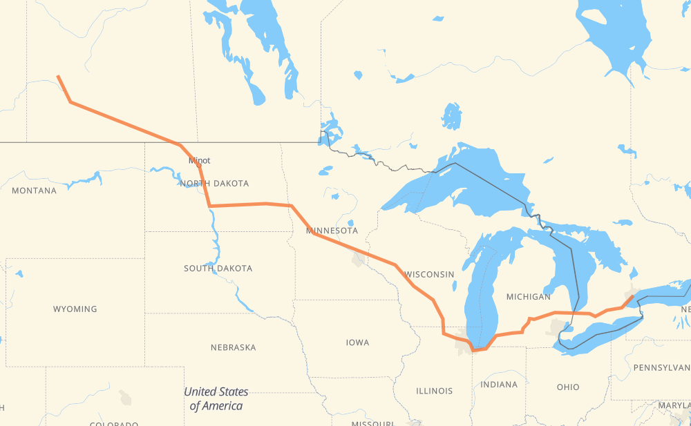
The distance from Toronto to Plato is 1,911 miles by road including 1,340 miles on motorways. Road takes approximately 30 hours and 56 minutes and goes through Mississauga, Burlington, Hamilton, Brantford, Woodstock, Sarnia and Flint.
| Shortest distance by air | 1,443 mi ✈️ |
| Car route length | 1,911.3 mi 🚗 |
| Driving time | 30 h 56 min |
| Fuel amount | 65 gal |
| Fuel cost | 255.5 USD |
| Point | Distance | Time | Fuel | |
| Toronto | 0 mi | 00 min | 0.0 gal | |
|
Gardiner 15 mi, 16 min
|
||||
| Mississauga | 15 mi | 16 min | 0.4 gal | |
|
QEW 19 mi, 17 min
|
||||
| Burlington | 34 mi | 34 min | 0.9 gal | |
|
403 7 mi, 07 min
|
||||
| Hamilton | 41 mi | 41 min | 1.3 gal | |
|
403 21 mi, 20 min
|
||||
| Brantford | 62 mi | 1 h 01 min | 2.0 gal | |
|
403 24 mi, 23 min
|
||||
| Woodstock | 86 mi | 1 h 25 min | 2.8 gal | |
|
401 402 88 mi, 1 h 20 min
|
||||
| Sarnia | 174 mi | 2 h 45 min | 5.7 gal | |
|
402 I 69 76 mi, 1 h 13 min
|
||||
| Flint | 249 mi | 3 h 58 min | 8.4 gal | |
|
I 69 62 mi, 54 min
|
||||
| Lansing | 311 mi | 4 h 52 min | 10.5 gal | |
|
I 69 63 mi, 55 min
|
||||
| Kalamazoo | 374 mi | 5 h 48 min | 12.7 gal | |
|
I 94 I 90 254 mi, 3 h 54 min
|
||||
| Janesville | 628 mi | 9 h 43 min | 21.3 gal | |
|
I 39 35 mi, 30 min
|
||||
| Madison | 663 mi | 10 h 13 min | 22.4 gal | |
|
I 39 I 94 175 mi, 2 h 35 min
|
||||
| Eau Claire | 839 mi | 12 h 49 min | 28.3 gal | |
|
I 94 322 mi, 4 h 49 min
|
||||
| Fargo | 1,161 mi | 17 h 39 min | 39.5 gal | |
|
I 94 4 mi, 04 min
|
||||
| West Fargo | 1,166 mi | 17 h 43 min | 39.6 gal | |
|
I 94 183 mi, 2 h 41 min
|
||||
| Bismarck | 1,349 mi | 20 h 25 min | 45.7 gal | |
|
US 83 98 mi, 1 h 54 min
|
||||
| Minot | 1,447 mi | 22 h 20 min | 48.8 gal | |
|
US 83 US 52 130 mi, 2 h 31 min
|
||||
| Estevan | 1,578 mi | 24 h 52 min | 53.5 gal | |
|
39A 39 54 mi, 1 h 01 min
|
||||
| Weyburn | 1,632 mi | 25 h 53 min | 54.1 gal | |
|
39 111 mi, 2 h 01 min
|
||||
| Moose Jaw | 1,743 mi | 27 h 54 min | 58.5 gal | |
|
1 91 mi, 1 h 37 min
|
||||
| Swift Current | 1,834 mi | 29 h 32 min | 62.1 gal | |
|
4 342 79 mi, 1 h 25 min
|
||||
| Plato | 1,913 mi | 30 h 57 min | 65.0 gal | |
Frequently Asked Questions
How much does it cost to drive from Toronto to Plato?
Fuel cost: 255.5 USD
This fuel cost is calculated as: (Route length 1,911.3 mi) / (Fuel consumption 29.4 mpg) * (Fuel price 3.93 USD / gal)
You can adjust fuel consumption and fuel price here.
How long is a car ride from Toronto to Plato?
Driving time: 30 h 56 min
This time is calculated for driving at the maximum permitted speed, taking into account traffic rules restrictions.
- 1,082 mi with a maximum speed 68 mph = 15 h 54 min
- 20 mi with a maximum speed 65 mph = 18 min
- 162 mi with a maximum speed 62 mph = 2 h 36 min
- 31 mi with a maximum speed 60 mph = 31 min
- 331 mi with a maximum speed 56 mph = 5 h 54 min
- 29 mi with a maximum speed 56 mph = 30 min
- 18 mi with a maximum speed 55 mph = 19 min
- 232 mi with a maximum speed 50 mph = 4 h 40 min
- 2 mi with a maximum speed 45 mph = 2 min
- 1 mi with a maximum speed 43 mph = 1 min
- 2 mi with a maximum speed 31 mph = 4 min
The calculated driving time does not take into account intermediate stops and traffic jams.
How far is Toronto to Plato by land?
The distance between Toronto and Plato is 1,911.3 mi by road including 1,339.7 mi on motorways.
Precise satellite coordinates of highways were used for this calculation. The start and finish points are the centers of Toronto and Plato respectively.
How far is Toronto to Plato by plane?
The shortest distance (air line, as the crow flies) between Toronto and Plato is 1,443.4 mi.
This distance is calculated using the Haversine formula as a great-circle distance between two points on the surface of a sphere. The start and finish points are the centers of Toronto and Plato respectively. Actual distance between airports may be different.
How many hours is Toronto from Plato by plane?
Boeing 737 airliner needs 2 h 54 min to cover the distance of 1,443 mi at a cruising speed of 497 mph.
Small plane "Cessna 172" needs 10 h 33 min to flight this distance at average speed of 136 mph.
This time is approximate and do not take into account takeoff and landing times, airport location and other real world factors.
How long is a helicopter ride from Toronto to Plato?
Fast helicopter "Eurocopter AS350" or "Hughes OH-6 Cayuse" need 9 h 40 min to cover the distance of 1,443 mi at a cruising speed of 149 mph.
Popular "Robinson R44" needs 11 h 3 min to flight this distance at average speed of 130 mph.
This time is approximate and do not take into account takeoff and landing times, aerodrome location and other real world factors.
What city is halfway between Toronto and Plato?
The halfway point between Toronto and Plato is Rogers. It is located about 3 mi from the exact midpoint by road.
The distance from Rogers to Toronto is 953 mi and driving will take about 14 h 32 min. The road between Rogers and Plato has length 959 mi and will take approximately 16 h 23 min.
The other cities located close to halfway point:
Where is Toronto in relation to Plato?
Toronto is located 1,443 mi east of Plato.
Toronto has geographic coordinates: latitude 43.65396, longitude -79.38721.
Plato has geographic coordinates: latitude 51.16368, longitude -108.44503.
Which highway goes from Toronto to Plato?
The route from Toronto to Plato follows I 94, I 90, US 52, I 69, 39, US 83, 1, I 39, 403, 402.
Other minor sections pass along the road:
- 4: 46 mi
- 342: 38 mi
- 401: 31 mi
- ND 5: 29 mi
- I 694: 29 mi
- QEW: 24 mi
- US 51: 19 mi
- 19: 16 mi
- US 41: 14 mi
- US 2: 12 mi
- US 59: 11 mi
- Gardiner: 9 mi
- ND 3: 7 mi
- 39A: 7 mi
- 18: 7 mi
- US 12: 6 mi
- ND 1: 5 mi
- 24: 5 mi
- I 96: 5 mi
- 738: 4 mi
- MN 95: 4 mi
- ND 200: 4 mi
- ND 1804: 3 mi
- MN 210: 3 mi
- US 31: 3 mi
- US 10: 3 mi
- WI 35: 2 mi
- 6: 2 mi
- US 83 Bypass: 2 mi
- US 20: 2 mi
- WI 11: 2 mi
- US 52 Truck: 2 mi
- US 281 Truck: 1 mi