Distance between Tulcingo de Valle and Depósito de Evaporación Solar "El Caracol"
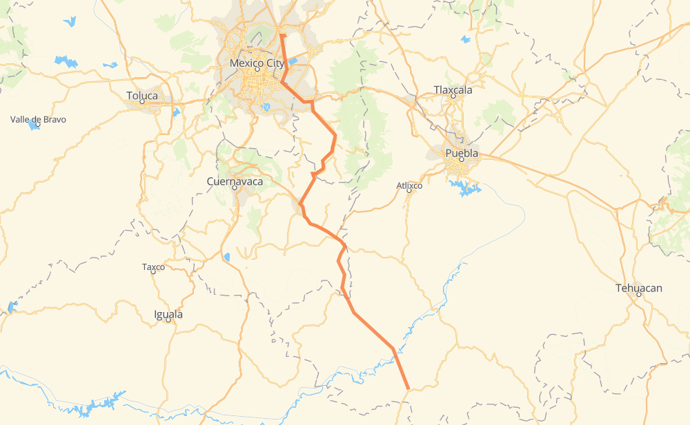
The distance from Tulcingo de Valle to Depósito de Evaporación Solar "El Caracol" is 154 miles by road including 37 miles on motorways. Road takes approximately 3 hours and 6 minutes and goes through Ciudad de Chiautla de Tapia, Axochiapan, Jonacatepec, Atlatlahucan, San Miguel Neplanta de Sor Juana Inés de la Cruz, Tepetlixpa and Chalco de Díaz Covarrubias.
| Shortest distance by air | 112 mi ✈️ |
| Car route length | 154.1 mi 🚗 |
| Driving time | 3 h 6 min |
| Fuel amount | 5.2 gal |
| Fuel cost | 20.5 USD |
| Toll roads cost | 135 MXN |
| Point | Distance | Time | Fuel | |
| Tulcingo de Valle | 0 mi | 00 min | 0.0 gal | |
|
27 mi, 31 min
|
||||
| Ciudad de Chiautla de Tapia | 27 mi | 31 min | 0.6 gal | |
|
27 mi, 33 min
|
||||
| Axochiapan | 53 mi | 1 h 04 min | 1.7 gal | |
|
MOR 031 10 mi, 13 min
|
||||
| Jonacatepec | 63 mi | 1 h 18 min | 2.1 gal | |
|
MEX 160 29 mi, 33 min
|
||||
| Atlatlahucan | 93 mi | 1 h 52 min | 3.0 gal | |
|
MEX 115 9 mi, 11 min
|
||||
| Tepetlixpa | 102 mi | 2 h 03 min | 3.2 gal | |
|
MEX 115 22 mi, 24 min
|
||||
| Chalco de Díaz Covarrubias | 124 mi | 2 h 27 min | 4.1 gal | |
|
MEX 115 2 mi, 03 min
|
||||
| Ixtapaluca | 126 mi | 2 h 31 min | 4.3 gal | |
|
MEX 150D 8 mi, 08 min
|
||||
| La Paz | 134 mi | 2 h 39 min | 4.5 gal | |
|
MEX 150D 57D 20 mi, 27 min
|
||||
| Depósito de Evaporación Solar "El Caracol" | 154 mi | 3 h 06 min | 5.0 gal | |
Frequently Asked Questions
How many toll booths are there from Tulcingo de Valle to Depósito de Evaporación Solar "El Caracol"?
There are 3 toll booths between Tulcingo de Valle and Depósito de Evaporación Solar "El Caracol": Ozumba, Ixtapaluca and Circuito Exterior Mexiquense T-2 Las Americas Conmex.
How much does the toll booths cost from Tulcingo de Valle to Depósito de Evaporación Solar "El Caracol"?
Toll roads cost: Ozumba (53 MXN) + Ixtapaluca (22 MXN) + Circuito Exterior Mexiquense T-2 Las Americas Conmex (60 MXN) = 135 MXN
How much does it cost to drive from Tulcingo de Valle to Depósito de Evaporación Solar "El Caracol"?
Fuel cost: 20.5 USD
This fuel cost is calculated as: (Route length 154.1 mi) / (Fuel consumption 29.4 mpg) * (Fuel price 3.9 USD / gal)
You can adjust fuel consumption and fuel price here.
Toll roads cost: 135 MXN
How long is a car ride from Tulcingo de Valle to Depósito de Evaporación Solar "El Caracol"?
Driving time: 3 h 6 min
This time is calculated for driving at the maximum permitted speed, taking into account traffic rules restrictions.
- 6 mi with a maximum speed 68 mph = 4 min
- 7 mi with a maximum speed 62 mph = 6 min
- 30 mi with a maximum speed 56 mph = 32 min
- 104 mi with a maximum speed 50 mph = 2 h 6 min
- 6 mi with a maximum speed 31 mph = 11 min
- 1 mi with a maximum speed 12 mph = 4 min
The calculated driving time does not take into account intermediate stops and traffic jams.
How far is Tulcingo de Valle to Depósito de Evaporación Solar "El Caracol" by land?
The distance between Tulcingo de Valle and Depósito de Evaporación Solar "El Caracol" is 154.1 mi by road including 37.3 mi on motorways.
Precise satellite coordinates of highways were used for this calculation. The start and finish points are the centers of Tulcingo de Valle and Depósito de Evaporación Solar "El Caracol" respectively.
How far is Tulcingo de Valle to Depósito de Evaporación Solar "El Caracol" by plane?
The shortest distance (air line, as the crow flies) between Tulcingo de Valle and Depósito de Evaporación Solar "El Caracol" is 111.8 mi.
This distance is calculated using the Haversine formula as a great-circle distance between two points on the surface of a sphere. The start and finish points are the centers of Tulcingo de Valle and Depósito de Evaporación Solar "El Caracol" respectively. Actual distance between airports may be different.
How many hours is Tulcingo de Valle from Depósito de Evaporación Solar "El Caracol" by plane?
Boeing 737 airliner needs 13 min to cover the distance of 112 mi at a cruising speed of 497 mph.
Small plane "Cessna 172" needs 49 min to flight this distance at average speed of 136 mph.
This time is approximate and do not take into account takeoff and landing times, airport location and other real world factors.
How long is a helicopter ride from Tulcingo de Valle to Depósito de Evaporación Solar "El Caracol"?
Fast helicopter "Eurocopter AS350" or "Hughes OH-6 Cayuse" need 45 min to cover the distance of 112 mi at a cruising speed of 149 mph.
Popular "Robinson R44" needs 51 min to flight this distance at average speed of 130 mph.
This time is approximate and do not take into account takeoff and landing times, aerodrome location and other real world factors.
What city is halfway between Tulcingo de Valle and Depósito de Evaporación Solar "El Caracol"?
The halfway point between Tulcingo de Valle and Depósito de Evaporación Solar "El Caracol" is Amayuca. It is located about 1 mi from the exact midpoint by road.
The distance from Amayuca to Tulcingo de Valle is 76 mi and driving will take about 1 h 32 min. The road between Amayuca and Depósito de Evaporación Solar "El Caracol" has length 79 mi and will take approximately 1 h 33 min.
The other cities located close to halfway point:
- Jonacatepec is in 63 mi from Tulcingo de Valle and 91 mi from Depósito de Evaporación Solar "El Caracol"
- Atlatlahucan is in 93 mi from Tulcingo de Valle and 62 mi from Depósito de Evaporación Solar "El Caracol"
- Axochiapan is in 53 mi from Tulcingo de Valle and 101 mi from Depósito de Evaporación Solar "El Caracol"
Where is Tulcingo de Valle in relation to Depósito de Evaporación Solar "El Caracol"?
Tulcingo de Valle is located 112 mi south-east of Depósito de Evaporación Solar "El Caracol".
Tulcingo de Valle has geographic coordinates: latitude 18.04582, longitude -98.44111.
Depósito de Evaporación Solar "El Caracol" has geographic coordinates: latitude 19.57055, longitude -99.00181.
Which highway goes from Tulcingo de Valle to Depósito de Evaporación Solar "El Caracol"?
The route from Tulcingo de Valle to Depósito de Evaporación Solar "El Caracol" follows MEX 115.
Other minor sections pass along the road:
- MEX 160: 20 mi
- 57D: 11 mi
- MEX 150D: 9 mi
- MOR 031: 1 mi