Distance between Vancouver BC and Yellowstone IN
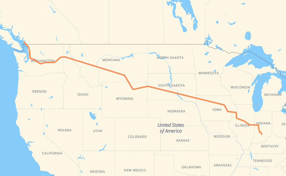
The distance from Vancouver to Yellowstone is 2,443 miles by road including 2,216 miles on motorways. Road takes approximately 37 hours and 53 minutes and goes through Bellingham, Everett, Bellevue, Moses Lake, Spokane, Coeur d'Alene and Missoula.
| Shortest distance by air | 1,934 mi ✈️ |
| Car route length | 2,443.2 mi 🚗 |
| Driving time | 37 h 53 min |
| Fuel amount | 83.1 gal |
| Fuel cost | 326.6 USD |
| Point | Distance | Time | Fuel | |
| Vancouver | 0 mi | 00 min | 0.0 gal | |
|
99 56 mi, 1 h 00 min
|
||||
| Bellingham | 56 mi | 1 h 00 min | 1.7 gal | |
|
I 5 58 mi, 54 min
|
||||
| Everett | 114 mi | 1 h 54 min | 3.7 gal | |
|
I 5 I 405 28 mi, 28 min
|
||||
| Bellevue | 142 mi | 2 h 23 min | 4.7 gal | |
|
I 405 I 90 158 mi, 2 h 21 min
|
||||
| Moses Lake | 300 mi | 4 h 44 min | 9.7 gal | |
|
I 90 113 mi, 1 h 40 min
|
||||
| Spokane | 413 mi | 6 h 25 min | 13.9 gal | |
|
I 90 32 mi, 29 min
|
||||
| Coeur d'Alene | 444 mi | 6 h 54 min | 15.0 gal | |
|
I 90 165 mi, 2 h 27 min
|
||||
| Missoula | 610 mi | 9 h 22 min | 20.7 gal | |
|
I 90 114 mi, 1 h 40 min
|
||||
| Butte | 723 mi | 11 h 03 min | 24.1 gal | |
|
I 90 226 mi, 3 h 24 min
|
||||
| Billings | 950 mi | 14 h 28 min | 32.1 gal | |
|
I 90 134 mi, 2 h 16 min
|
||||
| Sheridan | 1,084 mi | 16 h 44 min | 36.6 gal | |
|
I 90 99 mi, 1 h 27 min
|
||||
| Gillette | 1,184 mi | 18 h 12 min | 40.1 gal | |
|
I 90 97 mi, 1 h 29 min
|
||||
| Spearfish | 1,280 mi | 19 h 41 min | 43.3 gal | |
|
I 90 42 mi, 37 min
|
||||
| Rapid City | 1,322 mi | 20 h 19 min | 44.9 gal | |
|
I 90 11 mi, 10 min
|
||||
| Box Elder | 1,333 mi | 20 h 29 min | 45.2 gal | |
|
I 90 255 mi, 3 h 45 min
|
||||
| Mitchell | 1,589 mi | 24 h 15 min | 53.8 gal | |
|
I 90 75 mi, 1 h 06 min
|
||||
| Sioux Falls | 1,665 mi | 25 h 21 min | 56.4 gal | |
|
I 29 84 mi, 1 h 15 min
|
||||
| Sioux City | 1,749 mi | 26 h 37 min | 59.3 gal | |
|
US 20 Business US 20 209 mi, 3 h 32 min
|
||||
| Waterloo | 1,957 mi | 30 h 10 min | 66.5 gal | |
|
US 20 I 380 53 mi, 48 min
|
||||
| Cedar Rapids | 2,010 mi | 30 h 58 min | 68.1 gal | |
|
I 380 28 mi, 25 min
|
||||
| Iowa City | 2,038 mi | 31 h 23 min | 69.3 gal | |
|
I 80 50 mi, 44 min
|
||||
| Davenport | 2,088 mi | 32 h 07 min | 70.8 gal | |
|
I 80 I 74 98 mi, 1 h 27 min
|
||||
| Peoria | 2,185 mi | 33 h 35 min | 74.2 gal | |
|
I 74 42 mi, 38 min
|
||||
| Bloomington | 2,228 mi | 34 h 13 min | 75.7 gal | |
|
US 51 I 74 216 mi, 3 h 39 min
|
||||
| Yellowstone | 2,443 mi | 37 h 52 min | 83.1 gal | |
Frequently Asked Questions
How much does it cost to drive from Vancouver to Yellowstone?
Fuel cost: 326.6 USD
This fuel cost is calculated as: (Route length 2,443.2 mi) / (Fuel consumption 29.4 mpg) * (Fuel price 3.93 USD / gal)
You can adjust fuel consumption and fuel price here.
How long is a car ride from Vancouver to Yellowstone?
Driving time: 37 h 53 min
This time is calculated for driving at the maximum permitted speed, taking into account traffic rules restrictions.
- 1,663 mi with a maximum speed 68 mph = 24 h 27 min
- 226 mi with a maximum speed 65 mph = 3 h 29 min
- 147 mi with a maximum speed 62 mph = 2 h 22 min
- 103 mi with a maximum speed 60 mph = 1 h 43 min
- 140 mi with a maximum speed 56 mph = 2 h 29 min
- 4 mi with a maximum speed 56 mph = 4 min
- 40 mi with a maximum speed 55 mph = 43 min
- 6 mi with a maximum speed 50 mph = 7 min
- 92 mi with a maximum speed 50 mph = 1 h 51 min
- 8 mi with a maximum speed 45 mph = 10 min
- 1 mi with a maximum speed 40 mph = 1 min
- 2 mi with a maximum speed 37 mph = 2 min
- 2 mi with a maximum speed 35 mph = 4 min
- 6 mi with a maximum speed 31 mph = 10 min
- 2 mi with a maximum speed 30 mph = 3 min
- 1 mi with a maximum speed 19 mph = 1 min
The calculated driving time does not take into account intermediate stops and traffic jams.
How far is Vancouver to Yellowstone by land?
The distance between Vancouver and Yellowstone is 2,443.2 mi by road including 2,216.4 mi on motorways.
Precise satellite coordinates of highways were used for this calculation. The start and finish points are the centers of Vancouver and Yellowstone respectively.
How far is Vancouver to Yellowstone by plane?
The shortest distance (air line, as the crow flies) between Vancouver and Yellowstone is 1,934.3 mi.
This distance is calculated using the Haversine formula as a great-circle distance between two points on the surface of a sphere. The start and finish points are the centers of Vancouver and Yellowstone respectively. Actual distance between airports may be different.
How many hours is Vancouver from Yellowstone by plane?
Boeing 737 airliner needs 3 h 53 min to cover the distance of 1,934 mi at a cruising speed of 497 mph.
Small plane "Cessna 172" needs 14 h 9 min to flight this distance at average speed of 136 mph.
This time is approximate and do not take into account takeoff and landing times, airport location and other real world factors.
How long is a helicopter ride from Vancouver to Yellowstone?
Fast helicopter "Eurocopter AS350" or "Hughes OH-6 Cayuse" need 12 h 58 min to cover the distance of 1,934 mi at a cruising speed of 149 mph.
Popular "Robinson R44" needs 14 h 49 min to flight this distance at average speed of 130 mph.
This time is approximate and do not take into account takeoff and landing times, aerodrome location and other real world factors.
What city is halfway between Vancouver and Yellowstone?
The halfway point between Vancouver and Yellowstone is Linden. It is located about 9 mi from the exact midpoint by road.
The distance from Linden to Vancouver is 1,230 mi and driving will take about 18 h 51 min. The road between Linden and Yellowstone has length 1,213 mi and will take approximately 19 h 1 min.
The other cities located close to halfway point:
Where is Vancouver in relation to Yellowstone?
Vancouver is located 1,934 mi north-west of Yellowstone.
Vancouver has geographic coordinates: latitude 49.26243, longitude -123.11554.
Yellowstone has geographic coordinates: latitude 38.99893, longitude -86.34249.
Which highway goes from Vancouver to Yellowstone?
The route from Vancouver to Yellowstone follows I 90, I 74, US 20, US 14, US 87, I 5, I 29, IA 27, I 80, US 212, I 380, US 12.
Other minor sections pass along the road:
- US 395: 60 mi
- US 231: 58 mi
- US 191: 57 mi
- IL 110: 38 mi
- SD 79: 31 mi
- 99: 25 mi
- US 16: 25 mi
- US 83: 19 mi
- SR 46: 19 mi
- US 6: 18 mi
- I 405: 18 mi
- US 218: 16 mi
- SR 446: 15 mi
- MT 200: 13 mi
- US 71: 10 mi
- I 15: 7 mi
- US 51: 7 mi
- US 85: 7 mi
- US 89: 7 mi
- SD 63: 7 mi
- SD 73: 6 mi
- SD 50: 6 mi
- SD 34: 6 mi
- I 55: 6 mi
- SR 67: 6 mi
- US 20 Business: 5 mi
- US 61: 5 mi
- US 93: 5 mi
- SD 45: 4 mi
- US 97: 4 mi
- US 16 Truck: 4 mi
- SR 45: 3 mi
- US 2: 2 mi
- US 18: 2 mi
- US 59: 1 mi
- SR 32: 1 mi
- SR 47: 1 mi
- SD 37: 1 mi