Distance between Vanderkloof and Dam
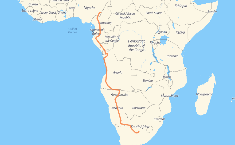
The distance from Vanderkloof to Dam is 4,255 miles by road including 67 miles on motorways. Road takes approximately 82 hours and 22 minutes and goes through Upington, Okahandja, Otjiwarongo, Ondjiva, Benguela, Lobito and Sumbe.
| Shortest distance by air | 2,766 mi ✈️ |
| Car route length | 4,255.1 mi 🚗 |
| Driving time | 82 h 22 min |
| Fuel amount | 144.7 gal |
| Fuel cost | 568.8 USD |
| Point | Distance | Time | Fuel | |
| Vanderkloof | 0 mi | 00 min | 0.0 gal | |
|
N10 354 mi, 6 h 42 min
|
||||
| Upington | 354 mi | 6 h 42 min | 11.2 gal | |
|
N10 B1 632 mi, 11 h 18 min
|
||||
| Okahandja | 985 mi | 18 h 01 min | 33.5 gal | |
|
B1 109 mi, 1 h 57 min
|
||||
| Otjiwarongo | 1,095 mi | 19 h 59 min | 37.2 gal | |
|
B1 B10 422 mi, 7 h 38 min
|
||||
| Ondjiva | 1,517 mi | 27 h 37 min | 51.2 gal | |
|
EN120 EN105 464 mi, 8 h 56 min
|
||||
| Benguela | 1,982 mi | 36 h 33 min | 67.4 gal | |
|
EN100 17 mi, 21 min
|
||||
| Lobito | 1,998 mi | 36 h 54 min | 67.9 gal | |
|
EN260 EN100 113 mi, 2 h 05 min
|
||||
| Sumbe | 2,111 mi | 39 h 00 min | 71.7 gal | |
|
EN100 517 mi, 9 h 36 min
|
||||
| M'banza Congo | 2,628 mi | 48 h 37 min | 88.6 gal | |
|
EN120 RN1 270 mi, 6 h 20 min
|
||||
| Dolisie | 2,898 mi | 54 h 57 min | 98.4 gal | |
|
P2 RN2 751 mi, 14 h 51 min
|
||||
| Ebolowa | 3,649 mi | 69 h 48 min | 124.0 gal | |
|
N 2 N2 67 mi, 1 h 21 min
|
||||
| Mbalmayo | 3,716 mi | 71 h 10 min | 126.0 gal | |
|
N2 33 mi, 39 min
|
||||
| Yaounde | 3,749 mi | 71 h 50 min | 127.4 gal | |
|
N1 N4 80 mi, 1 h 36 min
|
||||
| Bafia | 3,830 mi | 73 h 27 min | 130.0 gal | |
|
N4 166 mi, 3 h 20 min
|
||||
| Kumbo | 3,995 mi | 76 h 48 min | 135.6 gal | |
|
N11 A8 271 mi, 5 h 34 min
|
||||
| Toungo | 4,266 mi | 82 h 22 min | 145.0 gal | |
Frequently Asked Questions
How much does it cost to drive from Vanderkloof to Dam?
Fuel cost: 568.8 USD
This fuel cost is calculated as: (Route length 4,255.1 mi) / (Fuel consumption 29.4 mpg) * (Fuel price 3.93 USD / gal)
You can adjust fuel consumption and fuel price here.
How long is a car ride from Vanderkloof to Dam?
Driving time: 82 h 22 min
This time is calculated for driving at the maximum permitted speed, taking into account traffic rules restrictions.
- 29 mi with a maximum speed 68 mph = 24 min
- 22 mi with a maximum speed 62 mph = 20 min
- 2,217 mi with a maximum speed 56 mph = 39 h 35 min
- 5 mi with a maximum speed 56 mph = 5 min
- 1,839 mi with a maximum speed 50 mph = 36 h 59 min
- 3 mi with a maximum speed 43 mph = 4 min
- 9 mi with a maximum speed 37 mph = 15 min
- 141 mi with a maximum speed 31 mph = 4 h 32 min
- 1 mi with a maximum speed 12 mph = 2 min
The calculated driving time does not take into account intermediate stops and traffic jams.
How far is Vanderkloof to Dam by land?
The distance between Vanderkloof and Dam is 4,255.1 mi by road including 67.1 mi on motorways.
Precise satellite coordinates of highways were used for this calculation. The start and finish points are the centers of Vanderkloof and Dam respectively.
How far is Vanderkloof to Dam by plane?
The shortest distance (air line, as the crow flies) between Vanderkloof and Dam is 2,766.3 mi.
This distance is calculated using the Haversine formula as a great-circle distance between two points on the surface of a sphere. The start and finish points are the centers of Vanderkloof and Dam respectively. Actual distance between airports may be different.
How many hours is Vanderkloof from Dam by plane?
Boeing 737 airliner needs 5 h 33 min to cover the distance of 2,766 mi at a cruising speed of 497 mph.
Small plane "Cessna 172" needs 20 h 14 min to flight this distance at average speed of 136 mph.
This time is approximate and do not take into account takeoff and landing times, airport location and other real world factors.
How long is a helicopter ride from Vanderkloof to Dam?
Fast helicopter "Eurocopter AS350" or "Hughes OH-6 Cayuse" need 18 h 33 min to cover the distance of 2,766 mi at a cruising speed of 149 mph.
Popular "Robinson R44" needs 21 h 12 min to flight this distance at average speed of 130 mph.
This time is approximate and do not take into account takeoff and landing times, aerodrome location and other real world factors.
What city is halfway between Vanderkloof and Dam?
The halfway point between Vanderkloof and Dam is Sumbe. It is located about 16 mi from the exact midpoint by road.
The distance from Sumbe to Vanderkloof is 2,111 mi and driving will take about 38 h 59 min. The road between Sumbe and Dam has length 2,144 mi and will take approximately 43 h 22 min.
The other cities located close to halfway point:
Where is Vanderkloof in relation to Dam?
Vanderkloof is located 2,766 mi south-east of Dam.
Vanderkloof has geographic coordinates: latitude -29.9975, longitude 24.74056.
Dam has geographic coordinates: latitude 8.11666, longitude 12.03333.
Which highway goes from Vanderkloof to Dam?
The route from Vanderkloof to Dam follows B1, EN100, EN105, N10, RN1, RN2, A8, B10, N2, B15, B3, EN120, RN 3, N4, R48.
Other minor sections pass along the road:
- P2: 60 mi
- EN260: 58 mi
- EN215: 51 mi
- A1: 33 mi
- RS107: 33 mi
- P 26: 30 mi
- P20: 30 mi
- EN100A: 27 mi
- N 4: 25 mi
- P15: 22 mi
- N1: 21 mi
- N11: 20 mi
- EN280: 20 mi
- EN110: 19 mi
- N6: 16 mi
- RN12: 16 mi
- N 2: 16 mi
- RN 6: 12 mi
- N 11: 11 mi
- P26: 9 mi
- RS108: 9 mi
- RN15: 8 mi
- N3: 3 mi
- RS103: 1 mi
- P 15: 1 mi
- EN372: 1 mi
- RP101: 1 mi
- N12: 1 mi
- D79: 1 mi