Distance between Wayne NE and Niagara Falls NY
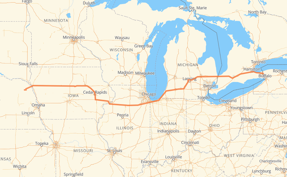
The distance from Wayne to Niagara Falls is 1,067 miles by road including 902 miles on motorways. Road takes approximately 16 hours and 49 minutes and goes through Sioux City, Waterloo, Cedar Rapids, Iowa City, Davenport, Peru and Joliet.
| Shortest distance by air | 915 mi ✈️ |
| Car route length | 1,066.9 mi 🚗 |
| Driving time | 16 h 49 min |
| Fuel amount | 36.3 gal |
| Fuel cost | 141.5 USD |
| Point | Distance | Time | Fuel | |
| Wayne | 0 mi | 00 min | 0.0 gal | |
|
NE 35 46 mi, 49 min
|
||||
| Sioux City | 46 mi | 49 min | 1.5 gal | |
|
US 75 US 20 207 mi, 3 h 29 min
|
||||
| Waterloo | 253 mi | 4 h 18 min | 8.5 gal | |
|
US 20 I 380 53 mi, 48 min
|
||||
| Cedar Rapids | 306 mi | 5 h 06 min | 10.1 gal | |
|
I 380 28 mi, 25 min
|
||||
| Iowa City | 334 mi | 5 h 32 min | 11.3 gal | |
|
I 80 49 mi, 43 min
|
||||
| Davenport | 383 mi | 6 h 16 min | 12.8 gal | |
|
I 280 I 80 86 mi, 1 h 16 min
|
||||
| Peru | 469 mi | 7 h 32 min | 15.9 gal | |
|
I 80 59 mi, 53 min
|
||||
| Joliet | 528 mi | 8 h 25 min | 17.9 gal | |
|
I 80 I 94 153 mi, 2 h 22 min
|
||||
| Kalamazoo | 681 mi | 10 h 48 min | 23.1 gal | |
|
I 94 I 69 65 mi, 56 min
|
||||
| Lansing | 746 mi | 11 h 45 min | 25.3 gal | |
|
I 69 62 mi, 54 min
|
||||
| Flint | 807 mi | 12 h 39 min | 27.4 gal | |
|
I 69 76 mi, 1 h 14 min
|
||||
| Sarnia | 884 mi | 13 h 54 min | 29.9 gal | |
|
402 88 mi, 1 h 20 min
|
||||
| Woodstock | 971 mi | 15 h 14 min | 32.9 gal | |
|
401 403 24 mi, 23 min
|
||||
| Brantford | 995 mi | 15 h 38 min | 33.7 gal | |
|
403 QEW 55 mi, 52 min
|
||||
| St. Catharines | 1,050 mi | 16 h 30 min | 35.6 gal | |
|
QEW 405 17 mi, 18 min
|
||||
| Niagara Falls | 1,067 mi | 16 h 49 min | 36.2 gal | |
Frequently Asked Questions
How much does it cost to drive from Wayne to Niagara Falls?
Fuel cost: 141.5 USD
This fuel cost is calculated as: (Route length 1,066.9 mi) / (Fuel consumption 29.4 mpg) * (Fuel price 3.9 USD / gal)
You can adjust fuel consumption and fuel price here.
How long is a car ride from Wayne to Niagara Falls?
Driving time: 16 h 49 min
This time is calculated for driving at the maximum permitted speed, taking into account traffic rules restrictions.
- 541 mi with a maximum speed 68 mph = 7 h 57 min
- 140 mi with a maximum speed 65 mph = 2 h 8 min
- 157 mi with a maximum speed 62 mph = 2 h 31 min
- 7 mi with a maximum speed 60 mph = 7 min
- 153 mi with a maximum speed 56 mph = 2 h 44 min
- 12 mi with a maximum speed 56 mph = 12 min
- 47 mi with a maximum speed 55 mph = 50 min
- 6 mi with a maximum speed 50 mph = 6 min
- 1 mi with a maximum speed 45 mph = 2 min
- 1 mi with a maximum speed 43 mph = 1 min
- 1 mi with a maximum speed 31 mph = 1 min
- 1 mi with a maximum speed 30 mph = 1 min
- 1 mi with a maximum speed 25 mph = 2 min
The calculated driving time does not take into account intermediate stops and traffic jams.
How far is Wayne to Niagara Falls by land?
The distance between Wayne and Niagara Falls is 1,066.9 mi by road including 901.6 mi on motorways.
Precise satellite coordinates of highways were used for this calculation. The start and finish points are the centers of Wayne and Niagara Falls respectively.
How far is Wayne to Niagara Falls by plane?
The shortest distance (air line, as the crow flies) between Wayne and Niagara Falls is 914.7 mi.
This distance is calculated using the Haversine formula as a great-circle distance between two points on the surface of a sphere. The start and finish points are the centers of Wayne and Niagara Falls respectively. Actual distance between airports may be different.
How many hours is Wayne from Niagara Falls by plane?
Boeing 737 airliner needs 1 h 50 min to cover the distance of 915 mi at a cruising speed of 497 mph.
Small plane "Cessna 172" needs 6 h 41 min to flight this distance at average speed of 136 mph.
This time is approximate and do not take into account takeoff and landing times, airport location and other real world factors.
How long is a helicopter ride from Wayne to Niagara Falls?
Fast helicopter "Eurocopter AS350" or "Hughes OH-6 Cayuse" need 6 h 8 min to cover the distance of 915 mi at a cruising speed of 149 mph.
Popular "Robinson R44" needs 7 h to flight this distance at average speed of 130 mph.
This time is approximate and do not take into account takeoff and landing times, aerodrome location and other real world factors.
What city is halfway between Wayne and Niagara Falls?
The halfway point between Wayne and Niagara Falls is New Lenox.
The distance from New Lenox to Wayne is 533 mi and driving will take about 8 h 30 min. The road between New Lenox and Niagara Falls has length 534 mi and will take approximately 8 h 19 min.
The other cities located close to halfway point:
Where is Wayne in relation to Niagara Falls?
Wayne is located 915 mi west of Niagara Falls.
Wayne has geographic coordinates: latitude 42.23432, longitude -97.01971.
Niagara Falls has geographic coordinates: latitude 43.10309, longitude -79.03026.
Which highway goes from Wayne to Niagara Falls?
The route from Wayne to Niagara Falls follows US 20, I 80, I 69, I 94, IA 27, I 380, 402.
Other minor sections pass along the road:
- 403: 40 mi
- NE 35: 36 mi
- US 6: 35 mi
- 401: 31 mi
- QEW: 31 mi
- I 280: 27 mi
- US 218: 16 mi
- US 71: 10 mi
- I 74: 9 mi
- NE 9: 7 mi
- US 75: 7 mi
- 405: 6 mi
- US 61: 6 mi
- I 294: 6 mi
- 24: 5 mi
- I 96: 4 mi
- I 129: 3 mi
- US 31: 3 mi
- NE 110: 2 mi
- I 190: 2 mi
- US 59: 1 mi
- NY 61: 1 mi
- NY 31: 1 mi
- US 41: 1 mi