Distance between Weizelsdorf and Sankt Gotthard im Mühlkreis
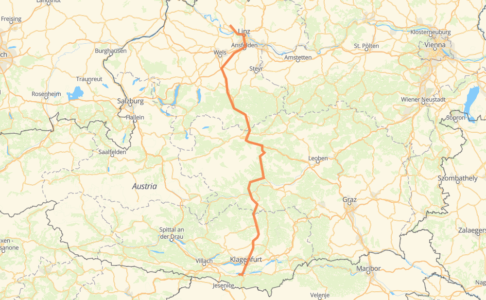
The distance from Weizelsdorf to Sankt Gotthard im Mühlkreis is 176 miles by road including 75 miles on motorways. Road takes approximately 3 hours and 18 minutes and goes through Linz, Ferlach, Annabichl, Althofen, Straßburg, Mariahof - Ortsteil Bahnhof and Trieben.
| Shortest distance by air | 127 mi ✈️ |
| Car route length | 175.8 mi 🚗 |
| Driving time | 3 h 18 min |
| Fuel amount | 6 gal |
| Fuel cost | 23.5 USD |
| Point | Distance | Time | Fuel | |
| Weizelsdorf | 0 mi | 00 min | 0.0 gal | |
|
B85 2 mi, 02 min
|
||||
| Ferlach | 2 mi | 02 min | 0.0 gal | |
|
B85 B91 10 mi, 15 min
|
||||
| Annabichl | 12 mi | 17 min | 0.4 gal | |
|
S37 19 mi, 21 min
|
||||
| Althofen | 30 mi | 39 min | 1.0 gal | |
|
B317 20 mi, 23 min
|
||||
| Mariahof - Ortsteil Bahnhof | 50 mi | 1 h 03 min | 1.7 gal | |
|
L513 B114 38 mi, 45 min
|
||||
| Trieben | 88 mi | 1 h 48 min | 2.9 gal | |
|
B114 6 mi, 06 min
|
||||
| Rottenmann | 94 mi | 1 h 54 min | 3.1 gal | |
|
A9 6 mi, 05 min
|
||||
| Liezen | 100 mi | 1 h 59 min | 3.3 gal | |
|
A9 66 mi, 1 h 03 min
|
||||
| Linz | 166 mi | 3 h 03 min | 5.6 gal | |
|
B127 10 mi, 15 min
|
||||
| Sankt Gotthard im Mühlkreis | 176 mi | 3 h 18 min | 6.0 gal | |
Frequently Asked Questions
How much does it cost to drive from Weizelsdorf to Sankt Gotthard im Mühlkreis?
Fuel cost: 23.5 USD
This fuel cost is calculated as: (Route length 175.8 mi) / (Fuel consumption 29.4 mpg) * (Fuel price 3.93 USD / gal)
You can adjust fuel consumption and fuel price here.
How long is a car ride from Weizelsdorf to Sankt Gotthard im Mühlkreis?
Driving time: 3 h 18 min
This time is calculated for driving at the maximum permitted speed, taking into account traffic rules restrictions.
- 42 mi with a maximum speed 68 mph = 36 min
- 30 mi with a maximum speed 62 mph = 29 min
- 63 mi with a maximum speed 56 mph = 1 h 7 min
- 11 mi with a maximum speed 50 mph = 12 min
- 13 mi with a maximum speed 43 mph = 18 min
- 16 mi with a maximum speed 31 mph = 30 min
- 1 mi with a maximum speed 19 mph = 3 min
The calculated driving time does not take into account intermediate stops and traffic jams.
How far is Weizelsdorf to Sankt Gotthard im Mühlkreis by land?
The distance between Weizelsdorf and Sankt Gotthard im Mühlkreis is 175.8 mi by road including 74.6 mi on motorways.
Precise satellite coordinates of highways were used for this calculation. The start and finish points are the centers of Weizelsdorf and Sankt Gotthard im Mühlkreis respectively.
How far is Weizelsdorf to Sankt Gotthard im Mühlkreis by plane?
The shortest distance (air line, as the crow flies) between Weizelsdorf and Sankt Gotthard im Mühlkreis is 127.4 mi.
This distance is calculated using the Haversine formula as a great-circle distance between two points on the surface of a sphere. The start and finish points are the centers of Weizelsdorf and Sankt Gotthard im Mühlkreis respectively. Actual distance between airports may be different.
How many hours is Weizelsdorf from Sankt Gotthard im Mühlkreis by plane?
Boeing 737 airliner needs 15 min to cover the distance of 127 mi at a cruising speed of 497 mph.
Small plane "Cessna 172" needs 55 min to flight this distance at average speed of 136 mph.
This time is approximate and do not take into account takeoff and landing times, airport location and other real world factors.
How long is a helicopter ride from Weizelsdorf to Sankt Gotthard im Mühlkreis?
Fast helicopter "Eurocopter AS350" or "Hughes OH-6 Cayuse" need 51 min to cover the distance of 127 mi at a cruising speed of 149 mph.
Popular "Robinson R44" needs 58 min to flight this distance at average speed of 130 mph.
This time is approximate and do not take into account takeoff and landing times, aerodrome location and other real world factors.
What city is halfway between Weizelsdorf and Sankt Gotthard im Mühlkreis?
The halfway point between Weizelsdorf and Sankt Gotthard im Mühlkreis is Trieben.
The distance from Trieben to Weizelsdorf is 88 mi and driving will take about 1 h 47 min. The road between Trieben and Sankt Gotthard im Mühlkreis has length 88 mi and will take approximately 1 h 31 min.
The other cities located close to halfway point:
Where is Weizelsdorf in relation to Sankt Gotthard im Mühlkreis?
Weizelsdorf is located 127 mi south of Sankt Gotthard im Mühlkreis.
Weizelsdorf has geographic coordinates: latitude 46.53528, longitude 14.22676.
Sankt Gotthard im Mühlkreis has geographic coordinates: latitude 48.38019, longitude 14.13248.