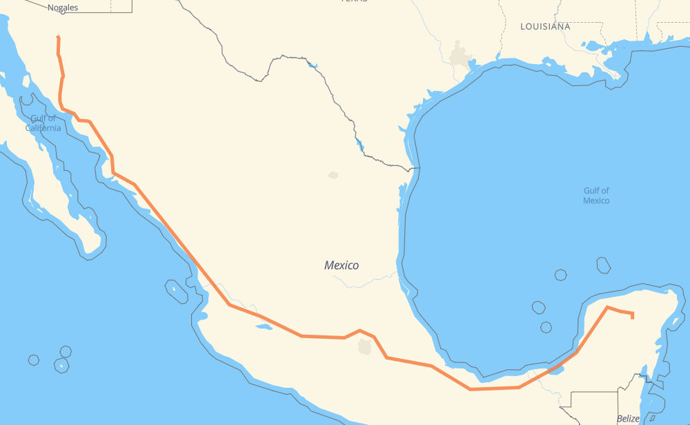
Distance between Xkopteil and Rancho Seco
The distance from Xkopteil to Rancho Seco is 2,184 miles by road including 1,696 miles on motorways. Road takes approximately 38 hours and 38 minutes and goes through Kanasín, Mérida, Orizaba, Tonalá, Tepic, Dimas (Estación Dimas) and Gabriel Leyva Solano.
| Shortest distance by air | 1,565 mi ✈️ |
| Car route length | 2,184.1 mi 🚗 |
| Driving time | 38 h 38 min |
| Fuel amount | 74.3 gal |
| Fuel cost | 292 USD |
| Toll roads cost | 3,358 + ? MXN |
| Point | Distance | Time | Fuel | |
| Xkopteil | 0 mi | 00 min | 0.0 gal | |
|
MEX 180 84 mi, 1 h 48 min
|
||||
| Kanasín | 84 mi | 1 h 48 min | 2.8 gal | |
|
MEX 180 7 mi, 07 min
|
||||
| Mérida | 91 mi | 1 h 55 min | 2.9 gal | |
|
MEX 180 644 mi, 11 h 27 min
|
||||
| Orizaba | 734 mi | 13 h 23 min | 24.9 gal | |
|
MEX 150D MEX 15D 492 mi, 8 h 45 min
|
||||
| Tonalá | 1,227 mi | 22 h 08 min | 41.6 gal | |
|
MEX 15D 138 mi, 2 h 17 min
|
||||
| Tepic | 1,365 mi | 24 h 26 min | 46.2 gal | |
|
MEX 15D 207 mi, 3 h 22 min
|
||||
| Dimas (Estación Dimas) | 1,571 mi | 27 h 48 min | 53.2 gal | |
|
MEX 15D 180 mi, 3 h 10 min
|
||||
| Gabriel Leyva Solano | 1,751 mi | 30 h 58 min | 59.3 gal | |
|
MEX 15D 27 mi, 31 min
|
||||
| Los Mochis | 1,778 mi | 31 h 30 min | 60.4 gal | |
|
MEX 15D 99 mi, 1 h 55 min
|
||||
| Navojoa | 1,877 mi | 33 h 25 min | 63.7 gal | |
|
MEX 15D 201 mi, 3 h 24 min
|
||||
| Hermosillo | 2,077 mi | 36 h 50 min | 70.6 gal | |
|
MEX 15 MEX 15D 107 mi, 1 h 47 min
|
||||
| Santa Ana | 2,184 mi | 38 h 38 min | 74.2 gal | |
Frequently Asked Questions
How many toll booths are there from Xkopteil to Rancho Seco?
There are 43 toll booths between Xkopteil and Rancho Seco: Hermosillo, Guaymas, Libramiento Cd Obregon, Fundicion, Estacion Don La Jaula, Fortín, Cuitláhuac, Cosamaloapan, Acayucan, Antonio Dovali, San Miguel, Sinaloa, Las Brisas, San Pedro km 197+100, Costa Rica, Marmol, El Rosario, Acaponeta, Ruiz, Trapichillo, Santa Maria del Oro, Plan de Barrancas, La Joya, Ocotlán, Zinapecuaro, Contepec, Panindicuaro, Ecuandureo, Atlacomulco — Maravatio, Atlacomulco 2, San Martin Texmelucan, San Martín, Amozoc 2, Amozoc, Esperanza 27, Sánchez Magallanes, Villahermosa Nacajuca, Zacatal, Unidad, Seybaplaya, Pisté, Arenal and El Pisal.
How much does the toll booths cost from Xkopteil to Rancho Seco?
Toll roads cost: Pisté (?) + Seybaplaya (77 MXN) + Unidad (?) + Zacatal (90 MXN) + Villahermosa Nacajuca (62 MXN) + Sánchez Magallanes (82 MXN) + Antonio Dovali (20 MXN) + Acayucan (?) + Cosamaloapan (229 MXN) + Cuitláhuac (114 MXN) + Fortín (33 MXN) + Esperanza 27 (140 MXN) + Amozoc (72 MXN) + Amozoc 2 (81 MXN) + San Martín (42 MXN) + San Martin Texmelucan (?) + Atlacomulco 2 (?) + Atlacomulco — Maravatio (50 MXN) + Contepec (?) + Zinapecuaro (161 MXN) + Panindicuaro (?) + Ecuandureo (111 MXN) + Ocotlán (226 MXN) + La Joya (?) + Arenal (131 MXN) + Plan de Barrancas (195 MXN) + Santa Maria del Oro (115 MXN) + Trapichillo (80 MXN) + Ruiz (?) + Acaponeta (240 MXN) + El Rosario (140 MXN) + Marmol (131 MXN) + Costa Rica (152 MXN) + San Pedro km 197+100 (34 MXN) + El Pisal (73 MXN) + Las Brisas (76 MXN) + Sinaloa (24 MXN) + San Miguel (69 MXN) + Estacion Don La Jaula (90 MXN) + Fundicion (90 MXN) + Libramiento Cd Obregon (?) + Guaymas (38 MXN) + Hermosillo (90 MXN) = 3,358 + ? MXN
How much does it cost to drive from Xkopteil to Rancho Seco?
Fuel cost: 292 USD
This fuel cost is calculated as: (Route length 2,184.1 mi) / (Fuel consumption 29.4 mpg) * (Fuel price 3.93 USD / gal)
You can adjust fuel consumption and fuel price here.
Toll roads cost: 3,358 + ? MXN
How long is a car ride from Xkopteil to Rancho Seco?
Driving time: 38 h 38 min
This time is calculated for driving at the maximum permitted speed, taking into account traffic rules restrictions.
- 361 mi with a maximum speed 68 mph = 5 h 18 min
- 770 mi with a maximum speed 62 mph = 12 h 23 min
- 141 mi with a maximum speed 56 mph = 2 h 31 min
- 101 mi with a maximum speed 56 mph = 1 h 48 min
- 774 mi with a maximum speed 50 mph = 15 h 34 min
- 10 mi with a maximum speed 43 mph = 13 min
- 12 mi with a maximum speed 37 mph = 20 min
- 12 mi with a maximum speed 31 mph = 24 min
- 1 mi with a maximum speed 25 mph = 3 min
The calculated driving time does not take into account intermediate stops and traffic jams.
How far is Xkopteil to Rancho Seco by land?
The distance between Xkopteil and Rancho Seco is 2,184.1 mi by road including 1,695.7 mi on motorways.
Precise satellite coordinates of highways were used for this calculation. The start and finish points are the centers of Xkopteil and Rancho Seco respectively.
How far is Xkopteil to Rancho Seco by plane?
The shortest distance (air line, as the crow flies) between Xkopteil and Rancho Seco is 1,564.6 mi.
This distance is calculated using the Haversine formula as a great-circle distance between two points on the surface of a sphere. The start and finish points are the centers of Xkopteil and Rancho Seco respectively. Actual distance between airports may be different.
How many hours is Xkopteil from Rancho Seco by plane?
Boeing 737 airliner needs 3 h 8 min to cover the distance of 1,565 mi at a cruising speed of 497 mph.
Small plane "Cessna 172" needs 11 h 26 min to flight this distance at average speed of 136 mph.
This time is approximate and do not take into account takeoff and landing times, airport location and other real world factors.
How long is a helicopter ride from Xkopteil to Rancho Seco?
Fast helicopter "Eurocopter AS350" or "Hughes OH-6 Cayuse" need 10 h 29 min to cover the distance of 1,565 mi at a cruising speed of 149 mph.
Popular "Robinson R44" needs 11 h 59 min to flight this distance at average speed of 130 mph.
This time is approximate and do not take into account takeoff and landing times, aerodrome location and other real world factors.
What city is halfway between Xkopteil and Rancho Seco?
The halfway point between Xkopteil and Rancho Seco is Tanimireche. It is located about 2 mi from the exact midpoint by road.
The distance from Tanimireche to Xkopteil is 1,091 mi and driving will take about 19 h 34 min. The road between Tanimireche and Rancho Seco has length 1,094 mi and will take approximately 19 h 3 min.
The other cities located close to halfway point:
Where is Xkopteil in relation to Rancho Seco?
Xkopteil is located 1,565 mi south-east of Rancho Seco.
Xkopteil has geographic coordinates: latitude 20.5131, longitude -88.58087.
Rancho Seco has geographic coordinates: latitude 30.5555, longitude -111.139.
Which highway goes from Xkopteil to Rancho Seco?
The route from Xkopteil to Rancho Seco follows MEX 15D, MEX 180, MEX 150D, MEX 145D, MEX M40D, MEX 180D.
Other minor sections pass along the road:
- MEX 15: 23 mi
- MEX 90: 21 mi
- MEX 70: 21 mi
- MEX 80D: 11 mi
- MEX 80: 7 mi
- MEX 23: 5 mi
- MEX 040D: 4 mi
- MEX 15d: 2 mi
- MEX 2D: 2 mi
- MEX 140D: 1 mi