Distance between Avrillé and Gex

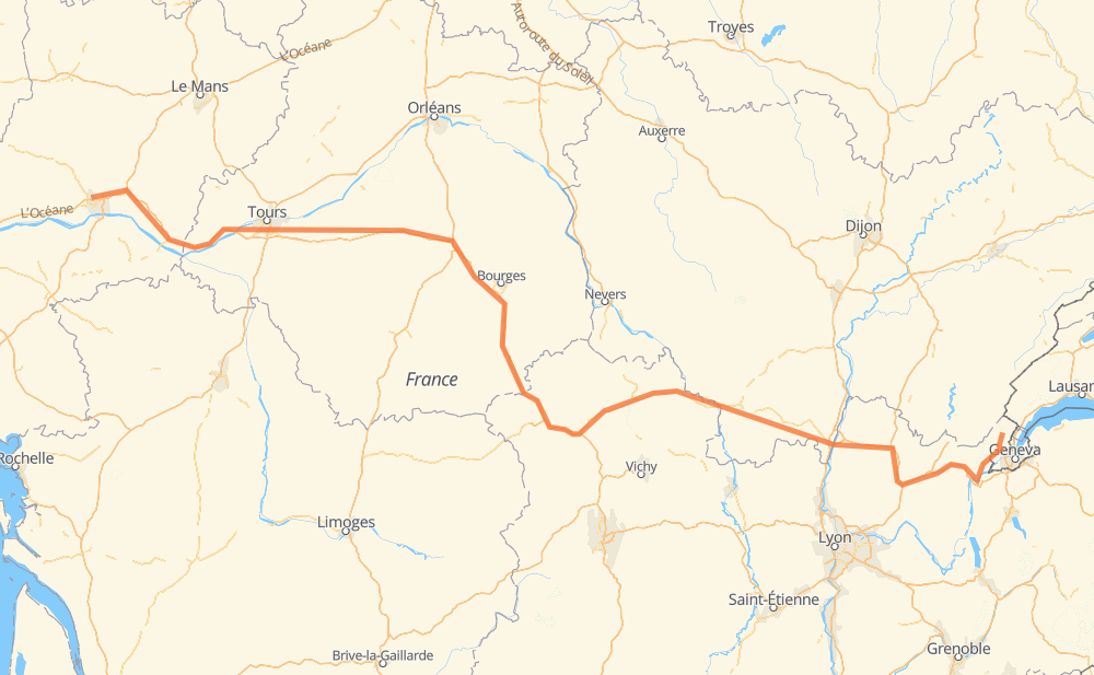
The distance from Avrillé to Gex is 431 miles by road including 298 miles on motorways. Road takes approximately 7 hours and 1 minute and goes through Angers, Joué-lès-Tours, Vierzon, Bourges, Digoin, Paray-le-Monial and Mâcon.

There are tolls on the route.
Shortest distance by air 324 mi ✈️
Car route length 430.6 mi 🚗
Driving time 7 h 1 min
Fuel amount 14.6 gal
Fuel cost 57.1 USD
Click here to load the interactive map
Compare this route in other services:
City
Town
Village
Hamlet
Motorway
Primary
Secondary
Unclassified
Point Distance Time Fuel
Avrillé 0 mi 0:00 00 min 0.0 gal
3 mi, 04 min
Angers 3 mi 0:04 04 min 0.0 gal
A 11 A 85 70 mi, 1 h 03 min
Joué-lès-Tours 73 mi 1:07 1 h 07 min 2.4 gal
A 85 73 mi, 1 h 05 min
Vierzon 146 mi 2:12 2 h 12 min 4.8 gal
A 71 22 mi, 19 min
Bourges 168 mi 2:32 2 h 32 min 5.6 gal
A 71 123 mi, 2 h 05 min
Digoin 291 mi 4:37 4 h 37 min 9.8 gal
N 79 4 mi, 04 min
Paray-le-Monial 295 mi 4:41 4 h 41 min 10.0 gal
N 79 41 mi, 46 min
Mâcon 336 mi 5:28 5 h 28 min 11.4 gal
A 406 A 40 70 mi, 1 h 02 min
Bellegarde-sur-Valserine 406 mi 6:30 6 h 30 min 13.8 gal
D 1206 D 884 24 mi, 29 min
Gex 431 mi 7:00 7 h 00 min 14.6 gal
City
Town
Village
Hamlet
Motorway
Primary
Secondary
Unclassified
Point Distance Time Fuel
Avrillé 0 mi 0:00 00 min 0.0 gal
3 mi, 04 min
Angers 3 mi 0:04 04 min 0.0 gal
A 11 6 mi, 06 min
Pellouailles-les-Vignes 9 mi 0:10 10 min 0.3 gal
A 11 9 mi, 08 min
Fontaine-Milon 19 mi 0:19 19 min 0.5 gal
A 85 15 mi, 13 min
Les Chauvinières 34 mi 0:32 32 min 1.0 gal
A 85 9 mi, 08 min
Allonnes 43 mi 0:40 40 min 1.3 gal
A 85 10 mi, 08 min
La Grande Varenne 53 mi 0:49 49 min 1.8 gal
A 85 1 mi, 00 min
La Perrée 54 mi 0:50 50 min 1.8 gal
A 85 2 mi, 02 min
Fouillé 57 mi 0:52 52 min 1.9 gal
A 85 5 mi, 04 min
Bresne 62 mi 0:56 56 min 2.0 gal
A 85 3 mi, 03 min
La Bertellerie 65 mi 0:59 59 min 2.2 gal
A 85 2 mi, 02 min
La Gatinière 67 mi 1:02 1 h 02 min 2.2 gal
A 85 6 mi, 05 min
Joué-lès-Tours 73 mi 1:07 1 h 07 min 2.4 gal
A 85 4 mi, 04 min
Juche-Perdrix 78 mi 1:11 1 h 11 min 2.6 gal
A 85 9 mi, 07 min
Les Grandes Maisons 86 mi 1:19 1 h 19 min 2.8 gal
A 85 14 mi, 12 min
Le Moulin Bodeau 101 mi 1:31 1 h 31 min 3.2 gal
A 85 7 mi, 06 min
Mareuil-sur-Cher 107 mi 1:37 1 h 37 min 3.6 gal
A 85 3 mi, 03 min
Saint-Romain-sur-Cher 111 mi 1:40 1 h 40 min 3.7 gal
A 85 35 mi, 31 min
Vierzon 146 mi 2:12 2 h 12 min 4.8 gal
A 71 6 mi, 04 min
Foëcy 151 mi 2:17 2 h 17 min 5.1 gal
A 71 2 mi, 02 min
La Chevalerie 154 mi 2:19 2 h 19 min 5.2 gal
A 71 14 mi, 12 min
Bourges 168 mi 2:32 2 h 32 min 5.6 gal
A 71 7 mi, 06 min
Lissay-Lochy 175 mi 2:38 2 h 38 min 5.8 gal
A 71 12 mi, 10 min
Farges-Allichamps 187 mi 2:48 2 h 48 min 6.3 gal
A 71 3 mi, 02 min
Nozières 190 mi 2:51 2 h 51 min 6.4 gal
A 71 4 mi, 03 min
Soye 194 mi 2:54 2 h 54 min 6.5 gal
A 71 6 mi, 05 min
Les Tonnelles 201 mi 3:00 3 h 00 min 6.7 gal
A 71 32 mi, 28 min
Les Bouis 232 mi 3:28 3 h 28 min 7.9 gal
A 71 N 79 1 mi, 01 min
Les Beauforts 234 mi 3:30 3 h 30 min 7.9 gal
N 79 1 mi, 01 min
Brunatière 235 mi 3:31 3 h 31 min 8.0 gal
N 79 7 mi, 08 min
Les Ébaudis 242 mi 3:40 3 h 40 min 8.2 gal
N 79 4 mi, 03 min
Cressanges 246 mi 3:44 3 h 44 min 8.3 gal
N 79 6 mi, 05 min
Besson 252 mi 3:50 3 h 50 min 8.5 gal
N 79 11 mi, 12 min
Montbeugny 262 mi 4:03 4 h 03 min 8.8 gal
N 79 21 mi, 25 min
Au Petit Bois 283 mi 4:28 4 h 28 min 9.6 gal
N 79 2 mi, 01 min
Les Loges de Sept-Fonds 285 mi 4:30 4 h 30 min 9.7 gal
N 79 4 mi, 04 min
Les Canches 289 mi 4:34 4 h 34 min 9.8 gal
N 79 2 mi, 02 min
Digoin 291 mi 4:37 4 h 37 min 9.8 gal
N 79 4 mi, 04 min
Paray-le-Monial 295 mi 4:41 4 h 41 min 10.0 gal
N 79 2 mi, 02 min
Volesvres 298 mi 4:43 4 h 43 min 10.1 gal
N 79 1 mi, 01 min
Les Cadolles 299 mi 4:45 4 h 45 min 10.1 gal
N 79 5 mi, 05 min
Charolles 304 mi 4:50 4 h 50 min 10.3 gal
N 79 3 mi, 03 min
Vendenesse-lès-Charolles 307 mi 4:54 4 h 54 min 10.4 gal
N 79 4 mi, 04 min
La Gare 311 mi 4:59 4 h 59 min 10.6 gal
N 79 1 mi, 00 min
Les Grands Noyers 313 mi 5:00 5 h 00 min 10.6 gal
N 79 2 mi, 02 min
Verosvres 314 mi 5:02 5 h 02 min 10.7 gal
N 79 2 mi, 01 min
Chalanforge 316 mi 5:04 5 h 04 min 10.7 gal
N 79 1 mi, 00 min
Le Pas des Places 317 mi 5:04 5 h 04 min 10.8 gal
N 79 1 mi, 00 min
Chandon 317 mi 5:05 5 h 05 min 10.8 gal
N 79 1 mi, 01 min
Les Prioles 318 mi 5:06 5 h 06 min 10.8 gal
N 79 2 mi, 02 min
Les Rasses 320 mi 5:08 5 h 08 min 10.8 gal
N 79 2 mi, 02 min
Clermain 322 mi 5:10 5 h 10 min 10.9 gal
N 79 1 mi, 01 min
Moulin de la Roche 323 mi 5:12 5 h 12 min 11.0 gal
N 79 1 mi, 01 min
Sainte-Cécile 324 mi 5:13 5 h 13 min 11.0 gal
N 79 4 mi, 04 min
La Roche 328 mi 5:17 5 h 17 min 11.1 gal
N 79 2 mi, 02 min
Sologny 330 mi 5:19 5 h 19 min 11.2 gal
N 79 2 mi, 02 min
Moulin Préaud 332 mi 5:21 5 h 21 min 11.3 gal
N 79 1 mi, 00 min
Les Fourneaux 332 mi 5:22 5 h 22 min 11.3 gal
N 79 2 mi, 02 min
Saint-Léger 334 mi 5:24 5 h 24 min 11.3 gal
N 79 2 mi, 02 min
Mâcon 336 mi 5:27 5 h 27 min 11.4 gal
A 406 5 mi, 04 min
La Villeneuve 341 mi 5:31 5 h 31 min 11.6 gal
A 406 4 mi, 03 min
Piquerand 345 mi 5:35 5 h 35 min 11.7 gal
A 40 5 mi, 04 min
La Croix de Pierre 350 mi 5:39 5 h 39 min 11.9 gal
A 40 7 mi, 06 min
Vermont 358 mi 5:45 5 h 45 min 12.1 gal
A 40 6 mi, 04 min
Gas Péroud 363 mi 5:50 5 h 50 min 12.3 gal
A 40 6 mi, 04 min
La Grande Vavrette 368 mi 5:55 5 h 55 min 12.5 gal
A 40 1 mi, 01 min
Les Brovières 370 mi 5:56 5 h 56 min 12.6 gal
A 40 2 mi, 02 min
Chiloup 372 mi 5:58 5 h 58 min 12.6 gal
A 40 2 mi, 01 min
Mas Pommier 375 mi 6:00 6 h 00 min 12.7 gal
A 40 3 mi, 02 min
Neuville-sur-Ain 378 mi 6:03 6 h 03 min 12.8 gal
A 40 4 mi, 03 min
Chamagnat 382 mi 6:07 6 h 07 min 12.9 gal
A 40 2 mi, 02 min
Ceignes 384 mi 6:09 6 h 09 min 13.0 gal
A 40 3 mi, 02 min
Saint-Martin-du-Frêne 387 mi 6:11 6 h 11 min 13.1 gal
A 40 4 mi, 03 min
Les Neyrolles 391 mi 6:15 6 h 15 min 13.3 gal
A 40 3 mi, 02 min
Le Martinet 395 mi 6:18 6 h 18 min 13.4 gal
A 40 2 mi, 02 min
La Voute 398 mi 6:20 6 h 20 min 13.5 gal
A 40 4 mi, 03 min
Châtillon-en-Michaille 402 mi 6:24 6 h 24 min 13.6 gal
A 40 D 101f 4 mi, 04 min
Bellegarde-sur-Valserine 406 mi 6:29 6 h 29 min 13.8 gal
D 1206 2 mi, 02 min
Grésin 408 mi 6:32 6 h 32 min 13.9 gal
D 1206 1 mi, 01 min
Léaz 409 mi 6:34 6 h 34 min 13.9 gal
D 1206 1 mi, 01 min
Longeray 411 mi 6:36 6 h 36 min 14.0 gal
D 1206 D 984 2 mi, 03 min
Collonges 413 mi 6:39 6 h 39 min 14.0 gal
D 884 2 mi, 02 min
Farges 416 mi 6:41 6 h 41 min 14.1 gal
D 884 1 mi, 01 min
Péron 417 mi 6:43 6 h 43 min 14.2 gal
D 884 7 mi, 07 min
Saint-Genis-Pouilly 424 mi 6:51 6 h 51 min 14.4 gal
D 884 2 mi, 03 min
Chevry 427 mi 6:54 6 h 54 min 14.5 gal
D 984c 2 mi, 02 min
Échenevex 428 mi 6:56 6 h 56 min 14.5 gal
D 984c 2 mi, 02 min
Gex 431 mi 6:59 6 h 59 min 14.6 gal

Frequently Asked Questions

How much does it cost to drive from Avrillé to Gex?

Fuel cost: 57.1 USD

This fuel cost is calculated as: (Route length 430.6 mi) / (Fuel consumption 29.4 mpg) * (Fuel price 3.9 USD / gal)

You can adjust fuel consumption and fuel price here.

How long is a car ride from Avrillé to Gex?

Driving time: 7 h 1 min

This time is calculated for driving at the maximum permitted speed, taking into account traffic rules restrictions.

  • 286 mi with a maximum speed 68 mph = 4 h 12 min
  • 4 mi with a maximum speed 62 mph = 3 min
  • 58 mi with a maximum speed 56 mph = 1 h 2 min
  • 9 mi with a maximum speed 56 mph = 10 min
  • 63 mi with a maximum speed 50 mph = 1 h 15 min
  • 6 mi with a maximum speed 43 mph = 7 min
  • 4 mi with a maximum speed 31 mph = 8 min

The calculated driving time does not take into account intermediate stops and traffic jams.

How far is Avrillé to Gex by land?

The distance between Avrillé and Gex is 430.6 mi by road including 298.3 mi on motorways.

Precise satellite coordinates of highways were used for this calculation. The start and finish points are the centers of Avrillé and Gex respectively.

How far is Avrillé to Gex by plane?

The shortest distance (air line, as the crow flies) between Avrillé and Gex is 324.4 mi.

This distance is calculated using the Haversine formula as a great-circle distance between two points on the surface of a sphere. The start and finish points are the centers of Avrillé and Gex respectively. Actual distance between airports may be different.

How many hours is Avrillé from Gex by plane?

Boeing 737 airliner needs 39 min to cover the distance of 324 mi at a cruising speed of 497 mph.

Small plane "Cessna 172" needs 2 h 22 min to flight this distance at average speed of 136 mph.

This time is approximate and do not take into account takeoff and landing times, airport location and other real world factors.

How long is a helicopter ride from Avrillé to Gex?

Fast helicopter "Eurocopter AS350" or "Hughes OH-6 Cayuse" need 2 h 10 min to cover the distance of 324 mi at a cruising speed of 149 mph.

Popular "Robinson R44" needs 2 h 29 min to flight this distance at average speed of 130 mph.

This time is approximate and do not take into account takeoff and landing times, aerodrome location and other real world factors.

What city is halfway between Avrillé and Gex?

The halfway point between Avrillé and Gex is Les Tonnelles. It is located about 15 mi from the exact midpoint by road.

The distance from Les Tonnelles to Avrillé is 201 mi and driving will take about 3 h. The road between Les Tonnelles and Gex has length 230 mi and will take approximately 4 h.

The other cities located close to halfway point:

Where is Avrillé in relation to Gex?

Avrillé is located 324 mi west of Gex.

Avrillé has geographic coordinates: latitude 47.50457, longitude -0.59565.

Gex has geographic coordinates: latitude 46.33244, longitude 6.05888.

Which highway goes from Avrillé to Gex?

The route from Avrillé to Gex follows A 85, N 79, A 71.

Other minor sections pass along the road:

  • A 40: 60 mi
  • A 11: 12 mi
  • D 884: 10 mi
  • A 406: 7 mi
  • D 1206: 6 mi
  • D 984c: 5 mi
  • D 984: 2 mi
  • D 101f: 1 mi
  • D 35a: 1 mi
  • D 35: 1 mi
  • D 107: 1 mi
Have any questions? Contact us!