Distance between Rio Verde de Mato Grosso and Demerval Lobão
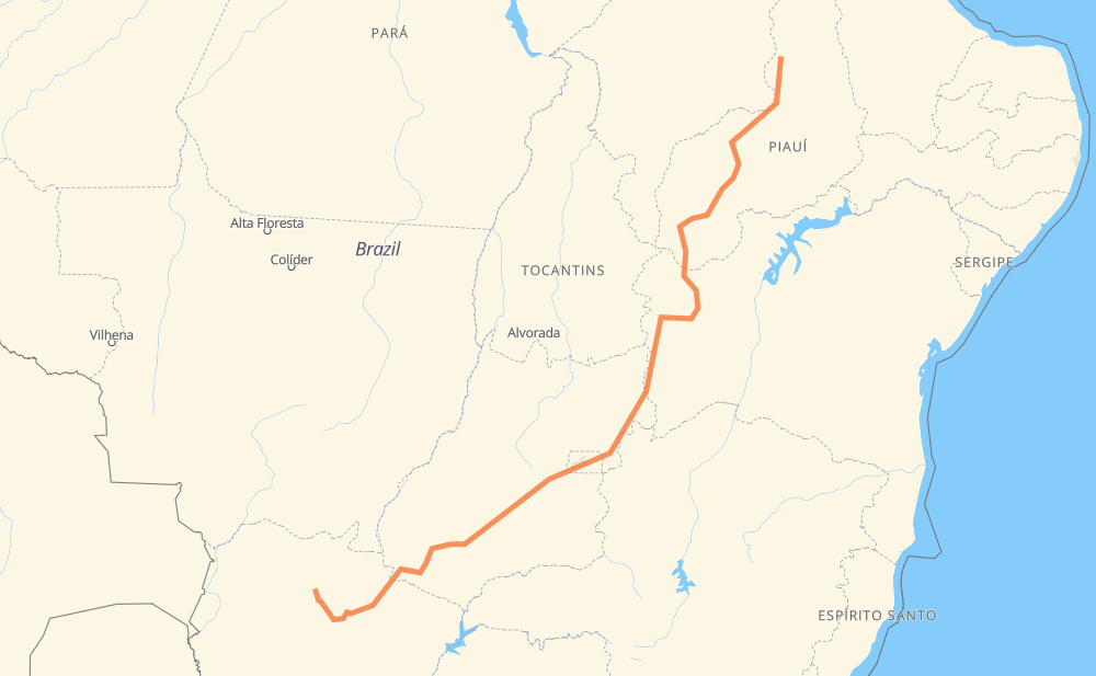
The distance from Rio Verde de Mato Grosso to Demerval Lobão is 1,685 miles by road including 303 miles on motorways. Road takes approximately 30 hours and 29 minutes and goes through São Gabriel do Oeste, Camapuã, Santa Genoveva II, Setor de Mansões de Samambaia - SMSE - Setor de Mansões Sudeste, Vila Areal, Setor Militar Urbano and Setor Noroeste.
| Shortest distance by air | 1,245 mi ✈️ |
| Car route length | 1,684.5 mi 🚗 |
| Driving time | 30 h 29 min |
| Fuel amount | 57.3 gal |
| Fuel cost | 225.1 USD |
| Point | Distance | Time | Fuel | |
| Rio Verde de Mato Grosso | 0 mi | 00 min | 0.0 gal | |
|
BR-163 42 mi, 45 min
|
||||
| São Gabriel do Oeste | 42 mi | 45 min | 1.3 gal | |
|
BR-163 40 mi, 45 min
|
||||
| Camapuã | 81 mi | 1 h 31 min | 2.2 gal | |
|
BR-060 450 mi, 7 h 42 min
|
||||
| Santa Genoveva II | 531 mi | 9 h 14 min | 18.0 gal | |
|
BR-060 110 mi, 2 h 04 min
|
||||
| Setor de Mansões de Samambaia - SMSE - Setor de Mansões Sudeste | 641 mi | 11 h 18 min | 21.7 gal | |
|
BR-060 6 mi, 06 min
|
||||
| Vila Areal | 647 mi | 11 h 25 min | 21.9 gal | |
|
BR-060 DF-003 11 mi, 13 min
|
||||
| Setor Militar Urbano | 658 mi | 11 h 38 min | 22.3 gal | |
|
DF-003 4 mi, 04 min
|
||||
| Vila Weslian Roriz | 662 mi | 11 h 43 min | 22.4 gal | |
|
DF-003 BR-020 40 mi, 48 min
|
||||
| Morada do Sol | 702 mi | 12 h 32 min | 23.9 gal | |
|
BR-020 3 mi, 03 min
|
||||
| DAIF | 706 mi | 12 h 36 min | 24.0 gal | |
|
BR-020 BR-135 982 mi, 17 h 53 min
|
||||
| -5.36406, -42.67399 | 1,688 mi | 30 h 29 min | 57.4 gal | |
Frequently Asked Questions
How much does it cost to drive from Rio Verde de Mato Grosso to Demerval Lobão?
Fuel cost: 225.1 USD
This fuel cost is calculated as: (Route length 1,684.5 mi) / (Fuel consumption 29.4 mpg) * (Fuel price 3.93 USD / gal)
You can adjust fuel consumption and fuel price here.
How long is a car ride from Rio Verde de Mato Grosso to Demerval Lobão?
Driving time: 30 h 29 min
This time is calculated for driving at the maximum permitted speed, taking into account traffic rules restrictions.
- 144 mi with a maximum speed 68 mph = 2 h 7 min
- 89 mi with a maximum speed 62 mph = 1 h 26 min
- 1,095 mi with a maximum speed 56 mph = 19 h 32 min
- 344 mi with a maximum speed 50 mph = 6 h 55 min
- 10 mi with a maximum speed 37 mph = 16 min
- 1 mi with a maximum speed 31 mph = 1 min
- 4 mi with a maximum speed 25 mph = 9 min
The calculated driving time does not take into account intermediate stops and traffic jams.
How far is Rio Verde de Mato Grosso to Demerval Lobão by land?
The distance between Rio Verde de Mato Grosso and Demerval Lobão is 1,684.5 mi by road including 302.6 mi on motorways.
Precise satellite coordinates of highways were used for this calculation. The start and finish points are the centers of Rio Verde de Mato Grosso and Demerval Lobão respectively.
How far is Rio Verde de Mato Grosso to Demerval Lobão by plane?
The shortest distance (air line, as the crow flies) between Rio Verde de Mato Grosso and Demerval Lobão is 1,244.6 mi.
This distance is calculated using the Haversine formula as a great-circle distance between two points on the surface of a sphere. The start and finish points are the centers of Rio Verde de Mato Grosso and Demerval Lobão respectively. Actual distance between airports may be different.
How many hours is Rio Verde de Mato Grosso from Demerval Lobão by plane?
Boeing 737 airliner needs 2 h 30 min to cover the distance of 1,245 mi at a cruising speed of 497 mph.
Small plane "Cessna 172" needs 9 h 6 min to flight this distance at average speed of 136 mph.
This time is approximate and do not take into account takeoff and landing times, airport location and other real world factors.
How long is a helicopter ride from Rio Verde de Mato Grosso to Demerval Lobão?
Fast helicopter "Eurocopter AS350" or "Hughes OH-6 Cayuse" need 8 h 20 min to cover the distance of 1,245 mi at a cruising speed of 149 mph.
Popular "Robinson R44" needs 9 h 32 min to flight this distance at average speed of 130 mph.
This time is approximate and do not take into account takeoff and landing times, aerodrome location and other real world factors.
What city is halfway between Rio Verde de Mato Grosso and Demerval Lobão?
The halfway point between Rio Verde de Mato Grosso and Demerval Lobão is Vila Rosário. It is located about 19 mi from the exact midpoint by road.
The distance from Vila Rosário to Rio Verde de Mato Grosso is 861 mi and driving will take about 15 h 27 min. The road between Vila Rosário and Demerval Lobão has length 823 mi and will take approximately 15 h 2 min.
The other cities located close to halfway point:
Where is Rio Verde de Mato Grosso in relation to Demerval Lobão?
Rio Verde de Mato Grosso is located 1,245 mi south-west of Demerval Lobão.
Rio Verde de Mato Grosso has geographic coordinates: latitude -18.91692, longitude -54.84107.
Demerval Lobão has geographic coordinates: latitude -5.36406, longitude -42.67399.
Which highway goes from Rio Verde de Mato Grosso to Demerval Lobão?
The route from Rio Verde de Mato Grosso to Demerval Lobão follows BR-060, BR-135, BR-020, BR-343, PI-250, BR-163.
Other minor sections pass along the road:
- BR-242: 52 mi
- GO-184: 50 mi
- GO-206: 40 mi
- BR-316: 31 mi
- BR-153: 29 mi
- GO-050: 18 mi
- BR-010: 16 mi
- BR-030: 16 mi
- DF-003: 14 mi
- GO-108: 9 mi
- DF-075: 7 mi
- BR-364: 6 mi
- BR-230: 5 mi
- BR-158: 4 mi
- PI-394: 4 mi
- PI-140: 1 mi