Distance between Bulnes and Lavalle
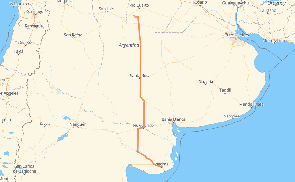
The distance from Bulnes to Lavalle is 591 miles by road. Road takes approximately 10 hours and 52 minutes and goes through Santa Rosa, Vicuña Mackenna, Eduardo Castex, La Cuesta del Sur and Río Colorado.
| Shortest distance by air | 514 mi ✈️ |
| Car route length | 590.9 mi 🚗 |
| Driving time | 10 h 52 min |
| Fuel amount | 20.1 gal |
| Fuel cost | 78.4 USD |
| Point | Distance | Time | Fuel | |
| Bulnes | 0 mi | 00 min | 0.0 gal | |
|
RPE86 10 mi, 10 min
|
||||
| Coronel Moldes | 10 mi | 10 min | 0.3 gal | |
|
RPE86 32 mi, 34 min
|
||||
| Vicuña Mackenna | 42 mi | 45 min | 0.7 gal | |
|
RN35 147 mi, 2 h 42 min
|
||||
| Eduardo Castex | 189 mi | 3 h 27 min | 5.9 gal | |
|
RN35 43 mi, 48 min
|
||||
| Santa Rosa | 232 mi | 4 h 16 min | 7.8 gal | |
|
RN35 9 mi, 10 min
|
||||
| La Cuesta del Sur | 240 mi | 4 h 26 min | 8.0 gal | |
|
RN35 19 mi, 20 min
|
||||
| Ataliva Roca | 260 mi | 4 h 47 min | 8.6 gal | |
|
RN35 45 mi, 50 min
|
||||
| San Germán | 304 mi | 5 h 37 min | 10.0 gal | |
|
RN35 RN154 98 mi, 1 h 47 min
|
||||
| Río Colorado | 403 mi | 7 h 25 min | 13.7 gal | |
|
RN22 RN251 173 mi, 3 h 09 min
|
||||
| El Juncal | 577 mi | 10 h 34 min | 19.2 gal | |
|
RN3 14 mi, 17 min
|
||||
| -40.82530, -63.02269 | 591 mi | 10 h 52 min | 20.1 gal | |
Frequently Asked Questions
How much does it cost to drive from Bulnes to Lavalle?
Fuel cost: 78.4 USD
This fuel cost is calculated as: (Route length 590.9 mi) / (Fuel consumption 29.4 mpg) * (Fuel price 3.9 USD / gal)
You can adjust fuel consumption and fuel price here.
How long is a car ride from Bulnes to Lavalle?
Driving time: 10 h 52 min
This time is calculated for driving at the maximum permitted speed, taking into account traffic rules restrictions.
- 478 mi with a maximum speed 56 mph = 8 h 32 min
- 104 mi with a maximum speed 50 mph = 2 h 6 min
- 6 mi with a maximum speed 37 mph = 9 min
- 1 mi with a maximum speed 31 mph = 1 min
- 1 mi with a maximum speed 25 mph = 1 min
The calculated driving time does not take into account intermediate stops and traffic jams.
How far is Bulnes to Lavalle by land?
The distance between Bulnes and Lavalle is 590.9 mi by road.
Precise satellite coordinates of highways were used for this calculation. The start and finish points are the centers of Bulnes and Lavalle respectively.
How far is Bulnes to Lavalle by plane?
The shortest distance (air line, as the crow flies) between Bulnes and Lavalle is 513.9 mi.
This distance is calculated using the Haversine formula as a great-circle distance between two points on the surface of a sphere. The start and finish points are the centers of Bulnes and Lavalle respectively. Actual distance between airports may be different.
How many hours is Bulnes from Lavalle by plane?
Boeing 737 airliner needs 1 h 2 min to cover the distance of 514 mi at a cruising speed of 497 mph.
Small plane "Cessna 172" needs 3 h 45 min to flight this distance at average speed of 136 mph.
This time is approximate and do not take into account takeoff and landing times, airport location and other real world factors.
How long is a helicopter ride from Bulnes to Lavalle?
Fast helicopter "Eurocopter AS350" or "Hughes OH-6 Cayuse" need 3 h 26 min to cover the distance of 514 mi at a cruising speed of 149 mph.
Popular "Robinson R44" needs 3 h 56 min to flight this distance at average speed of 130 mph.
This time is approximate and do not take into account takeoff and landing times, aerodrome location and other real world factors.
What city is halfway between Bulnes and Lavalle?
The halfway point between Bulnes and Lavalle is San Germán. It is located about 9 mi from the exact midpoint by road.
The distance from San Germán to Bulnes is 304 mi and driving will take about 5 h 37 min. The road between San Germán and Lavalle has length 286 mi and will take approximately 5 h 14 min.
The other cities located close to halfway point:
Where is Bulnes in relation to Lavalle?
Bulnes is located 514 mi north of Lavalle.
Bulnes has geographic coordinates: latitude -33.5053, longitude -64.67629.
Lavalle has geographic coordinates: latitude -40.8253, longitude -63.02269.
Which highway goes from Bulnes to Lavalle?
The route from Bulnes to Lavalle follows RN35, RN154, RN251, RN250.
Other minor sections pass along the road:
- RN3: 25 mi
- RPE86: 20 mi
- RN22: 20 mi
- RP1: 1 mi