Distance between Melipilla and Laguna
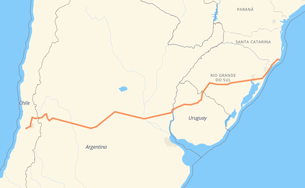
The distance from Melipilla to Laguna is 1,717 miles by road including 498 miles on motorways. Road takes approximately 31 hours and 10 minutes and goes through Colina, Los Andes, San Luis, Río Cuarto, Villa María, Rosario and Tacuarembó.
| Shortest distance by air | 1,373 mi ✈️ |
| Car route length | 1,716.8 mi 🚗 |
| Driving time | 31 h 10 min |
| Fuel amount | 58.4 gal |
| Fuel cost | 229.5 USD |
| Point | Distance | Time | Fuel | |
| Melipilla | 0 mi | 00 min | 0.0 gal | |
|
78 68 mi, 1 h 06 min
|
||||
| Colina | 68 mi | 1 h 06 min | 1.8 gal | |
|
57 52 mi, 1 h 04 min
|
||||
| Los Andes | 119 mi | 2 h 11 min | 3.0 gal | |
|
60-CH RN7 316 mi, 6 h 01 min
|
||||
| San Luis | 435 mi | 8 h 12 min | 14.7 gal | |
|
RN7 RN8 132 mi, 2 h 25 min
|
||||
| Río Cuarto | 567 mi | 10 h 38 min | 19.1 gal | |
|
RN8 RN158 87 mi, 1 h 51 min
|
||||
| Villa María | 654 mi | 12 h 29 min | 22.2 gal | |
|
RP2 RN9 156 mi, 2 h 19 min
|
||||
| Rosario | 810 mi | 14 h 49 min | 27.4 gal | |
|
RNA008 26 332 mi, 6 h 05 min
|
||||
| Tacuarembó | 1,142 mi | 20 h 55 min | 38.7 gal | |
|
26 5 71 mi, 1 h 17 min
|
||||
| Rivera | 1,213 mi | 22 h 12 min | 41.2 gal | |
|
5 BR-290 520 mi, 9 h 17 min
|
||||
| Laguna | 1,733 mi | 31 h 30 min | 58.8 gal | |
Hotels of Laguna
Frequently Asked Questions
How much does it cost to drive from Melipilla to Laguna?
Fuel cost: 229.5 USD
This fuel cost is calculated as: (Route length 1,716.8 mi) / (Fuel consumption 29.4 mpg) * (Fuel price 3.93 USD / gal)
You can adjust fuel consumption and fuel price here.
How long is a car ride from Melipilla to Laguna?
Driving time: 31 h 10 min
This time is calculated for driving at the maximum permitted speed, taking into account traffic rules restrictions.
- 354 mi with a maximum speed 68 mph = 5 h 12 min
- 94 mi with a maximum speed 62 mph = 1 h 30 min
- 809 mi with a maximum speed 56 mph = 14 h 26 min
- 2 mi with a maximum speed 56 mph = 2 min
- 378 mi with a maximum speed 50 mph = 7 h 36 min
- 18 mi with a maximum speed 43 mph = 24 min
- 40 mi with a maximum speed 37 mph = 1 h 3 min
- 7 mi with a maximum speed 31 mph = 13 min
- 2 mi with a maximum speed 28 mph = 5 min
- 12 mi with a maximum speed 25 mph = 29 min
- 1 mi with a maximum speed 19 mph = 3 min
The calculated driving time does not take into account intermediate stops and traffic jams.
How far is Melipilla to Laguna by land?
The distance between Melipilla and Laguna is 1,716.8 mi by road including 498.3 mi on motorways.
Precise satellite coordinates of highways were used for this calculation. The start and finish points are the centers of Melipilla and Laguna respectively.
How far is Melipilla to Laguna by plane?
The shortest distance (air line, as the crow flies) between Melipilla and Laguna is 1,372.6 mi.
This distance is calculated using the Haversine formula as a great-circle distance between two points on the surface of a sphere. The start and finish points are the centers of Melipilla and Laguna respectively. Actual distance between airports may be different.
How many hours is Melipilla from Laguna by plane?
Boeing 737 airliner needs 2 h 45 min to cover the distance of 1,373 mi at a cruising speed of 497 mph.
Small plane "Cessna 172" needs 10 h 2 min to flight this distance at average speed of 136 mph.
This time is approximate and do not take into account takeoff and landing times, airport location and other real world factors.
How long is a helicopter ride from Melipilla to Laguna?
Fast helicopter "Eurocopter AS350" or "Hughes OH-6 Cayuse" need 9 h 12 min to cover the distance of 1,373 mi at a cruising speed of 149 mph.
Popular "Robinson R44" needs 10 h 31 min to flight this distance at average speed of 130 mph.
This time is approximate and do not take into account takeoff and landing times, aerodrome location and other real world factors.
What city is halfway between Melipilla and Laguna?
The halfway point between Melipilla and Laguna is Nogoyá. It is located about 16 mi from the exact midpoint by road.
The distance from Nogoyá to Melipilla is 874 mi and driving will take about 15 h 59 min. The road between Nogoyá and Laguna has length 843 mi and will take approximately 15 h 11 min.
The other cities located close to halfway point:
Where is Melipilla in relation to Laguna?
Melipilla is located 1,373 mi west of Laguna.
Melipilla has geographic coordinates: latitude -33.68551, longitude -71.21457.
Laguna has geographic coordinates: latitude -28.48312, longitude -48.7812.
Which highway goes from Melipilla to Laguna?
The route from Melipilla to Laguna follows RN7, BR-290, RN9, BR-101, 26, BR-158, RN158, RN8, 5.
Other minor sections pass along the road:
- RP39: 62 mi
- 60-CH: 48 mi
- RN174: 38 mi
- 57: 37 mi
- 78: 35 mi
- BR-153: 34 mi
- RN12: 29 mi
- RP26: 25 mi
- BR-293: 19 mi
- 3: 18 mi
- RN14: 16 mi
- RN40: 13 mi
- 70: 13 mi
- BR-116: 12 mi
- RP2: 8 mi
- RN135: 8 mi
- BR-285: 6 mi
- RNA008: 6 mi
- Rs-290: 6 mi
- E-57: 5 mi
- E-61: 4 mi
- BR-473: 3 mi
- RP11: 2 mi
- A-101 F: 2 mi
- RP20: 2 mi
- RN40 RN7: 1 mi