Distance between Pine City MN and Arvada CO
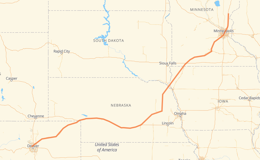
The distance from Pine City to Arvada is 928 miles by road including 549 miles on motorways. Road takes approximately 15 hours and 9 minutes and goes through Minneapolis, Sioux City, Columbus, Grand Island and North Platte.
| Shortest distance by air | 741 mi ✈️ |
| Car route length | 927.7 mi 🚗 |
| Driving time | 15 h 9 min |
| Fuel amount | 31.6 gal |
| Fuel cost | 123.1 USD |
| Point | Distance | Time | Fuel | |
| Pine City | 0 mi | 00 min | 0.0 gal | |
|
I 35 40 mi, 35 min
|
||||
| Forest Lake | 40 mi | 35 min | 1.3 gal | |
|
I 35 9 mi, 07 min
|
||||
| Lino Lakes | 48 mi | 43 min | 1.5 gal | |
|
I 35W 6 mi, 05 min
|
||||
| Blaine | 54 mi | 48 min | 1.8 gal | |
|
I 35W 15 mi, 16 min
|
||||
| Minneapolis | 69 mi | 1 h 05 min | 2.2 gal | |
|
I 35W MN 60 268 mi, 4 h 43 min
|
||||
| Sioux City | 337 mi | 5 h 48 min | 11.3 gal | |
|
US 75 NE 15 120 mi, 2 h 08 min
|
||||
| Columbus | 457 mi | 7 h 57 min | 15.4 gal | |
|
US 30 69 mi, 1 h 15 min
|
||||
| Grand Island | 526 mi | 9 h 12 min | 17.9 gal | |
|
US 34 I 80 148 mi, 2 h 11 min
|
||||
| North Platte | 674 mi | 11 h 24 min | 22.5 gal | |
|
I 80 I 76 254 mi, 3 h 45 min
|
||||
| Arvada | 928 mi | 15 h 09 min | 31.5 gal | |
Hotels of Arvada
Frequently Asked Questions
How much does it cost to drive from Pine City to Arvada?
Fuel cost: 123.1 USD
This fuel cost is calculated as: (Route length 927.7 mi) / (Fuel consumption 29.4 mpg) * (Fuel price 3.9 USD / gal)
You can adjust fuel consumption and fuel price here.
How long is a car ride from Pine City to Arvada?
Driving time: 15 h 9 min
This time is calculated for driving at the maximum permitted speed, taking into account traffic rules restrictions.
- 437 mi with a maximum speed 68 mph = 6 h 25 min
- 78 mi with a maximum speed 65 mph = 1 h 12 min
- 6 mi with a maximum speed 60 mph = 5 min
- 340 mi with a maximum speed 56 mph = 6 h 4 min
- 25 mi with a maximum speed 55 mph = 27 min
- 7 mi with a maximum speed 50 mph = 8 min
- 21 mi with a maximum speed 50 mph = 25 min
- 7 mi with a maximum speed 45 mph = 10 min
- 1 mi with a maximum speed 40 mph = 2 min
- 2 mi with a maximum speed 35 mph = 3 min
- 2 mi with a maximum speed 30 mph = 4 min
The calculated driving time does not take into account intermediate stops and traffic jams.
How far is Pine City to Arvada by land?
The distance between Pine City and Arvada is 927.7 mi by road including 549.3 mi on motorways.
Precise satellite coordinates of highways were used for this calculation. The start and finish points are the centers of Pine City and Arvada respectively.
How far is Pine City to Arvada by plane?
The shortest distance (air line, as the crow flies) between Pine City and Arvada is 740.7 mi.
This distance is calculated using the Haversine formula as a great-circle distance between two points on the surface of a sphere. The start and finish points are the centers of Pine City and Arvada respectively. Actual distance between airports may be different.
How many hours is Pine City from Arvada by plane?
Boeing 737 airliner needs 1 h 29 min to cover the distance of 741 mi at a cruising speed of 497 mph.
Small plane "Cessna 172" needs 5 h 25 min to flight this distance at average speed of 136 mph.
This time is approximate and do not take into account takeoff and landing times, airport location and other real world factors.
How long is a helicopter ride from Pine City to Arvada?
Fast helicopter "Eurocopter AS350" or "Hughes OH-6 Cayuse" need 4 h 58 min to cover the distance of 741 mi at a cruising speed of 149 mph.
Popular "Robinson R44" needs 5 h 40 min to flight this distance at average speed of 130 mph.
This time is approximate and do not take into account takeoff and landing times, aerodrome location and other real world factors.
What city is halfway between Pine City and Arvada?
The halfway point between Pine City and Arvada is Gardiner. It is located about 4 mi from the exact midpoint by road.
The distance from Gardiner to Pine City is 469 mi and driving will take about 8 h 9 min. The road between Gardiner and Arvada has length 459 mi and will take approximately 7 h.
The other cities located close to halfway point:
Where is Pine City in relation to Arvada?
Pine City is located 741 mi north-east of Arvada.
Pine City has geographic coordinates: latitude 45.82607, longitude -92.96854.
Arvada has geographic coordinates: latitude 39.80055, longitude -105.08116.
Which highway goes from Pine City to Arvada?
The route from Pine City to Arvada follows I 80, I 76, MN 60, US 6, US 30, US 169.
Other minor sections pass along the road:
- IA 60: 59 mi
- NE 15: 55 mi
- I 35: 42 mi
- NE 35: 36 mi
- US 75: 34 mi
- I 35W: 33 mi
- CO 52: 14 mi
- US 34: 11 mi
- US 20: 10 mi
- MN 30: 9 mi
- NE 9: 7 mi
- US 59: 7 mi
- MN 15: 5 mi
- I 494: 4 mi
- MN 5: 4 mi
- I 129: 4 mi
- MN 22: 2 mi
- US 85: 2 mi
- NE 2: 2 mi
- NE 110: 2 mi
- US 81: 2 mi
- US 275: 2 mi
- US 71: 1 mi
- US 10: 1 mi
- MN 99: 1 mi
- MN 93: 1 mi
- I 90 Business: 1 mi