Distance between Puerto Dunn and La Cebada
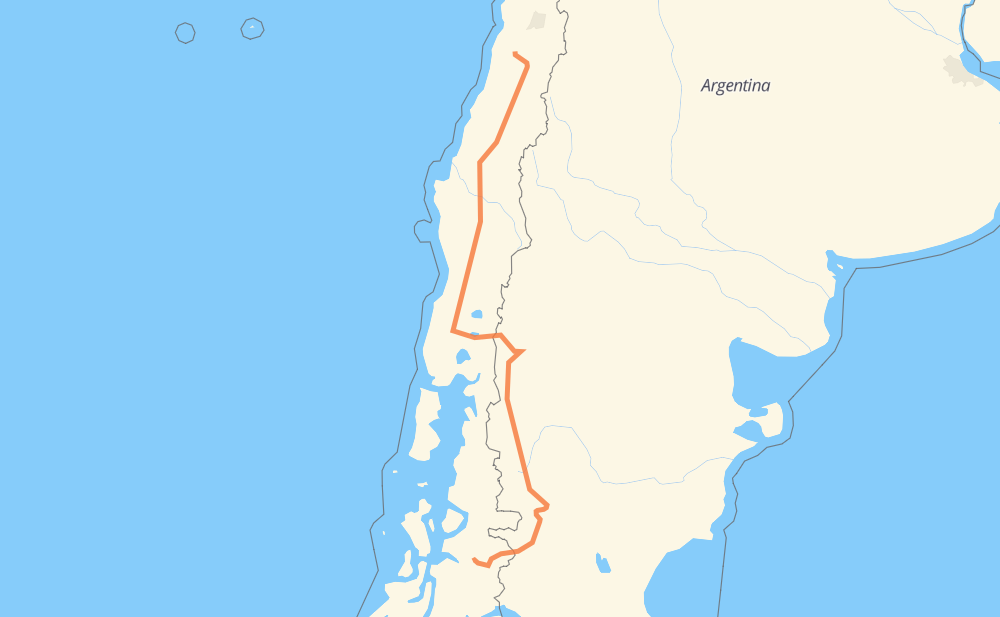
The distance from Puerto Dunn to La Cebada is 1,150 miles by road including 493 miles on motorways. Road takes approximately 21 hours and 1 minute and goes through Coyhaique, San Carlos de Bariloche, Osorno, Los Ángeles, Chillán, Linares and Talca.
| Shortest distance by air | 777 mi ✈️ |
| Car route length | 1,150.2 mi 🚗 |
| Driving time | 21 h 1 min |
| Fuel amount | 39.1 gal |
| Fuel cost | 153.7 USD |
| Point | Distance | Time | Fuel | |
| Puerto Dunn | 0 mi | 00 min | 0.0 gal | |
|
240 53 mi, 1 h 17 min
|
||||
| Coyhaique | 53 mi | 1 h 17 min | 0.8 gal | |
|
X-45 RN40 423 mi, 8 h 34 min
|
||||
| San Carlos de Bariloche | 476 mi | 9 h 51 min | 16.1 gal | |
|
RP237 215-CH 147 mi, 2 h 56 min
|
||||
| Osorno | 623 mi | 12 h 48 min | 20.9 gal | |
|
215-CH 5 264 mi, 4 h 01 min
|
||||
| Los Ángeles | 887 mi | 16 h 50 min | 29.6 gal | |
|
5 65 mi, 57 min
|
||||
| Chillán | 951 mi | 17 h 47 min | 32.3 gal | |
|
5 63 mi, 55 min
|
||||
| Linares | 1,014 mi | 18 h 43 min | 34.4 gal | |
|
5 30 mi, 26 min
|
||||
| Talca | 1,044 mi | 19 h 10 min | 35.3 gal | |
|
5 89 mi, 1 h 19 min
|
||||
| Curicó | 1,133 mi | 20 h 29 min | 38.3 gal | |
|
5 35 mi, 33 min
|
||||
| San Fernando | 1,169 mi | 21 h 02 min | 39.6 gal | |
|
5 66 37 mi, 44 min
|
||||
| La Cebada | 1,207 mi | 21 h 47 min | 40.8 gal | |
Frequently Asked Questions
How much does it cost to drive from Puerto Dunn to La Cebada?
Fuel cost: 153.7 USD
This fuel cost is calculated as: (Route length 1,150.2 mi) / (Fuel consumption 29.4 mpg) * (Fuel price 3.93 USD / gal)
You can adjust fuel consumption and fuel price here.
How long is a car ride from Puerto Dunn to La Cebada?
Driving time: 21 h 1 min
This time is calculated for driving at the maximum permitted speed, taking into account traffic rules restrictions.
- 447 mi with a maximum speed 68 mph = 6 h 34 min
- 31 mi with a maximum speed 62 mph = 29 min
- 356 mi with a maximum speed 56 mph = 6 h 21 min
- 2 mi with a maximum speed 56 mph = 2 min
- 226 mi with a maximum speed 50 mph = 4 h 32 min
- 4 mi with a maximum speed 43 mph = 5 min
- 30 mi with a maximum speed 37 mph = 47 min
- 45 mi with a maximum speed 31 mph = 1 h 27 min
- 1 mi with a maximum speed 25 mph = 3 min
- 11 mi with a maximum speed 19 mph = 35 min
The calculated driving time does not take into account intermediate stops and traffic jams.
How far is Puerto Dunn to La Cebada by land?
The distance between Puerto Dunn and La Cebada is 1,150.2 mi by road including 492.7 mi on motorways.
Precise satellite coordinates of highways were used for this calculation. The start and finish points are the centers of Puerto Dunn and La Cebada respectively.
How far is Puerto Dunn to La Cebada by plane?
The shortest distance (air line, as the crow flies) between Puerto Dunn and La Cebada is 777.3 mi.
This distance is calculated using the Haversine formula as a great-circle distance between two points on the surface of a sphere. The start and finish points are the centers of Puerto Dunn and La Cebada respectively. Actual distance between airports may be different.
How many hours is Puerto Dunn from La Cebada by plane?
Boeing 737 airliner needs 1 h 33 min to cover the distance of 777 mi at a cruising speed of 497 mph.
Small plane "Cessna 172" needs 5 h 41 min to flight this distance at average speed of 136 mph.
This time is approximate and do not take into account takeoff and landing times, airport location and other real world factors.
How long is a helicopter ride from Puerto Dunn to La Cebada?
Fast helicopter "Eurocopter AS350" or "Hughes OH-6 Cayuse" need 5 h 12 min to cover the distance of 777 mi at a cruising speed of 149 mph.
Popular "Robinson R44" needs 5 h 57 min to flight this distance at average speed of 130 mph.
This time is approximate and do not take into account takeoff and landing times, aerodrome location and other real world factors.
What city is halfway between Puerto Dunn and La Cebada?
The halfway point between Puerto Dunn and La Cebada is Río Bueno. It is located about 3 mi from the exact midpoint by road.
The distance from Río Bueno to Puerto Dunn is 572 mi and driving will take about 11 h 44 min. The road between Río Bueno and La Cebada has length 578 mi and will take approximately 9 h 16 min.
The other cities located close to halfway point:
Where is Puerto Dunn in relation to La Cebada?
Puerto Dunn is located 777 mi south of La Cebada.
Puerto Dunn has geographic coordinates: latitude -45.41464, longitude -72.53036.
La Cebada has geographic coordinates: latitude -34.20727, longitude -71.31448.
Which highway goes from Puerto Dunn to La Cebada?
The route from Puerto Dunn to La Cebada follows 5, RN40, 215-CH, RP20.
Other minor sections pass along the road:
- X-45: 38 mi
- 240: 25 mi
- RN231: 19 mi
- 66: 16 mi
- 7: 14 mi
- I-90-H: 12 mi
- RP38: 11 mi
- H-780: 6 mi
- RP237: 4 mi
- X-445: 2 mi
- H-782: 1 mi